Chasing rainbows and waterfalls

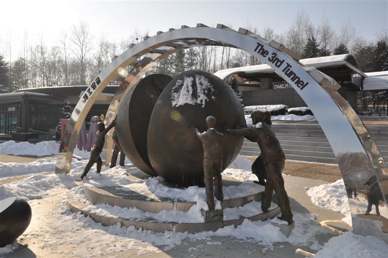
We’ve been bike touring around Iceland for four weeks now – and, after some terrific days riding along the north coast, we’ve had to bite the bullet and take the bus to the south-east for a headstart on the final leg of our trip.

3 Morning ride out of Akureyri

Day 24-28
Akureyri > Laugar > Myvatn >>>>>> Hofn
Distance: ~110km (plus 7.5 hours on a bus…)

The camp warden had warned us, so we had no one to blame but ourselves, of course. But it still felt better to blame the under-dressed, chavvy Icelandic teenagers who kept us awake until 4am with their drunken, inane conversations slurred less than a metre from our (should’ve-been) sleeping heads. (We could tell the conversation was inane, even though it was in Icelandic. There’s a certain cross-lingual rhythm to an annoying, superficial drunken conversation.)

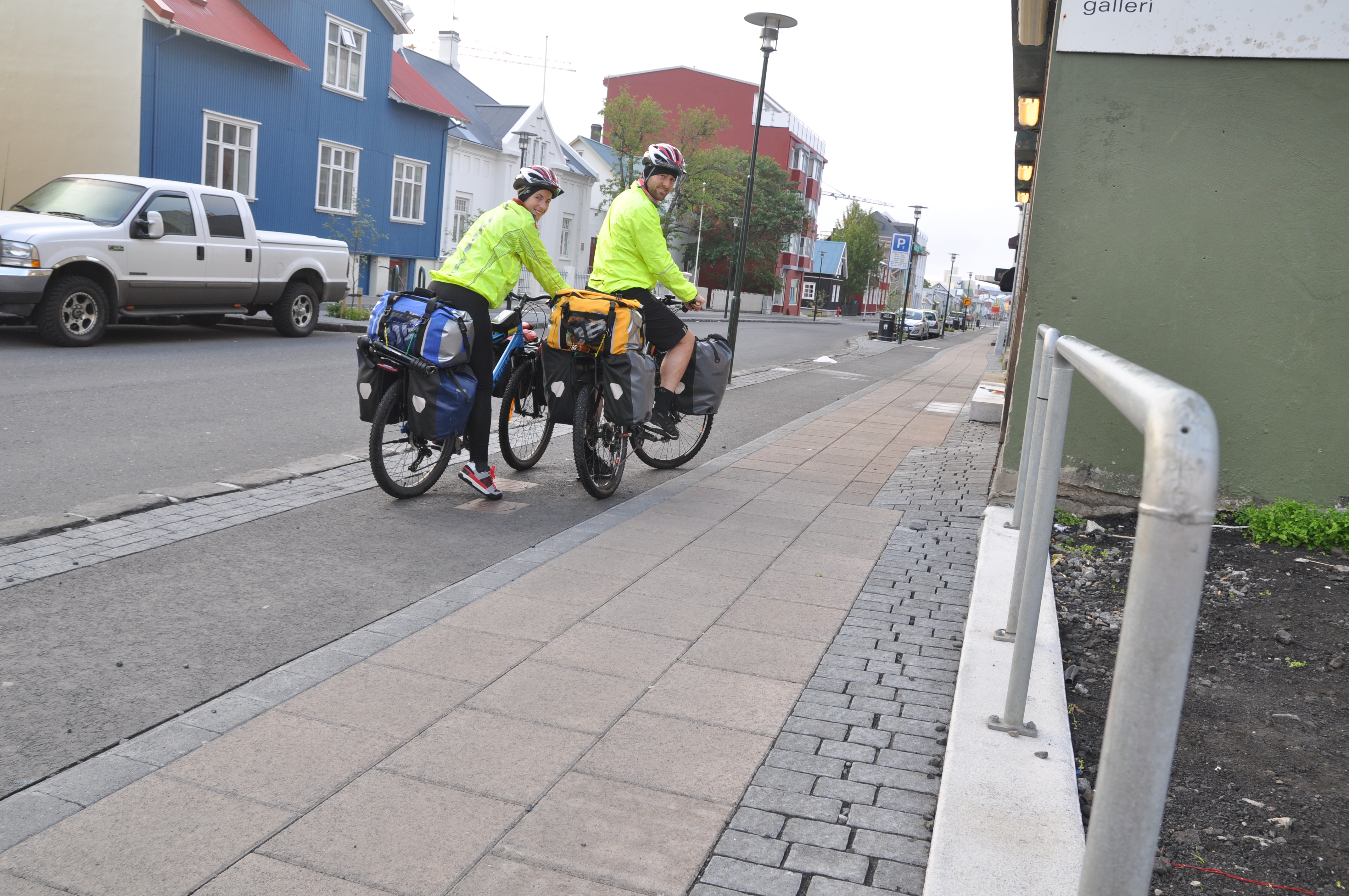
This was still in Akureyri – “the capital of the north” (population 18,000) – where we left off last post. We’d arrived at the campsite in the afternoon ready to settle in for a rest day, when the boy behind the desk told us we’d really be better off camping at the next site, about 8km out of town. There was a festival on that weekend, and “the teenagers were coming” he warned us – more or less in those exact, ominous words. We looked around at the few modest tents and campervans – it was already about 4pm on a Friday, and it didn’t look that bad, we thought. A festival also sounded potentially pretty good, and at that moment the idea of riding an extra 8km then and there – and then a 16km round-trip every time we wanted to go into the town the following day – sounded pretty unattractive. This campsite was also adjacent to the local pool/spa… So we stayed. “How bad can it be?” we thought.

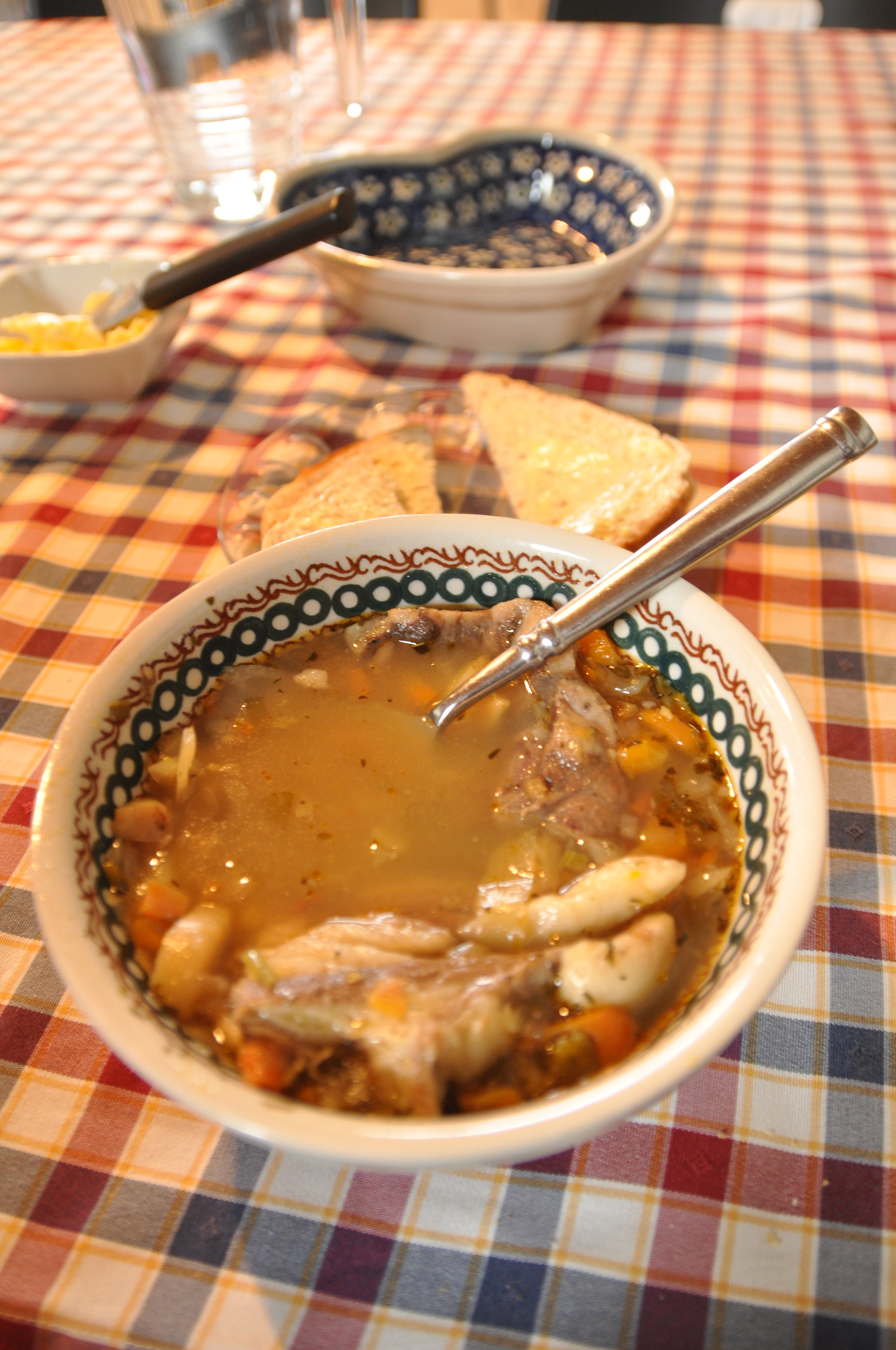
That night, it was fine. We refreshed ourselves at the impressive local pool, doing a few laps to stretch out our aching backs and legs and broiling ourselves in the several different-temperature hot tubs. We even plunged into the icy cold tub and giggled down the water slide a few times. We ate enormous burgers and fries for dinner at the local hostel and slept like babies. So far so good. We booked in for a second night.

Bad idea. Even after having a Chinese food buffet for lunch and beer and chips and a few rounds of our entertainment of choice – the card game Gin Rummy – before bed, we barely slept a wink. The ominous signs had started at about 9pm: car after car rocked up, enormous, cheap tents were haphazardly erected, plastic chairs placed out in circles and cases of beer stacked high. I felt like an old prude, shuffling around in my crocs-‘n’-socks and sensible hiking pants, grimacing at all the girls in their sheer stockings and mini skirts. “It’s six degrees girls! Put some pants on!” I wanted to say, shaking a crooked finger at them.

So, as we lay our heads down, we made the decision that we wouldn’t stew and fester in our tent getting more and more annoyed until a reasonable ‘waking’ hour. If by early morning we hadn’t had much sleep, we’d pack up and hit the road – one of the benefits of 24-hour daylight. And so it was. We ate a no-cook breakfast of granola and skyr (Icelandic yoghurt) before 5am, then packed up our tent to the soundtrack of some guy vomitting on a nearby fence and the by-now familiar, intermittent shouts of laughter from another guy who seemed to have heard a new joke at the same regular interval for the past seven hours.

8 On the road to Akureyri

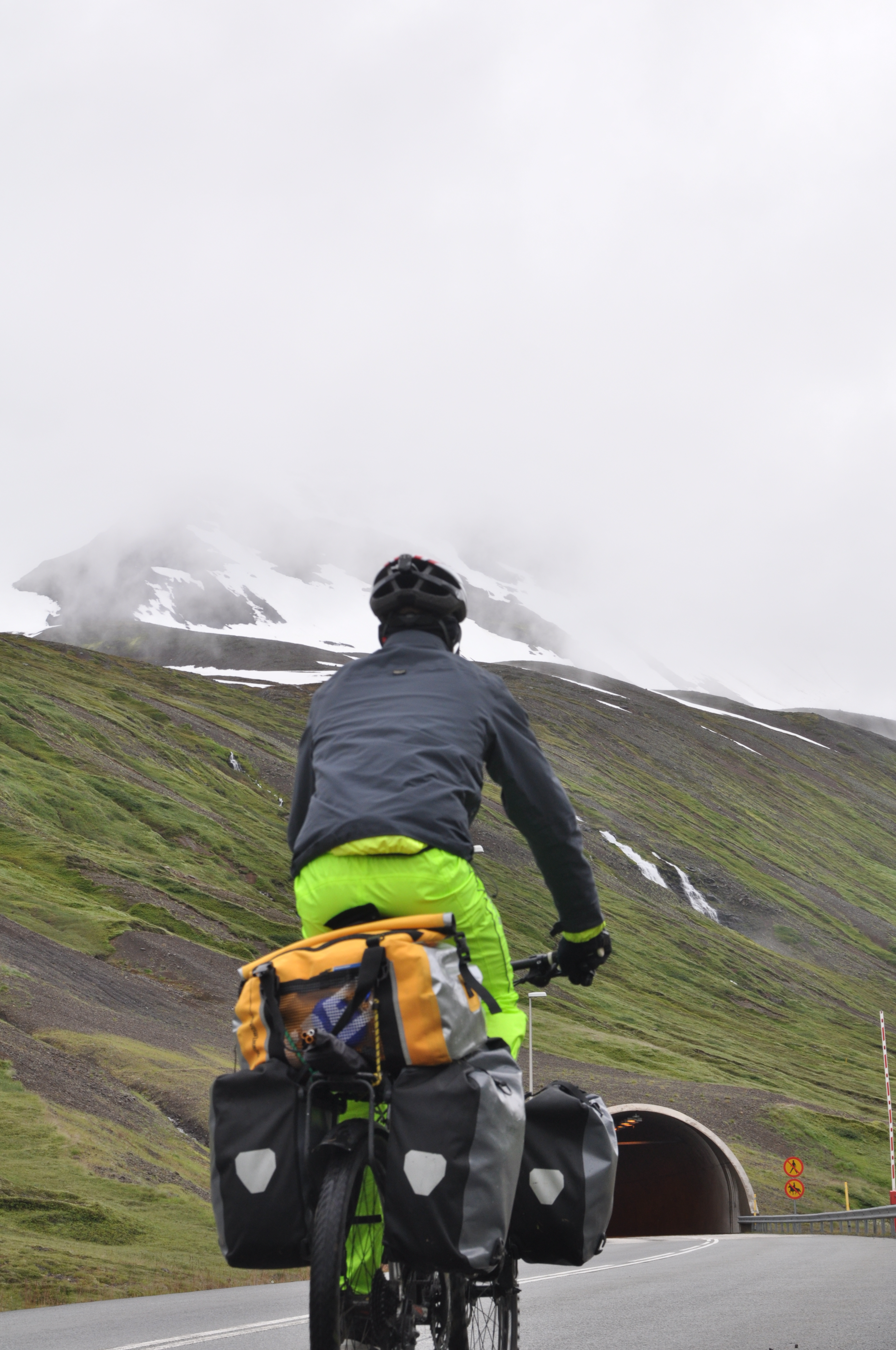
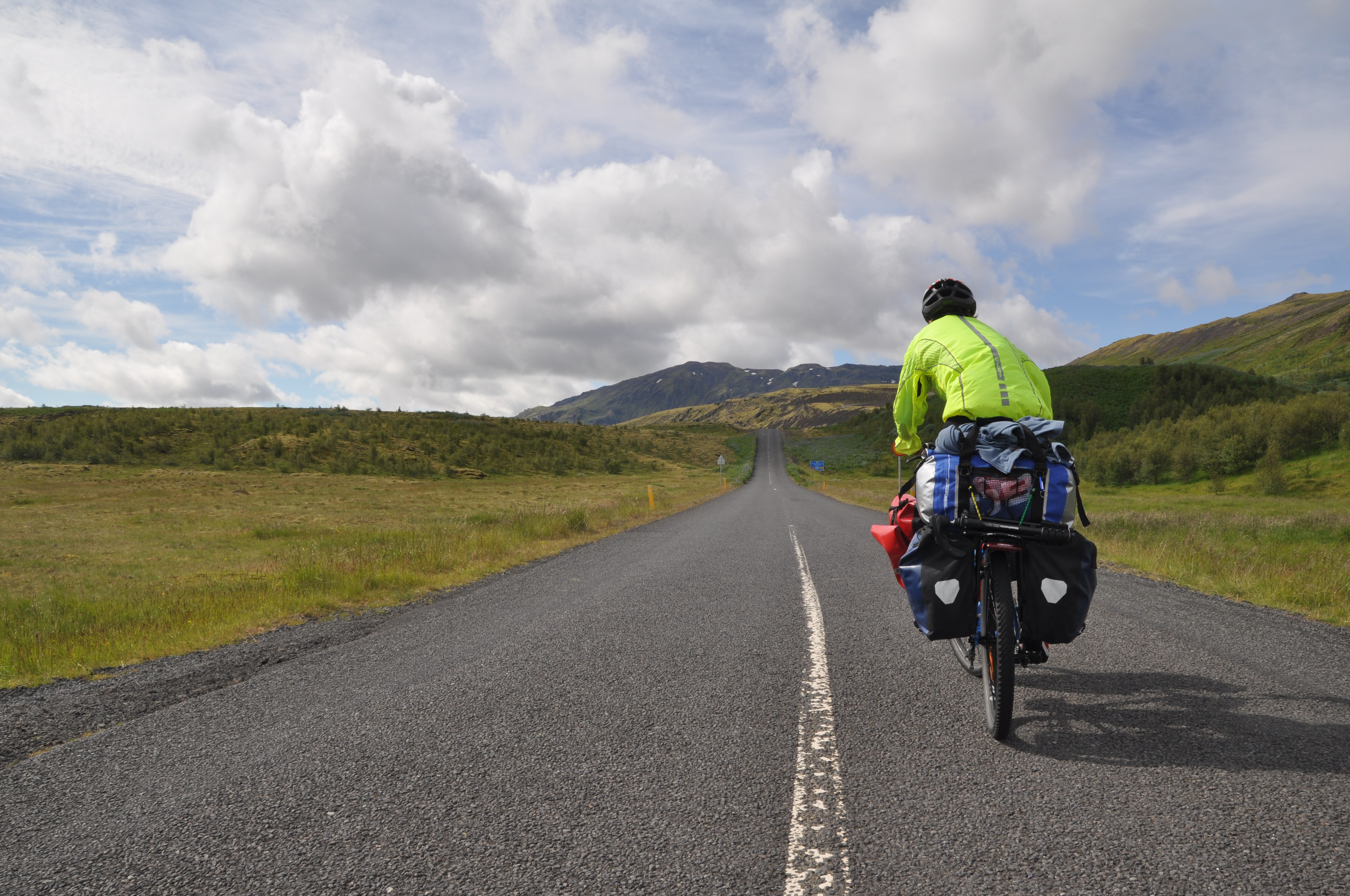
The sky was wide and blue and clear, but that also meant it was cold. (“Girls! Some pants!”) That northerly wind that had assisted us on our ride into town had also dropped the temperature somewhat, and my gloved hands were so numb they felt detached on the handlebars, like they belonged to someone else. I had to keep clapping them together to try and regain feeling – then we rode past a sign that told us the temperature was one degree Celcius. That explained it.

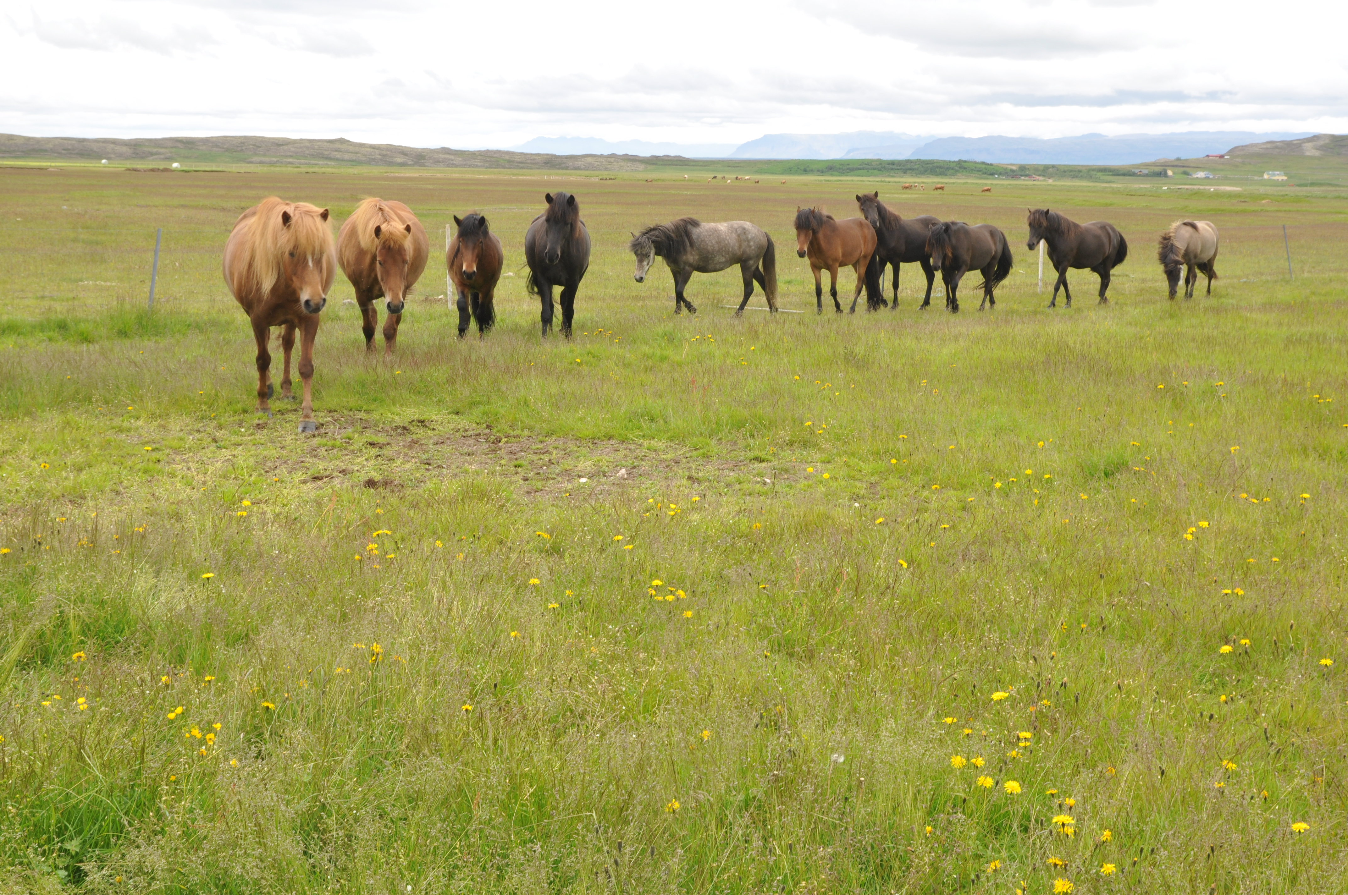
Luckily, the early hour (about 6am by the time we were on our bikes) meant the Ring Road was very quiet, so we skipped the steep mountain pass we were going to take as our first planned diversion from traffic. By the time we had rounded the first (more gradual) Ring Road climb in its place, our sleep-deprived grumpiness had waned, the sun was warming up and the endorphins had started to trickle in. We crested the first hill and saw before us wide-open lowland country – rolling green fields, a rushing royal-blue river, sky-high mountains and a long empty downhill road. This was the stuff. “Let’s open her up!” we cried and switched into top gear and sped down, leaving seedy, hung-over Akureyri in our wake and ready for the next stop on our adventure.

Water crossings and waterfalls

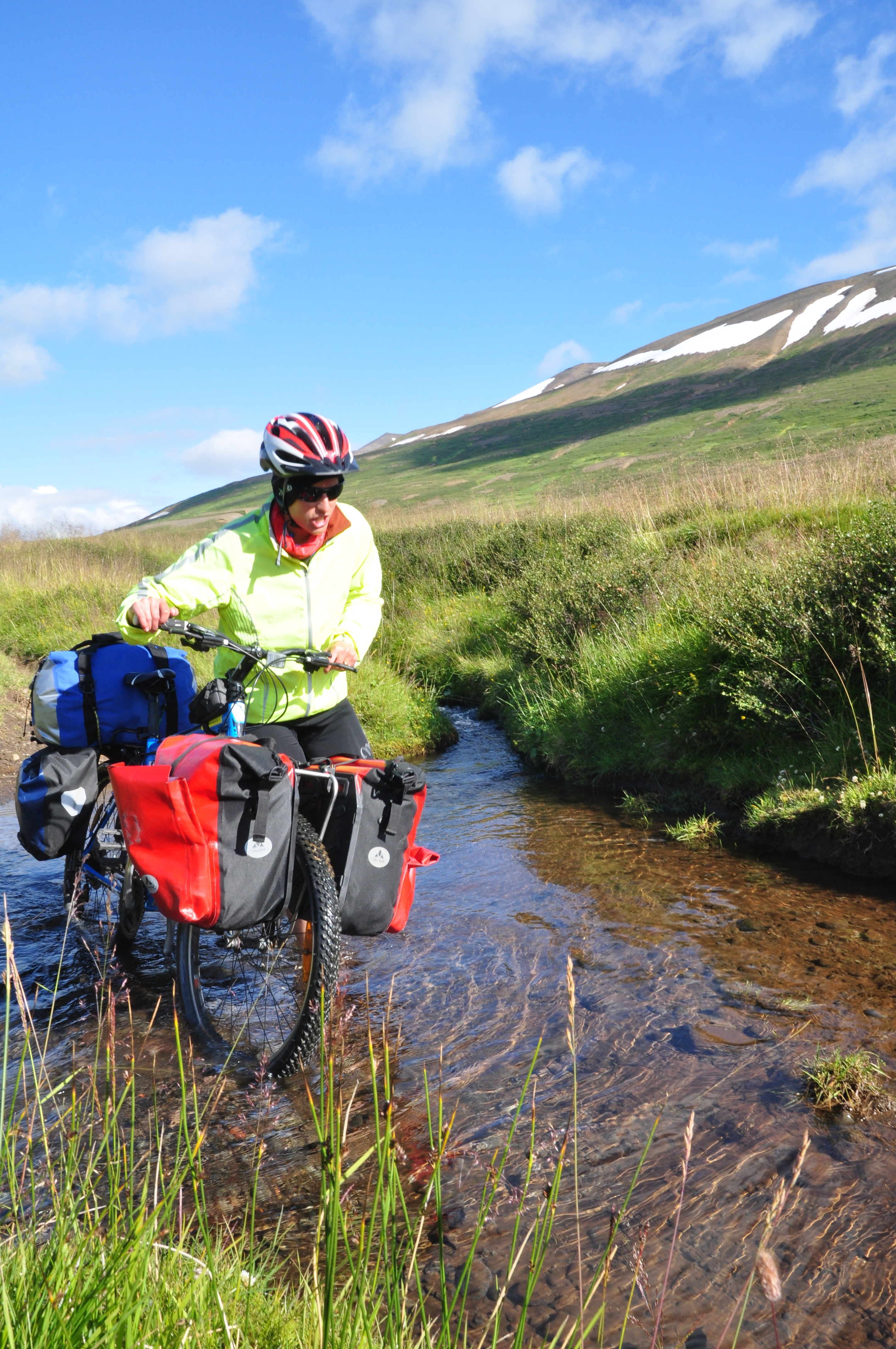
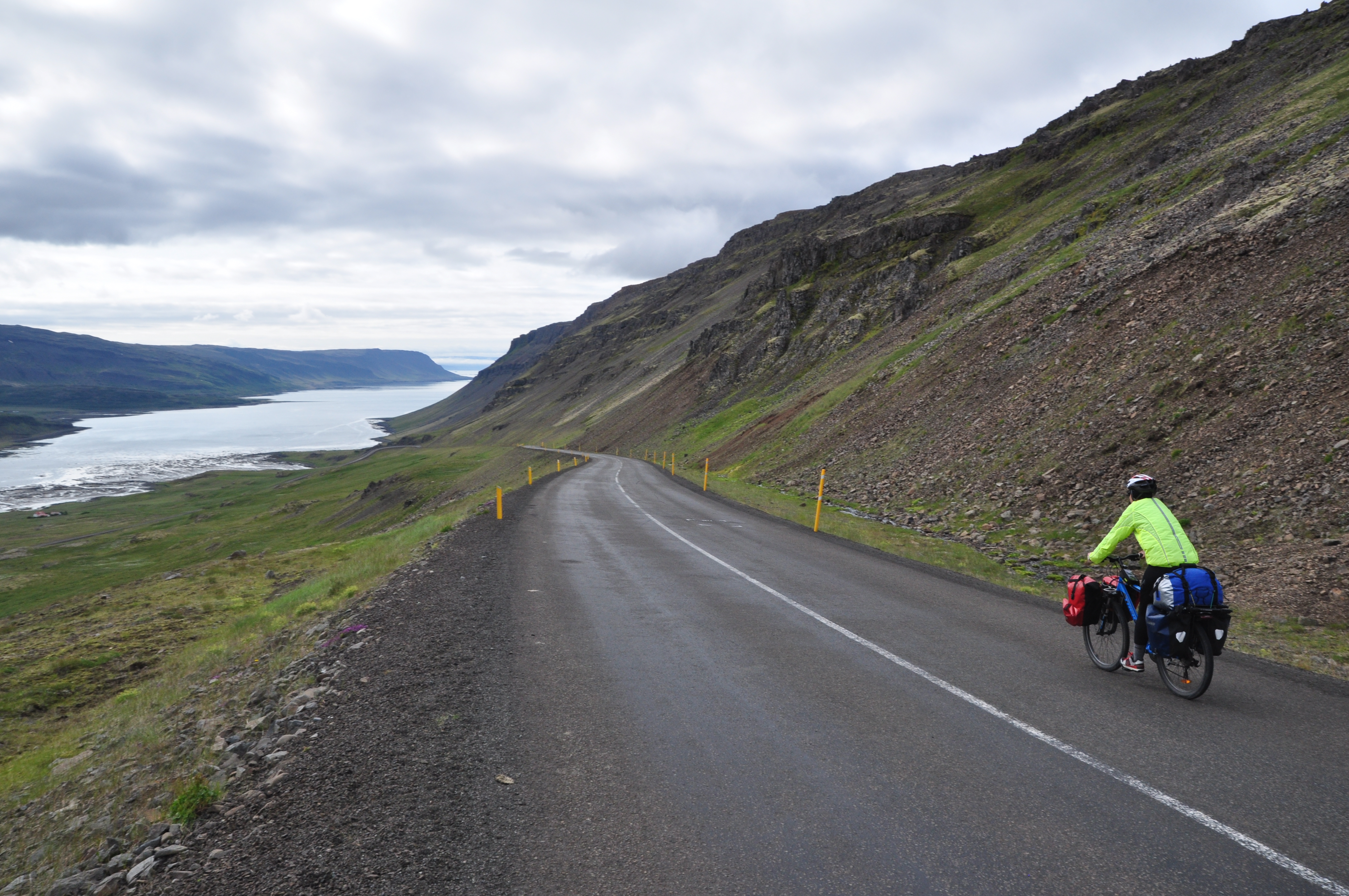
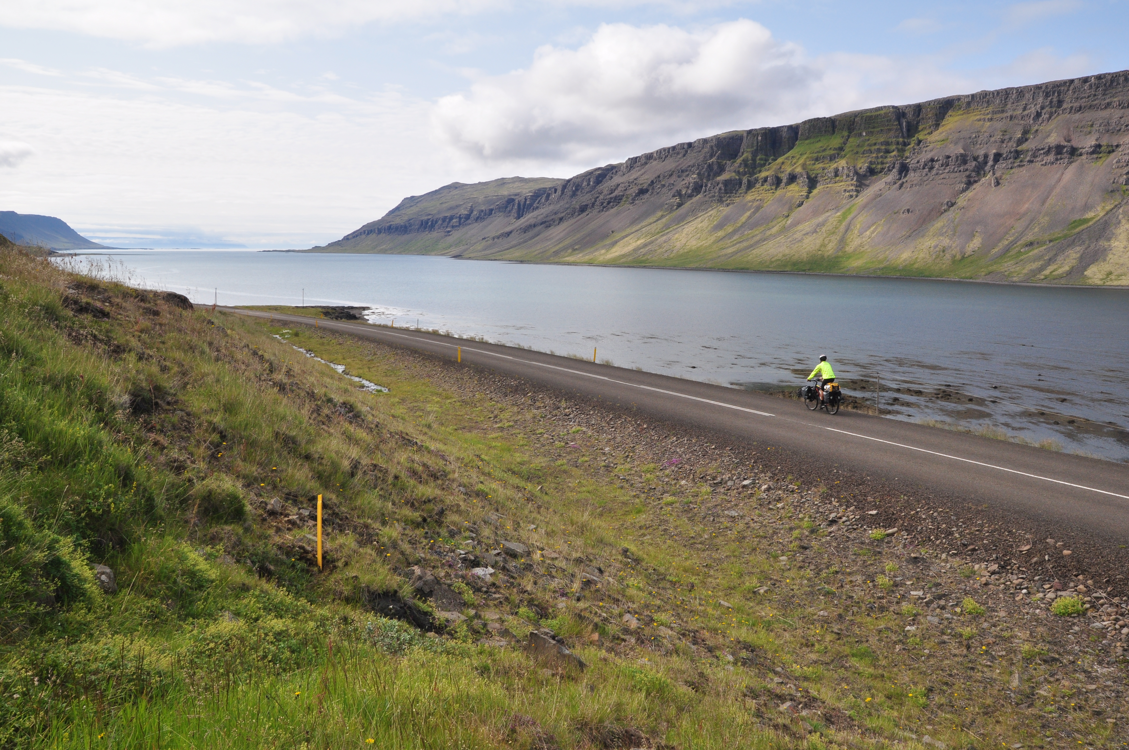
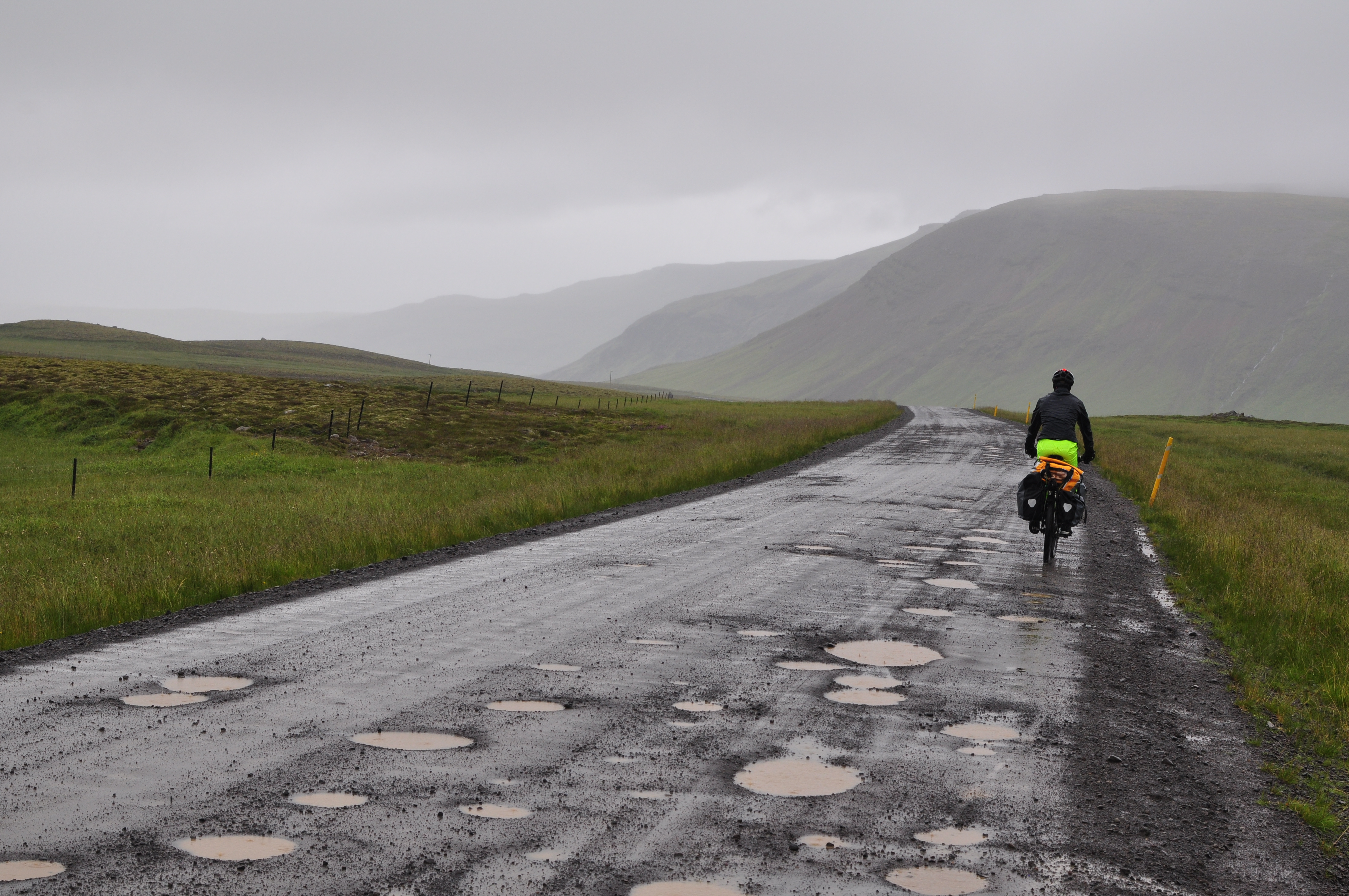
As the Ring Road picked up traffic that morning, we took our second planned diversion onto a dotted (on the map) ‘country road’ that ran parallel to the main road. The gravel was loose and there were several gates to open and close behind us as we climbed away from the tarmac and up on to a parallel plateau. If we wanted to avoid the traffic, then we’d done a great job – it didn’t look like this road had been used in a long time. The grass either side of the tyre tracks was higher than our knees. We also encountered our first water-crossing, or ford. Then another one, and another one.

5 Riding through long grass back roads

On the first one, Paul rode his bike through the 10cm-deep icy water, a little wobbly over the loose rocks but otherwise successful and dry. I envisioned myself losing balance and plunging (at least my shoes) into the water, so decided instead to take my shoes and socks off, roll up my pants and walk across. Freezing cold, but easy enough. I dried off my feet and put my shoes back on (“Hey! Now we can say we’ve done a water crossing!”), then rode on a little more – to where the stream crossed the track once again. This time, we managed to keep our feet dry by boulder hopping across, while wheeling our bikes through the water.

The final water crossing offered no such dry boulders, and it was a little too deep and fast-flowing to ride across. There was only one option, to take our shoes off again (which sounded a little annoying) and roll up our pants and brave the icy water. Or…

Feet cozy and dry, I nuzzled my face into the back of Paul’s warm neck, as we made our way across the final ford… together. Yes. A piggy back ride. Thanks Paul. It reminded me of riding a horse – I could feel through his hips as he balanced and progressed through the water over slippery boulders. I knew I’d brought along a husband on this trip for a reason.
6 Gemma water crossing
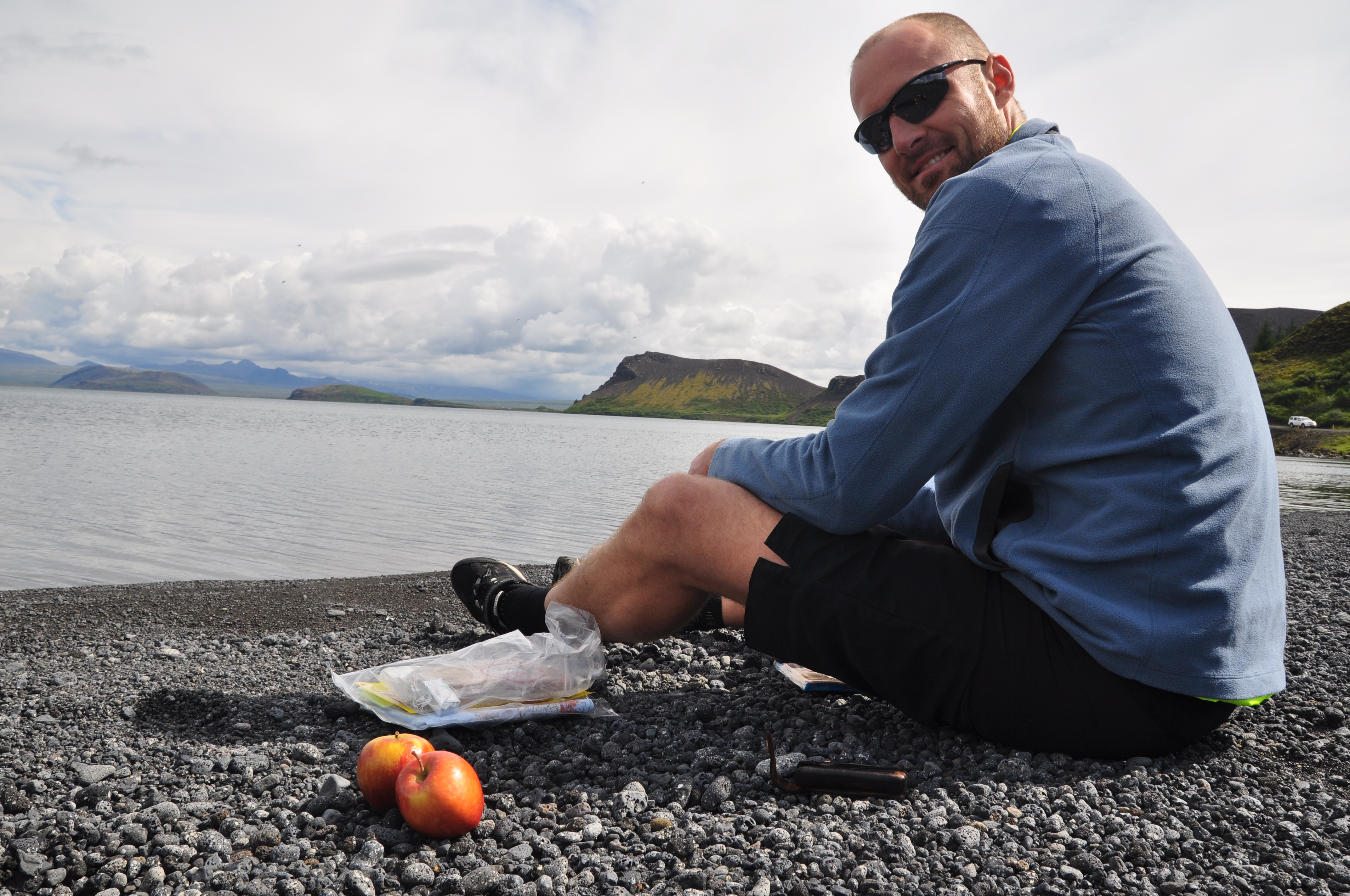
We emerged from our rural sidetrip to cross the Ring Road for a short stint before our next diversion – 10km around the back of a pretty lake, which was also where we ate our packed lunch. More smoked herring on rye bread with cream cheese and red onion, followed by half a block of chocolate shared between us and a very specific rationing of wine gum lollies.

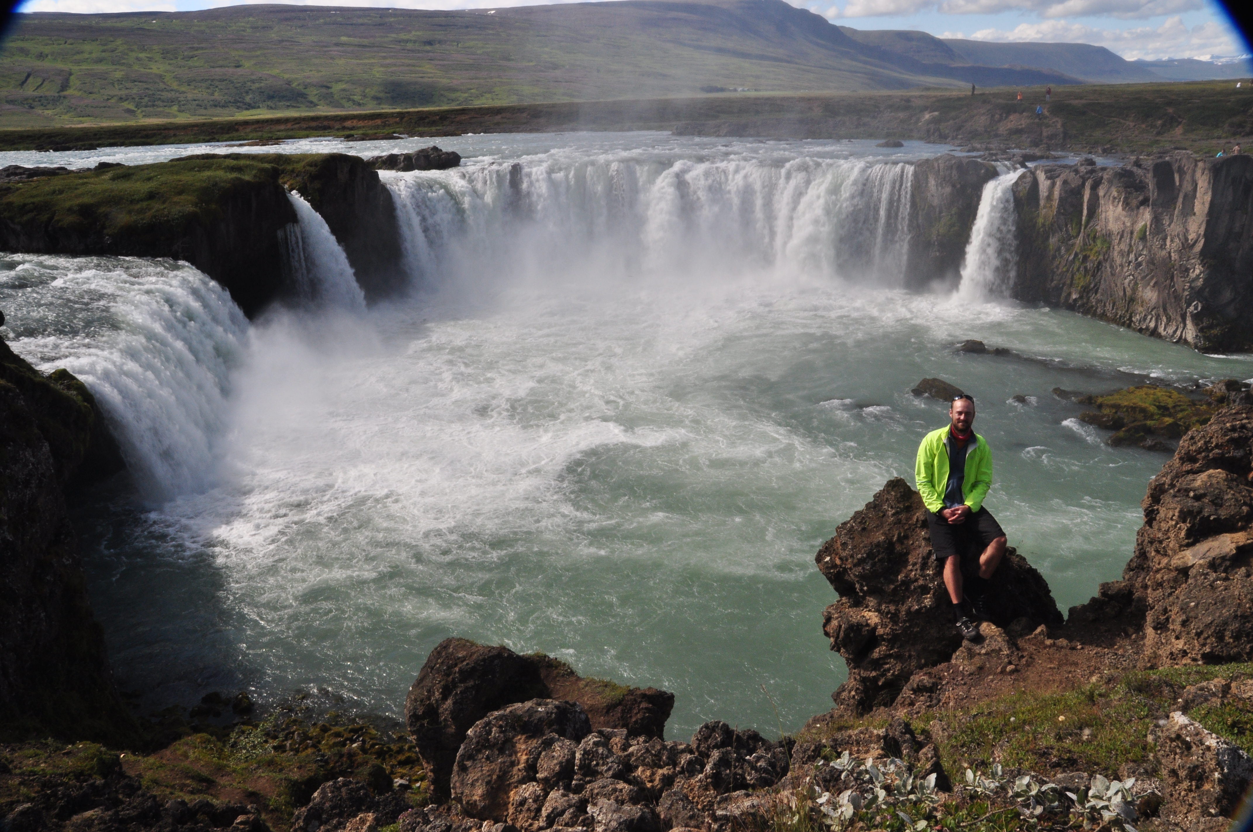
Our next stop was a place called Godafoss, which translates more or less to “the waterfall of the Gods”. Here, in around the year 1000 after a pagan ‘lawspeaker’ made Christianity the official religion of Iceland, he threw his statues of the Norse gods over the falls.

We had considered staying the night at Godafoss, but there was a slightly bigger village (with a pool!) – about 10km over a long hill into a headwind – and there was still enough time in the day, thanks to having set off at the crack of dawn. Anyway, we reasoned, we’d still have to ride over that hill first thing in the morning if we didn’t do it now.

We regained energy with coffee and carrot cake at the cafe near the falls, then joined the other tourists wandering down the pathway to the cliff edge. It’s easy to see why the falls have been afforded spiritual significance – they are awesome in the truest sense of the word; incalculable torrents of water gushing over an almost semi-circular cliff-face into the river, sending up boiling clouds of mist and fleeting rainbows.

9 Paul on the edge at Godafoss
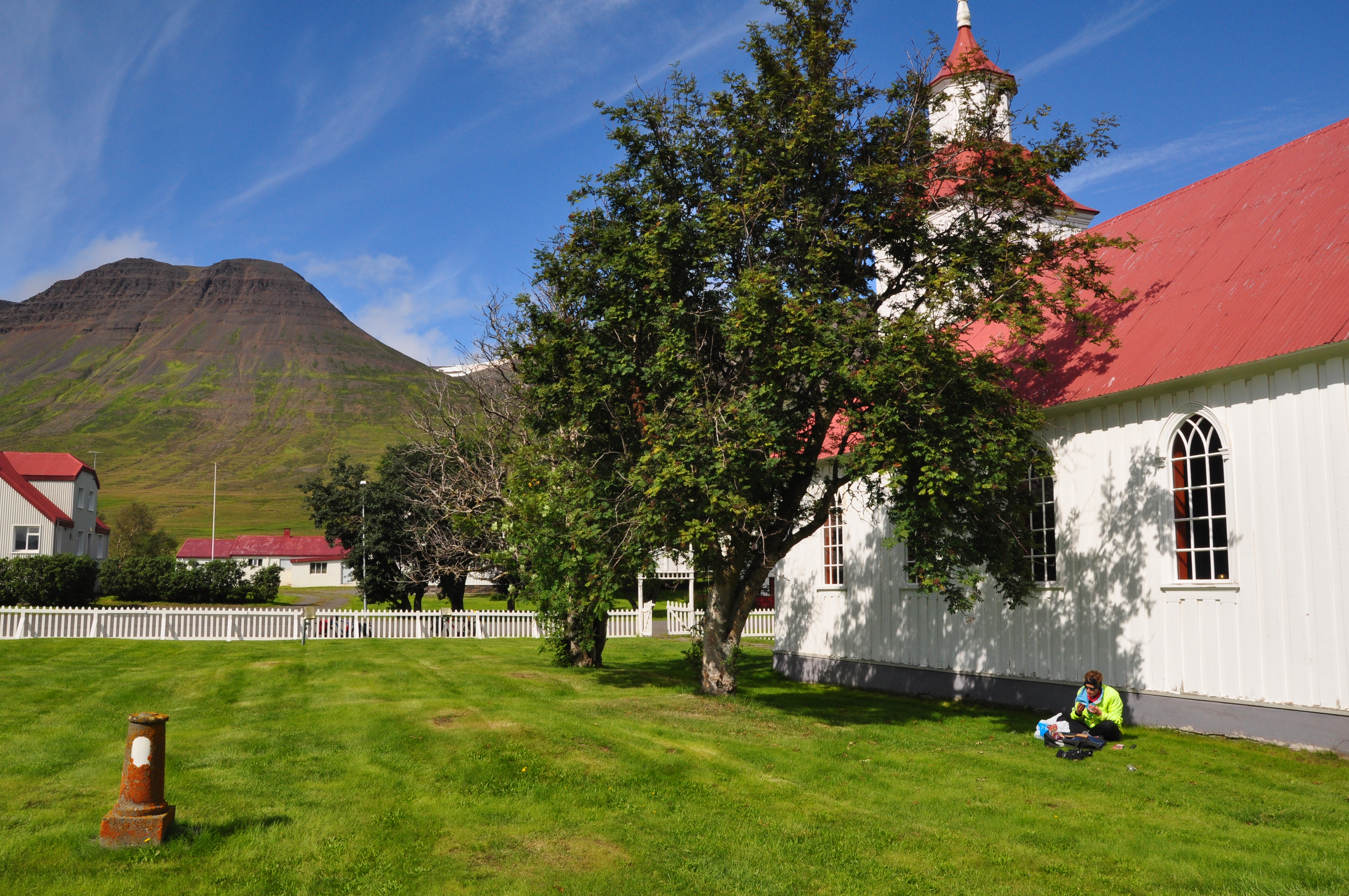
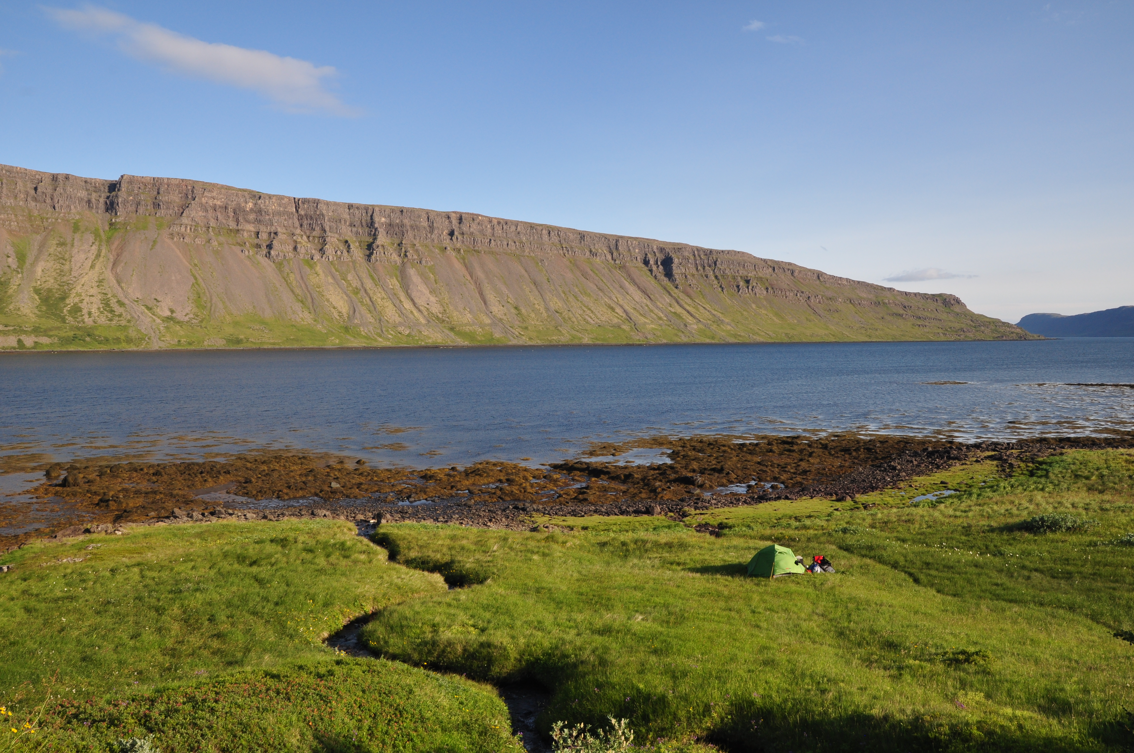
The final climb to the little town of Laugar, despite the headwind, was worth it. The campsite there was tiny and quiet, and the swimming pool perfect – which was just what we needed after Akureyri to properly recharge for the following day’s 40km ride to Myvatn. Myvatn is a tourist hotspot (literally…) in Iceland’s north, where we would spend a full day after arriving in order to do the place justice.

The ride around lake Myvatn itself that led us to our destination – the area’s main town, Reykahild – was long, flat and very pretty. Except, that is, for the bugs (midges) that hit your face in swarms, like rain, as well as occasionally the back of your throat, or worse – your eyeball, managing to infiltrate the space between your sunglasses and eyes, where you would inevitably blink at the wrong time, trapping them horrifically between eyelids. We were forced to pull over and retract from our panniers our best investment ever – our full-face bug nets – for the last leg of the ride. We later learned that these midges fertilise the volcanic plains when they die, helping the spectacular bright green flora to thrive. But they’re still annoying – it seems fitting that they’re most useful dead.

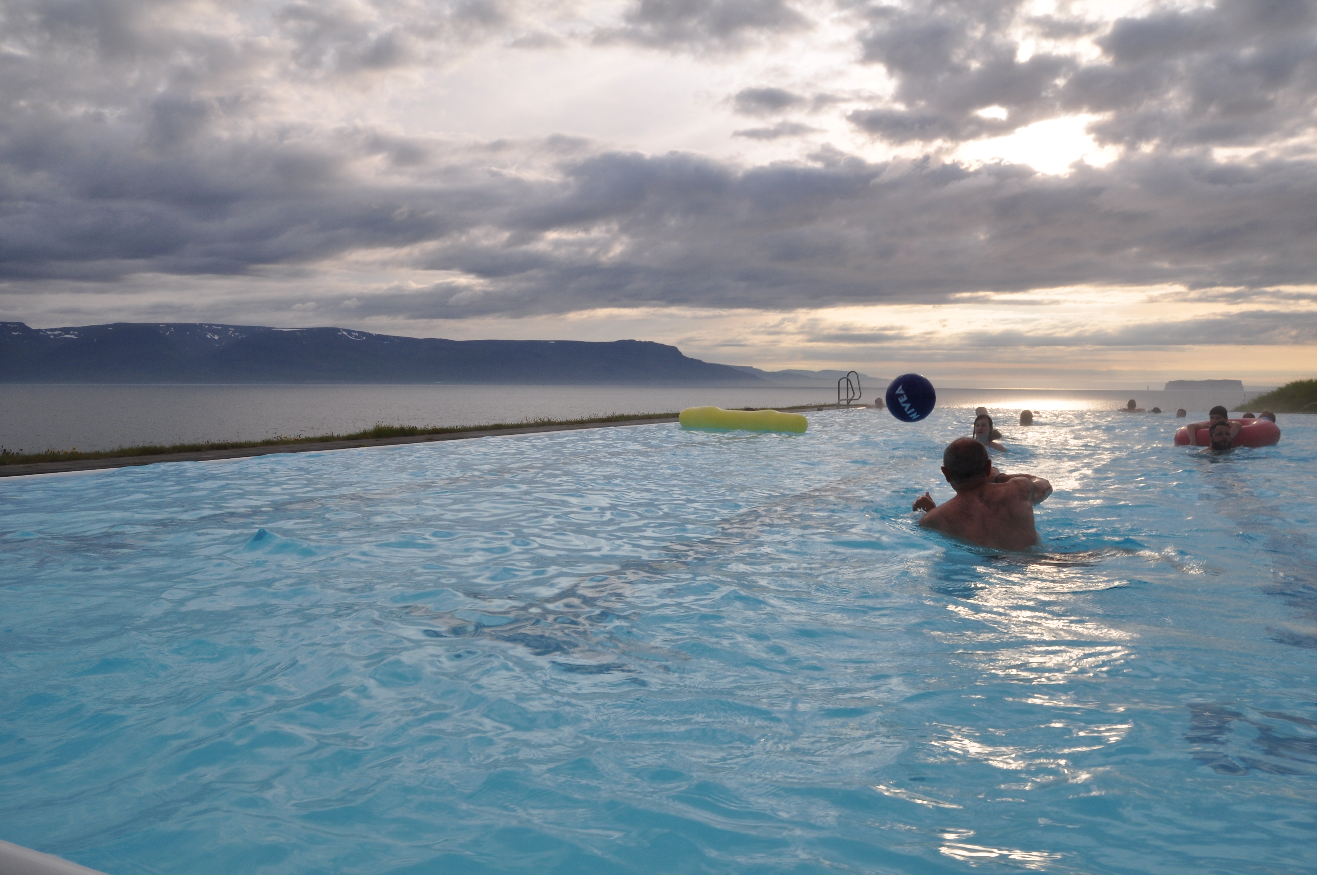
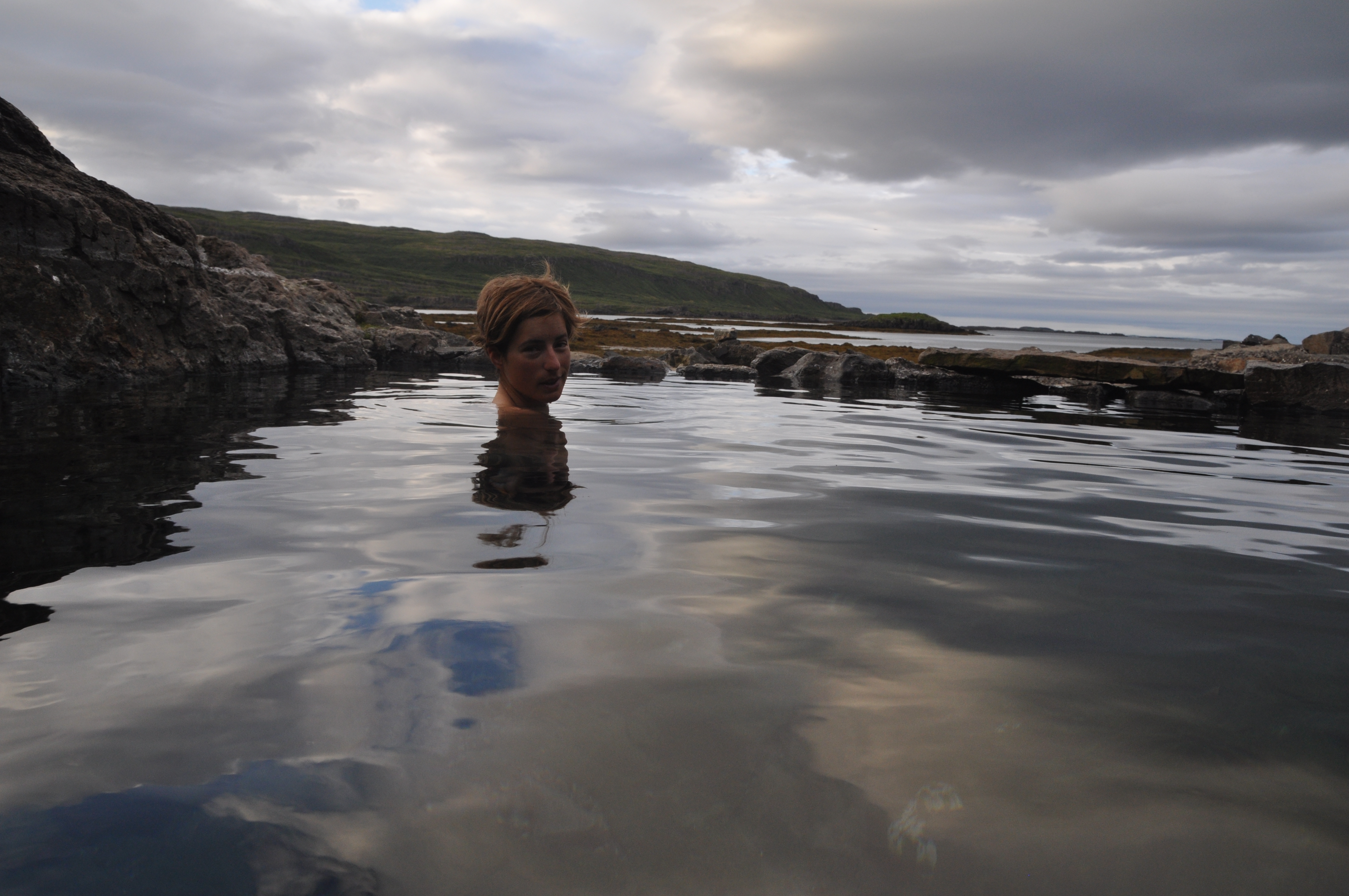
Myvatn is best known for its geological activity, centred around its version of the ‘Blue Lagoon’ hot springs, like the ones we’d visited earlier on in our trip, just outside Reykjavik. At about A$35 entry, they’re pricey but still less than half the price of entry to the Reykjavik version. We decided to save our visit until the following day, and instead made our usual way to the local pool and hot tub for a shower and swim, then a rest before dinner (lamb green curry and quinoa on the communal stove tops!).

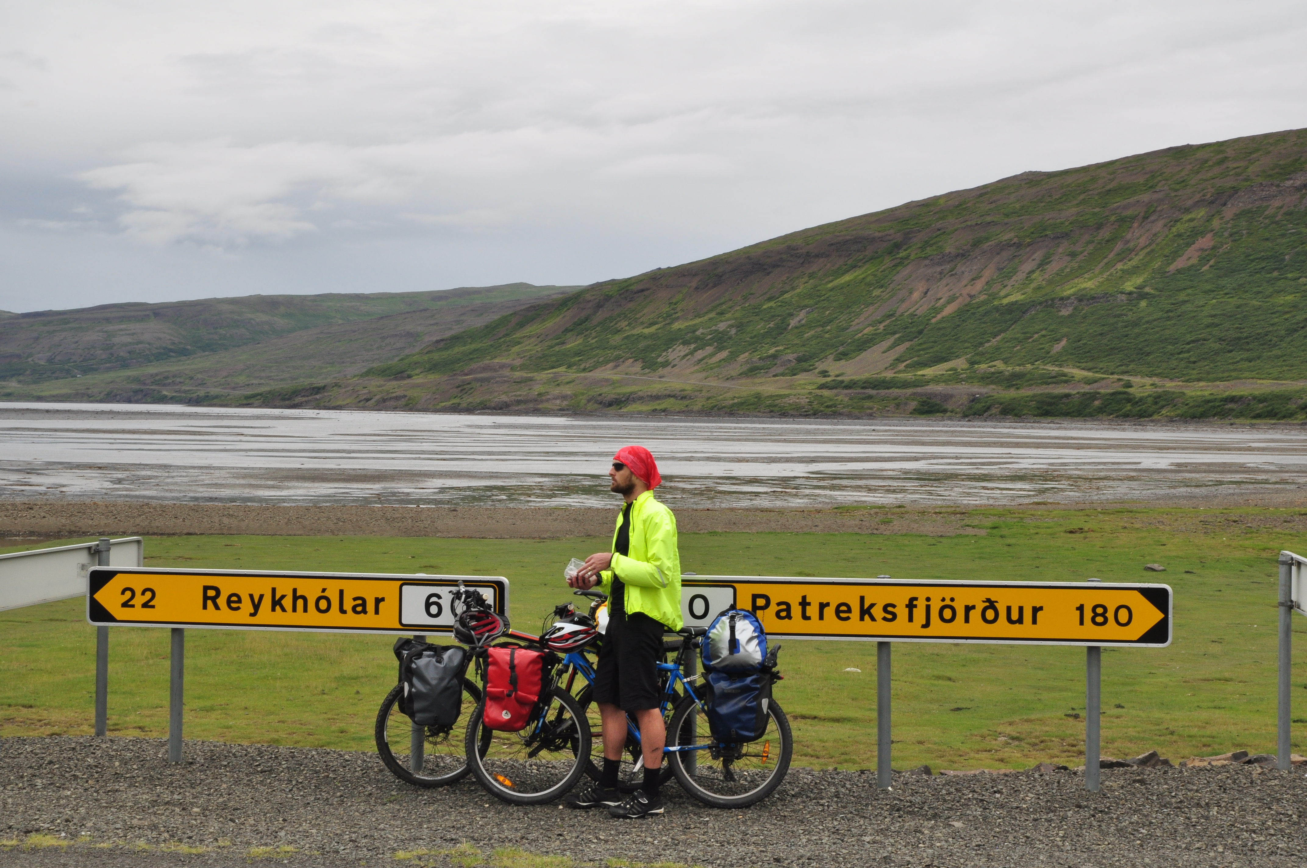
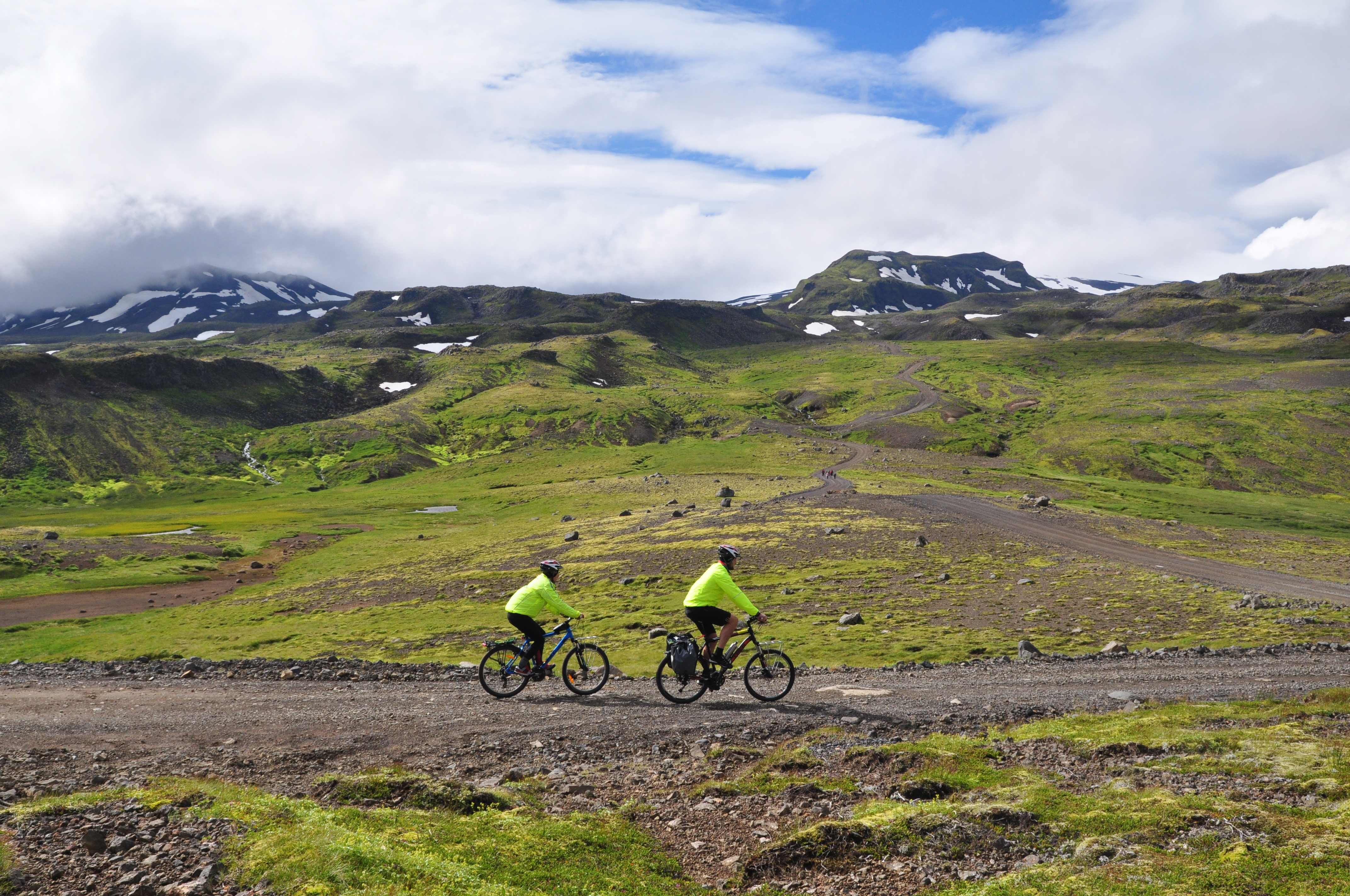
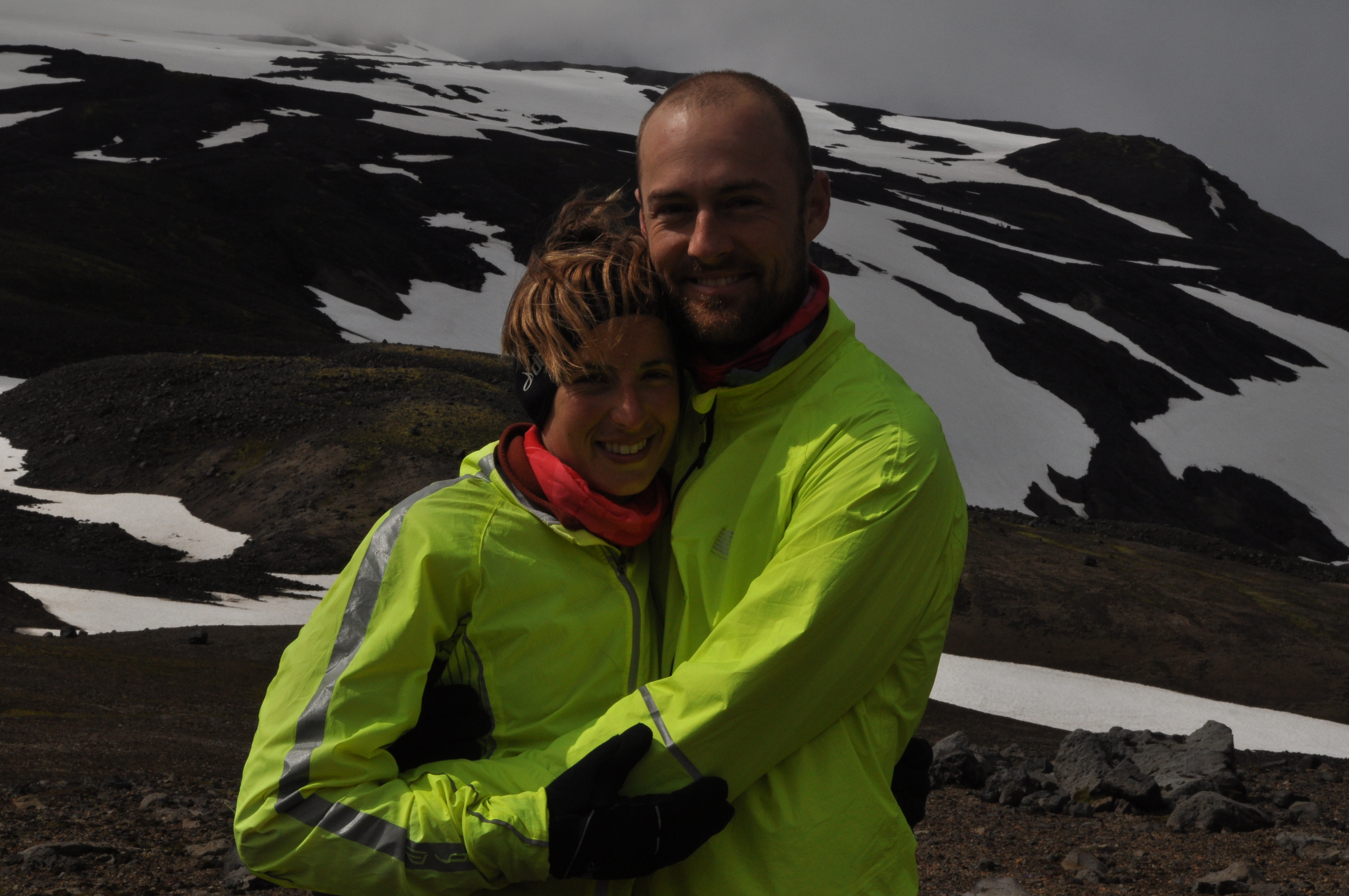
Our tourist day in Myvatn started with a rare sleep in, porridge and coffee for breakfast, more coffee at the local cafe over a wifi-fix, then a bus ride out to Dettifoss. We had considered riding to Dettifoss, but it was more than 50km distant, one-way, in the middle of sparse, rocky nowhere. We had also already planned that from Myvatn, we would have to take a long bus trip to the south-east of the country, to finish off our last week of riding along the south coast. This means missing out on riding through the entire east of the country, unfortunately, but many of the places we still really want to see are down south, so we have had to reach a compromise. Somehow, already, we’re running out of time! It could have something to do with the fact that instead of following the conventional Ring Road, our route looks a bit more like a schizophrenic dog hell-bent on chasing new scents around a park. Or something.

15 Dettifoss rainbow

It might have been the weather and the sparse surroundings, but Dettifoss had a far less light, spiritual feel to Godafoss and more of a dramatic, even menacing air – it is reputed to be the most powerful waterfall in Europe. The dark grey water rushed over the cliff-edge in a noisy, broiling mess, and the wind blew black volcanic dust and grit onto everything, including our hastily arranged sandwiches. Dettifoss actually featured in the film ‘Promethius’, in which an alien ‘engineer’ seeds life on Earth by tossing DNA over the falls. We watched on nervously as some other tourists on the other side of the falls seemed to risk throwing their own DNA in too, as they moved insanely close to the sheer cliff edge, climbing down onto rocks to get better photos – all the while ignoring signs that warned the rocks were unstable and often fell, and seemingly unfazed by the fierce wind and Dettifoss’s warning roar.

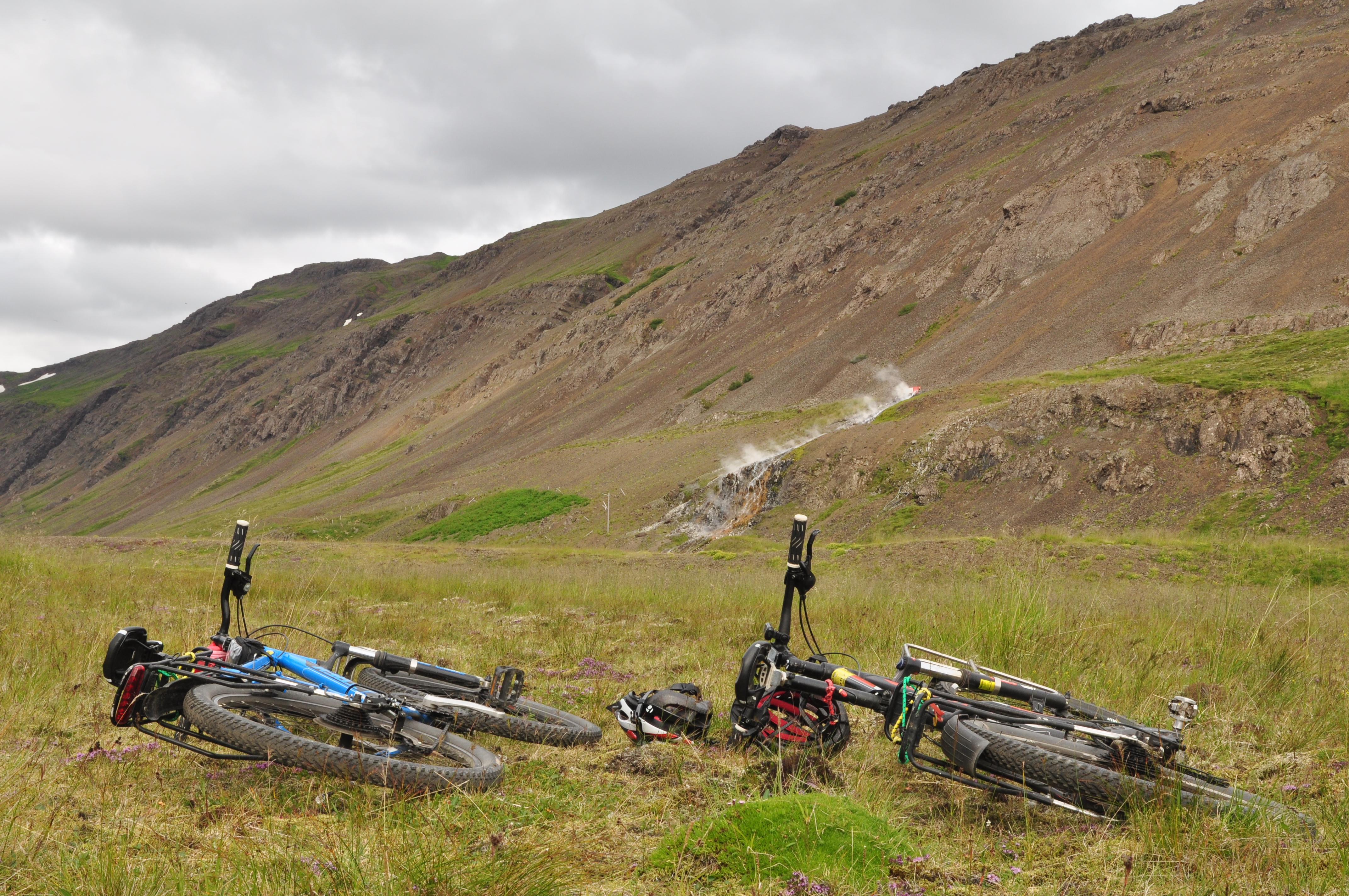
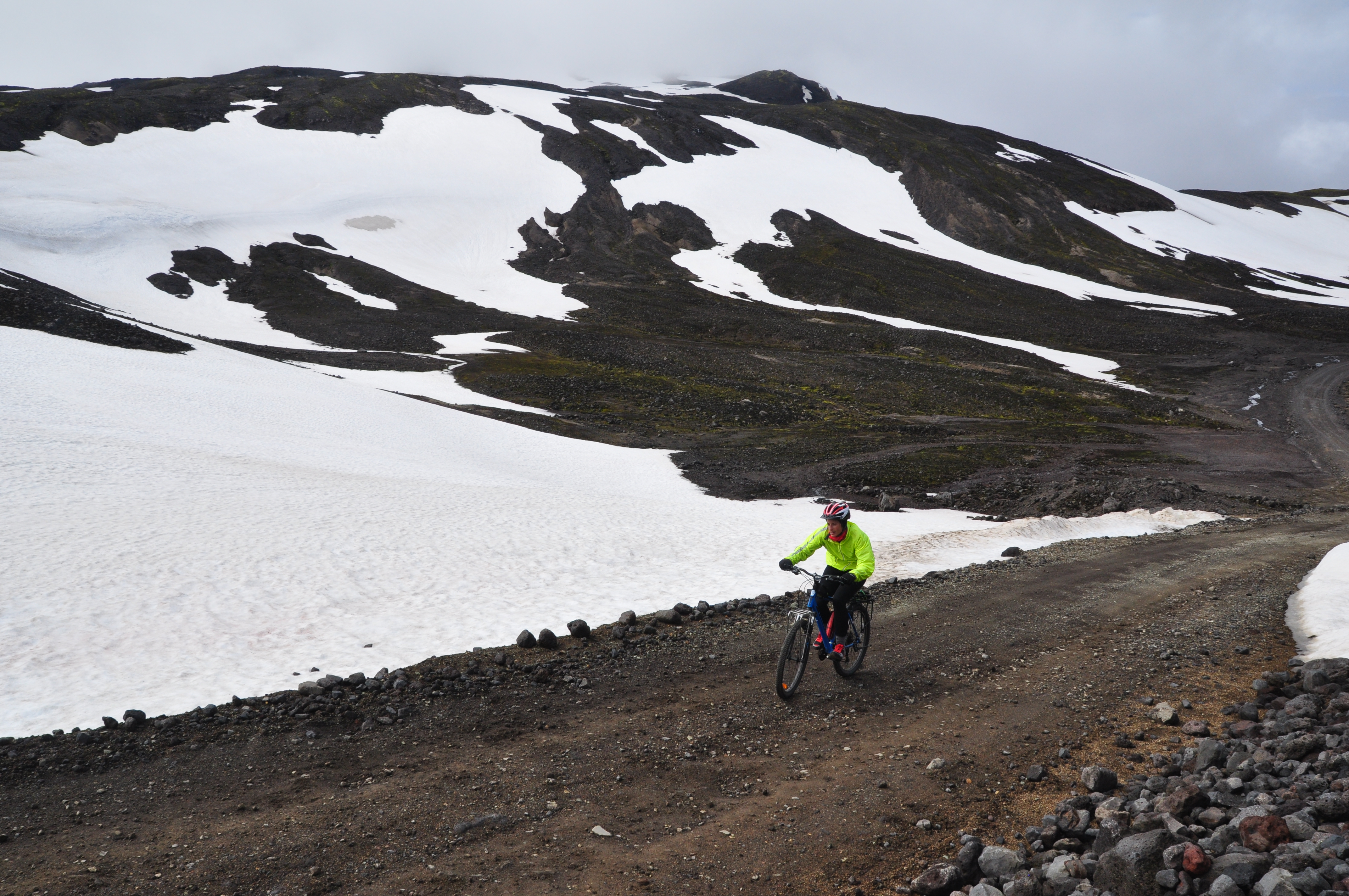
After a hot dog fix back in Reykahild and a rest that afternoon, we rode our bikes the 4km to the Myvatn ‘nature baths’, but first took a 6km round-trip walk from the site of the baths up to the edge of the crater of a nearby volcano called Hverfell. The track over bleak, charred landscape to the volcano looked almost like walking through a coal mine – but this place hasn’t been dug up. This is nascent Earth: volcanic rocks laying where they must have landed during the last eruption just 2500 years ago. Holes in the ground still spilled out scalding steam from the hot rocks below.
16 Hike up to Hverfell volcano
Returning to the baths after our hike, we found them just as we’d remembered in Reykjavik – a big, warm, pale blue, fairly shallow, mineral-rich lagoon. Unlike the public pool hot tubs we’ve been frequenting (which draw on the same geothermal sources for heat), the lagoons are less controlled (and, I’ll add, more expensive and crowded) – this means that rather than a consistent 42 degree heat, the water is often more like in the early-to-mid 30s, with the odd almost disconcerting ‘hot spot’. One of these in Myvatn welled up and seemed to form an impenetrable wall between bathers, who had circled around it like a campfire. We watched as unwitting swimmers drifted past peacefully, only to seem to seize up and start to twitch in pain as they retreated back, suddenly becoming aware of the invisible space everyone else was avoiding. I suddenly wished I’d never seen that movie ‘Dante’s Peak’.

We packed up the next morning for a 10am bus that would take us, in 7.5 hours, to a town called Hofn, on the south-east corner of the country and to the edge of Europe’s biggest glacier, Vatnajokull. I’m writing this from the bus, watching the incredible scenery of the east fjords fly by – still stunning out the window, but so fleeting, which is a foreign sensation to us now. No fresh wind in our face or sounds of birds or sheep to say hello to, or sense of anticipation with each new town that we skip through at high speed.

But all that begins again tomorrow – as does a new, incoming wave of heavy rain, according to the radar…

Thanks for reading! Don’t forget to sign up with your email address in the column on the right to receive updates for any future blog posts.

This slideshow requires JavaScript.

Advertisement

The north country

Hunting for crocs in northern Iceland, and the light at the end of the tunnel.

DSC_1021

Day 15-23
Saudarkrokur (aka sauerkraut) > Hofsos (aka hot sauce) > Siglufjordur (aka Sigmund Freud) > Dalvik (aka Croc country) > Akureyri (aka The Capital of the North)
Distance: approx. 180km

It’s raining that intermittent mist that fills the spaces between downpours and blinding sunshine. We’re running down the main street of a town called Saudarkrokur in northern Iceland, at the base of a peninsular we’re about to spend the next few days riding around.It’s about 3:45pm and we arrived in the town by bus about an hour earlier, having spent our last night in Reykholar at ‘pub trivia’ held in the local museum-cafe-information centre, generously translated into English (sometimes with difficulty, much to the locals’ amusement).

So, having covered a couple of hundred kilometres without breaking a sweat, we set up camp in Saudarkrokur and hit the main street on foot. Paul and his long legs are jogging about 100m ahead, and I am struggling behind with a developing stitch, trying to keep up. We only have 15 minutes. Reykholar pub trivia

The large, grey building and carpark described to us in the tourist information centre comes into view. I run through the sliding doors to find a row of checkouts acting as a gateway to a large general kind of department store. There are clothes, fishing gear, groceries, camping equipment – it looks promising. Red faced and glistening with sweat, I see Paul waiting for me at the checkouts and we enter the store together. I catch my breath and find the nearest shop assistant, who is getting ready for closing time at 4pm (or, as they’d say here, 1600).

“Excuse me…” I pant, looking at her through the haze of fog growing on my glasses. “Do you… sell… crocs?” I take another  breath. “You know, the shoes?” I point a little lamely at Paul’s navy blue pair, which I’d once teased him about. Not anymore.

The shop assistant looks at me, then the shoes, and shakes her head slowly. This could mean “No, we don’t sell those glorious, lightweight slip-on rubber shoes that look stylish on exactly no one,” or it could mean “I have no idea what you’re asking me, strange foreigner”.

There were no crocs. Deflated by the bad news, we retreat to a local pub, me dragging and cursing my heavy stiff bike shoes all the way.

Let me explain. As part of the enormous amount of gear planning and purchasing we undertook ahead of this 38-day bike tour around Iceland, we both included two pairs of shoes each. First and foremost, our cycling shoes (Paul’s a pair of clipless commuting shoes he already owned; mine a new pair of FiveTen mountain bike shoes, which have been great – on the bike).

Secondly, we would both have a pair of around-town/campsite shoes. Crucially, these had to be lightweight, as well as easy to slip on for moving in and out of the tent, etc. Paul packed his existing pair of crocs, while I had a pair of these strange black and pink rubber-soled neoprene/wetsuit booty things I’d once bought from Big W or K-Mart for water crossings on a multi-day hike that never eventuated, and which had therefore sat unused in my wardrobe for about a year. “These will do,” I had thought. Oh no, they wouldn’t. Within days they had fallen to pieces, the inner sole losing all form and function, to reveal a sticky mass of glue that managed to get everywhere and on everything. They were also constantly wet and developed a pretty foul stench before long. I looked forward to putting them on when we arrived at camp after a long day’s ride about as much as I would have looked forward to donning a full-length and damp wetsuit to wear around the streets of Iceland’s quaint villages.

And so, in a fit of disgust and despair, I disposed of the useless booties and resorted to wearing my stiff, heavy bike shoes all day everyday – but I knew that simply would not do for wandering around town on rest days, wearing to communal showers or on 4am dashes from the tent through mud and rain to communal toilets. It might not sound like a big deal, but after three weeks in a tent, the small things you take for granted at home become disproportionate in their potential for discomfort, like a speck of grit caught in your eye.
Crocs and socks
Alas, SaudarKROKur failed to deliver on the croc front (despite the name, which we re-dubbed as sauerkraut anyway). However, I do have some good (or bad?) news: I am now, finally, the proud owner and wearer of a pair of crocs (not the same brand, but the same thing, more or less). Even worse: make that crocs with socks, most of the time. The upside is that I fit right in in most parts of Iceland, as they truly do make a lot of sense here, and they also only cost about A$10. It took another four days, three towns and about 135km riding to find them… but luckily there was plenty to see and do along the way!

We left Sauerkraut at about midday the following day, having slept in that morning after a fitful, broken sleep, thanks to some very drunk and loud campers celebrating a local rally car event that had apparently recently wrapped up. The 35km ride to the next town, Hofsos, was quick and pleasant with clear weather, and the town hosted possibly our favourite swimming pool to date (if a little more crowded than usual, thanks to it being a particularly sunny Sunday). The pool was almost ‘infinity’-style, seeming to spill directly into the adjacent fjord, itself surrounded by misty, snow-covered mountains. We also enjoyed that evening wandering down to the fishing port and along the rocky beach.

Hofsos pool

Oh, and Hofsos also gave us our first experience of the famous Icelandic upside-down icecream. I don’t actually think this is a traditional or even common local dish, to be honest, but maybe it will become one. To be specific, when we ordered two chocolate-dipped soft-serve icecreams – to enjoy after a pannier-packed lunch of egg and remoulade sandwiches – the whole clump of icecream slipped from the waffle cone into the vat of that ‘magic’-style, instant-hardening  (i.e. certainly very unhealthy) chocolate sauce. I watched on in awe as she scooped the whole deformed chocolatey mass out with a spoon, plonked it in a paper cup and stuck the cone upside-down on top, then placed it on the counter next to the correctly formed version and said, straight-faced, “have a nice day”. We did.

Ritually watching the weather radar, we saw a day of rain on its way, and so packed up and set off from Hot sauce by 6.30am the next morning for our next stop, Siglufjorder. This was a 65km ride, and we arrived by midday – something of a personal record. You know you’re in rural Iceland when the biggest risks you face on a long day of riding are nervous sheep darting, inexplicably, in front of your bike during a fast downhill run, and when an Icelandic horse trots along the road beside you for 20-odd metres, with (honestly) an air of guilt and giddy excitement about having somehow escaped its enclosure (evident by the way it whinnied and shook its mane).

Hofsos

Arriving at Siglufjordur (if you can’t pronounce it, try Sigmund Freud, which is what we went with) typified the feeling we get whenever arriving at a new village or town after a long haul through the remote countryside. Suddenly, the immense soaring mountains, ice caps, steaming streams and lava fields narrow into a cozy valley lined by a smattering of colourful houses, a church steeple, an often respectably hipster ‘kaffihus’ and, of course, a swimming pool and hot tub. Each physically challenging journey between towns truly accentuates that sense of arrival, and of promise, offered by these villages. It’s not exactly wild, remote camping, but it’s the perfect way to balance the trip, and discovering the unique idiosincracies of each town is a highlight.
Herring buffet lunch
Sigmund Freud, for example, was once the ‘herring capital’ of Iceland, we learnt the following day, with most of the then-massive hauls of fish processed into oil and dried meal (the latter for livestock fodder, which seems a bit of a roundabout way for us humans to get protein). So, with our rest day aligned with the forecast period of rain, we spent the morning sheltering in a cafe with refill-coffee and wifi, then had a herring buffet lunch – an assortment of marinated herring (mustard sauce, garlic sauce, curry sauce, etc.), as well as boiled eggs and potatoes, Icelandic brown bread and hashed fish. We ate (more than) our ‘all you can eat’ fill, then wandered into the three adjacent museums dedicated to the town’s ‘herring era’ (which I imagine was a little like the ‘gold rush’ back in Australia). The boom, we learned guiltily as we daintily stifled herring-flavoured indigestion burps behind our hands, ended when herring stocks crashed in 1968, and from which numbers have never fully recovered.
Herring Era Museum Siglufjordur
The museums were genuinely fascinating, like stepping into a different world or era – complete with the Icelandic “she’ll be right” flair that, for an Aussie phrase, is far more fitting here. The dimly lit boathouse, for example, was a massive warehouse filled with actual Icelandic fishing boats fitted out as they would have been at sea. We could wander through them, up jittery ladders, down below decks, into the mess and up to the helm, exploring like kids anywhere and any way we liked, with no warning signs or safety barriers or officials watching over us. We next visited a multi-storey building that had once housed both male and female workers during the herring season, fit out with original bunk beds, original retro kitchen, low ceilings, larder and storage attic, etc. These are the best types of museums – the voyeuristic kind, and the perfect way to spend a rainy day in Iceland.

The rain let up for the next day’s ride out of Siglufjordur to Dalvik, which we’d looked at as simply a kind of half-way stop on the way to Akureyri, the latter the biggest town outside the Reykjavik area, sometimes called ‘the capital of the north’. I had been looking forward to Akureyri’s size and scope for two things: finding crocs (obviously), and eating something colourful and spicy and Asian, food we’ve sorely missed. As it turned out, Dalvik delivered on both fronts. I (joyfully) found and bought a pair of crocs in the supermarket, and – thanks to a communal camp kitchen that took us away from our camp stove for the first time in three weeks – cooked up a stir-fry storm.

The ride to Dalvik was an easy 35 or so kilometres – shortened significantly because, instead of gradually climbing over the mountain as we usually would have, we cut straight through it with 15km of tunnels. I’ll take the hill climb and its wide open spaces over those tunnels any day, please. These tunnels were less like urban traffic tunnels and more like mining tunnels, with unrendered, lumpy walls dripping with groundwater, dim flickering orange lights and shoulderless lanes (or, for the last 4km, a single lane for two-way 70km/h traffic). We donned all our high-vis gear, switched on our previously unused bike lights and let the mountain swallow us hole, hoping for the best.

Into the tunnel, Siglufjordur

Keeping up a high average speed (about 20km/h) and making full use of the regular lay-bys, we made it through the first 11km easily, physically at least. Mentally, we were a little drained, so – thinking the first 11km represented the only ones we’d face – we stopped at a gas station in the adjacent town, called Olafsfjurder, for coffee. We then put our helmets back on, got back on the bikes, panted up a hill and rounded a corner – to be faced by yet another ominous hole-in-a-mountain. This was the 4km single-lane tunnel. Again in typical Icelandic style, there was no real signage explaining just how cars and trucks were supposed to negotiate the narrow tunnel when they inevitably met, although it was long and straight enough that you could usually see lights coming in either direction with enough notice to pull into the nearest lay-by and wait. The trucks in particular were intimidating, roaring past in the dark sounding like earthquakes or thunderstorms, spraying our fluoro jackets with black road-grit.

We exited the final tunnel into the open fresh air and icy northerly wind with a sigh of relief. That icy northerly – blowing down from the Arctic Circle, which is less than 100km from here – would stay put for the following day’s 45km ride to the Capital of the North, Akureyri, which meant we covered the distance in just a little over two hours. We stopped off along the way for smoked herring and cream cheese on rye bread for lunch, eaten in the grounds of a 19th-century church and graveyard, sheltering from the wind.

Lunch

There’s a festival on here in Akureyri, with nightly open-air concerts and amusement rides and fairy floss (candy floss, if you’re not Australian), so we’re hanging around for a full day of wandering and eating and touristing. Next stop, the north’s Blue Lagoon, Lake Myvatn – but that’s another post.

Until then, as always, takk fyrir!

This slideshow requires JavaScript.

Hot dogs and hot tubs

Iceland is popularly known as ‘the land of fire and ice’, but we’re re-branding it ‘the land of hot dogs and hot tubs’. In between enjoying both of these over the past week, we’ve also eaten our best meal so far, seen our first puffins, soaked in a hot spring on the beach, and negotiated a construction zone…

Sweet descent in the Westfjords

We left off last post in a little town called Grundarfjordur, waiting on laundry whilst sheltering in an internet cafe. There we met and spent an hour chatting with a lovely German couple (a journalist and neurologist), who were on the tail-end of their year-long round-the-world backpacking trip, which had included Australia.

The town of Grundarfjordur was quaint, but the campsite one of the worst so far, with limited facilities and located away from the village centre in a kind of sunken quarry. However, we weren’t there for long: the weather radar showed heavy rain coming by midday the following day (we wondered what ‘heavy’ must have meant, if it didn’t apply to what we’d previously experienced?). So, a little eccentrically perhaps, we got ourselves out of bed, breakfasted and packed by 5am and arrived at our next destination, Stykkisholmur, by 9am. Abandoned house Grundarfjordur

The early-morning ride was on almost deserted (thanks to the time of day) long, winding roads through scenery including the most expansive lava fields we’ve come across so far. It was easy to imagine them spewing from the Earth orange and glowing millions of years ago, then crackling and solidifying into the form they now take.

The town of Stykkisholmur is where we would catch the ferry to the Westfjords, stopping over via a tiny, remote island called Flatey. The Westfjords splay out like fingers from Iceland’s northwest, and are geologically the oldest part of the country, as well as the most rural region. (Fjords are U-shaped, flooded glacial valleys.) We hadn’t fully planned that part of the trip, but it was next on the list, and it was where the ferry would take us – that much we knew. The rest would be decided over our enormous, unwieldy paper maps spread out in a cafe or in the green interior of our tent, as usual.

For fans of the movie The Secret Life of Walter Mitty, Stykkisholmur is also the setting for the scene in which Walter Mitty drinks a beer out of a shoe in a pub, then envisions Kristen Wiig singing Space Oddity as he jumps onto a helicopter driven by a drunken Icelandic man.

Before even setting up camp in Stykkisholmur, we had a couple of hot dogs in the local gas station, eaten standing in our dripping-wet bike gear next to some sort of farmers’/men’s meeting. These Icelandic delicacies (the hot dogs, not the farmers) are made up of toasted white buns, lined with diced raw onion, a sprinkling of dried-fried onions (aka ‘cronions’), a frankfurter and three types of sauce – tomato, maybe mayonnaise, and some sort of delicious, anonymous yet compulsory brown sauce. They are addictive, available everywhere, and cheap (usually around 350 kroner, or about AU$3.50). We also once had a special version in which the frankfurter was wrapped in bacon and topped with melted cheese… But I diverge.

Stykkisholmur

We spent the rest of the day in Stykkisholmur swimming in the local geothermally heated pool (and soaking in the adjacent 42°C hot tubs), grocery shopping and generally wandering about being tourists. By evening it was hard to fathom we’d ridden 45km that morning, and the ‘heavy rain’ never seemed to get much worse than the on/off showers we were by now used to.

The ferry the next morning left Stykkisholmur at 9am, and we would have about five hours over lunchtime on Flatey before being picked up again and taken to our first stop in the Westfjords for the evening.

The ferry also accommodates cars, so we hoped we might be able to ride our over-loaded mountain bikes up the ramp with them. Instead, however, it was onto the gangplank to make a bit of a spectacle among all the other foot traffic, the officials offering a non-committal shrug and a look that simply implied “good luck with that”. That was, until they realised we’d parked our bikes in a loading zone and directed us to find somewhere else (still of our choosing) to leave them for the trip.

Flatey is a tiny, remote island, about two square kilometres covered with colourful 19th- and early 20th-century (mostly holiday) houses. It is also home to the requisite wandering, curious goats and sheep, an old church and graveyard, a hotel/restaurant and a cafe/shop/information centre. The whole town emits a bit of an eccentric and creative air, and indeed according to Wikipedia was an Icelandic artistic and cultural centre up until the mid 19th-century. It would be the perfect place to hole up for six months and write a novel.

Flatey island

We disembarked the ferry from Stykkisholmur with the holidaying families (and their jubilant dogs), who loaded their luggage onto wheelbarrows left at the harbour – there are no cars on the island. Then, we all marched together down the single dirt road into the town centre, where they scattered into their respective houses, leaving us tourists milling like lost sheep, cameras hanging like pendulums around our necks.

We’d already ‘booked’ in lunch at the hotel restaurant from our mental ‘treat’ allowance, so we spent a few hours wandering around the island beforehand. Somewhat unexpectedly, we almost immediately spotted our first puffins – loads of them, in fact (a flock? a school, maybe?). Puffins!

Puffins are those clownish-looking seabirds, with big, bright orange beaks and orange feet that stick out behind their little black bodies when they fly like slightly clumsy (but very cute) bullets, barely above the water’s surface. They almost look like flying fish. We spent a while trying to get close-but-not-too-close with our inadequate lens to take a photo, and eventually decided it was near enough to lunchtime to head to the hotel – I think it was midday on the dot. We ordered blue mussels and Viking beer and cried little tears of joy as we soaked up the buttery broth with hot-from-the-oven bread.

We’d explored almost every square-metre of the island and were ready for the ferry by the time it arrived that afternoon to take us onto the Westfjords. By then we had also planned our next few days route – over chocolate digestive biscuits and instant coffee brewed on our camp stove by the ferry port. We realised that to take the one road that winds around (and over and over and over) the entire span of the Westfjords could take us well over a week, and as there were was only one road around and no regular or reliable buses, once we started we would have no choice but to either turn back or keep on going until we came out the other side – and we still had (and have) so much more of Iceland to see. Mussels on Flatey. The best.

Instead, we decided to head east from our first night’s campsite, which would be 6km from the ferry port. We’d ride over and around two of the fjords, before continuing on to the north of the country.

Part of our decision to take this particular route was also influenced by a desire to follow the little symbols on our maps that indicate swimming pools and hot springs (natural or pump-fed). We found our first one that evening, about 500m from our campsite – a hot pool built into rocks right on the beachfront, with a view of the surrounding mountains dotted with ice. The pool was overrun with another group of tourists that night, so we got up at 6am for a ‘bath’ the next morning before breakfast, and thankfully then we had it all to ourselves… Paul having rather conveniently forgotten to pack our swimsuits!

There was no official campsite within a day’s ride in the direction we were headed that day, so it would be our first night ‘free’ camping in Iceland. It would also be one of our toughest days, but to be followed by one of our best, to make up for it.

Hot pool in the Westfjords near Flokalundur campsiteIt was about midday when we hit the road again, starting off with our first long hill climb – about 8km long, 400m high. These climbs over the fjords are hard slogs and we averaged about, well, 8km an hour taht day. As usual, this is with plenty of brief stops, usually to make odd comments about some non-sequitur topic that we’d been thinking about while riding.

(Slog, slog, slog. Stop. “I was just thinking about Ian Thorpe. He’s really been through a lot, hasn’t he?” “Yeah, but things should get better for him now.” “Hmm.” Slog, slog, slog. Stop. “You know, those doughnut things we ate are called Kleiners. With a ‘K’.” “They’re best fresh, don’t you think? Those last ones we had were a bit dry.” “Maybe they’d be nice with butter?” “Hmm.” Slog, slog, slog. Stop. “My hay-fever’s been better here. Less dust…” …And so on, until we reach the top.)

Cycling through the Westfjords Iceland

The up-side of these climbs is actually the down-side – every long ascent is matched with another long, steep descent. This first was the only one on a sealed road and we flew down the other side in no time at all. Paul’s bike computer said he reached a maximum speed of 65km/h! I couldn’t help but massage the brakes a little more and hung behind at a more stately speed, maybe about 45-50km/h. But, hey, I would still have been speeding in a School Zone, so… watch out, kids!

About half way through the ride, the road condition changed from smooth tarmac, to gravel… to something truly ungodly. Enormous, loose, sharp rocks about the size of tennis balls covered the road, and they were at times simply impossible to ride over. Even the cars were taking it very slow over this stuff. We seemed to be passing through a long stretch of road under construction – as in, being built then and there. Killer gravel

Suddenly, we seemed to shrink down to miniature size as we rode up on a handful of 50-tonne steam rollers, diggers and dump trucks, with tyres alone at least twice our size, churning and dumping rocks right in front of us. We looked behind us and wondered if we’d missed a ‘road closed’ sign, but there was no other road to take. We managed to weave a little out of the way to the left, where some women milled about in front of some workers’ quarters, looking slightly amused but otherwise not that interested in our predicament. We then managed to make eye contact with the machine operators up in their yellow towers and get past them eventually (no OH&S over here…).

Before long, thankfully, the road surface returned to normal, but there was still the matter of finding that night’s campsite. Every other place we’ve travelled through in Iceland so far has had ample space for free camping had we wanted it, but we’ve always stayed at designated sites where available – to make use of showers and toilets, etc. Now, we rode along a two-lane road with rocky cliff to one side, and swampy marshland to the other. At one point we pulled into a potentially promising unoccupied summer house and knocked and called out (“Hello..? …Goden dag…?”). No one home, and no grassy yard anyway, even if we’d wanted to sneakily pitch a tent there for the night. We kept riding.

It had been a long day, and I may or may not have thrown a small (tiny, miniscule) tantrum over the sharp rocks and the diggers and the headwind, etc.

Eventually, Paul found a grassy spot down by the water. It would just mean leaving our bikes up closer to the road and ferrying our panniers in separate trips down a steep, rocky trail to get there. Despite the effort, the campsite turned out to be stunning, and we could properly appreciate it once we’d had ‘wet-wipe’ showers and brewed a cup of tea and then filled ourselves up with yet more packet-pasta, followed by chocolate. We even had our own constant-flowing stream of clear water in which to refill our bottles and wash our dishes and faces in. And the sun was shining bright and clear – and it stayed that way not only into the night, but for two full days!

Free camping in the Westfjords

The next day’s ride was much, much better. We rode over two more fjords, with long climbs and the complementary exhilarating, winding descents, surrounded by the biggest scenery you could imagine. We could see the road in either direction, winding around the water’s edge, for kilometres (so much so that we knew when the next car would pass us with at least five minutes notice).

That evening’s camp was on a farm marked on the map with that same tantalising water symbol. It isn’t officially a campsite, but a public pool/hot tub and a guesthouse. However, the owner kindly let us pitch our tent on her property for free and we payed the 300 kroner (about AU$3) each to use the pool and showers. She also showed us some local edible berries, and lamented that the other tent we saw pitched on her property had turned up the previous day and moved in without asking, then cooked their food on the guesthouse balcony, like squatters. We felt annoyed on her behalf, too – it’s people like that who give travellers a bad name.

This had been our second day of approximately 60km ride through the fjords, so it’s difficult to overstate just how good it felt lying back in that scalding hot tub, watching its source steam down the side of the mountain towering in front of us. If you need us, we'll be in the hot tub

A note about Icelandic public pools and hot tubs. It is compulsory everywhere here to shower thoroughly, and naked, before entering the shared pool. This is usually in communal (gender-segregated) shower rooms without cubicles – and enforced by the locals. It is an extremely practical, utilitarian – nay, genius – concept, of which Paul and I are both dedicated fans. I first experienced this a few years ago at a pool in Denmark, when the signs weren’t in English (as they are here, along with big pictures of cartoon people with highlighted red sections over their ‘pits and bits’). Back then, a kind but stern Danish woman shook her head at me as I showered in my swimming costume, and basically gestured the Danish version of “drop your dacks”, then nodded approvingly along with a few other onlookers as I obeyed and showered again. Doing this makes so much sense, and the pools are all the cleaner for it – without the bandaid fish and oilslick you’ll find in most public pools back home in Australia, and far less chlorinated, too. Also, you become so accustomed to swanning around the changeroom starkers that it almost feels silly putting on a swimsuit to go outside to the main pool area!

Day three of our ride out of the Westfjords took us to a bigger ‘town’ called Reykholar, which boasts none other than the country’s smallest grocery store. It was a 40km ride there, and we stopped at a roadside hotel at lunch time, before the last 13km leg – for a couple of hot dogs for lunch, of course. We were rained on for the last hilly section into town, and were starting to feel the cold set in. However, by the time we arrived, the weather seemed to take a full about-turn. The skies cleared and we suddenly felt ridiculous that we’d changed into thermals and fleeces, and switched to shorts and t-shirts.

Paul on the road Wesfjords Iceland

Of course, the campsite is located next to the swimming pool (pools in Iceland are like pubs in Australia – every town, no matter how small, has at least one ‘watering hole’). Our plan was to spend the night here, then take a bus a little way into the north of Iceland, skipping a bit of the Ring Road and giving ourselves a head start on the next leg of our trip. That’s still the plan, but we’d overestimated how regular or reliable the buses would be. It looks like we’ll be here an additional night and afternoon, before we ride 30km to the nearest bus stop, then take two separate two-hour bus trips over two days to our next stop – a place called Sauderkrokur on the north coast, where we’ll arrive Saturday afternoon no doubt eager to get back on our bikes. The pull of the road is becoming stronger.

For now, I’ve rather enjoyed writing this as we wait for the local cafe to open at 11am, then the pool at 3pm. Also, Iceland’s smallest supermarket sells hot dogs. So, we’re sorted for the next day or two. At least.


This slideshow requires JavaScript.


Journey to the centre of the Earth (and onwards)

Paul and Gemma cycling to SnaefessjokullDay 5 – 7
Hvalfjorur > Borgarnes > Olafsvik > Grundarfjordur (via Snaeffellsjokull glacier)

Distance: Approx. 340km (including 200km by bus!)

Okay, so… We cheated a little for the first time and took a bus – but then we rode around a glacier with a return trip in a fierce headwind and rain, which surely makes up for it?

We try to stay positive as we grind up the first steep climb, wheels slipping over loose gravel. That’s because we know we have another 12km of similar incline ahead of us, so there’s no point commenting on the obvious: this is tough. At least, however, the sun is shining, the wind is low for a change, and our bikes aren’t loaded with their usual luggage. At least, at least, at least. It has become a bit of a mantra of this trip, as we learn to find the positive in sometimes challenging situations. (At least there’s no headwind! At least there are no swarms of midges to swallow! At least we’re not standing on a Sydney bus stuck in traffic! Ha!)

Our tires spit out loose rocks which chink past our wheel spokes, and the sweat is soaking through our layers of jersey, fleece and wind-cheater. As on any steep climb, we take our usual approach – lowest gear possible and fairly regular breaks. We’re riding up road 570 from a small seaside fishing village called Olafsvik to Snaefellsjokull glacier, the latter located at the western tip of Snaeffellsnes peninsular, which juts out between Reykjavik and the Westfjords. The glacier sits at an altitude of 1446m atop an active volcano, which last erupted 1900 years ago and was made famous in Jules Vernes’ 1864 science fiction novel, Journey to the Centre of the Earth (which neither of us have read yet!)

DSC_0313

However, before we reach Snaefessjokull’s moody peak, allow me backtrack a little (not literally, thankfully. Distance is a valuable currency for us at the moment!)

We had spent our final evening back in Bjarteyjarsandur – the sheep farm that doubles as a campsite/accommodation, located by the beautiful Hvalfjordur (literally “whale fjord”) – eating double servings of home-made Icelandic lamb soup and watching the soccer World Cup semi-final. Showered, well-fed and rested, we saddled up the following morning for the 40km ride to our next stop, a town called Borgarnes.

DSC_0200Choosing, as usual, the back country route to avoid the main road, we’d mentally prepared ourselves for the long stretch of ‘yellow’ marked on our cycling map. (Yellow = steep.) The pretty little valley that we were to climb in and out of is surrounded on all sides by the now-familiar but always breathtaking green cliff faces and gushing waterfalls, with the valley floor smattered with colourful little houses and wandering sheep. It had a cosy, protected feel to counter the almost agoraphobia-inducing expanses we’ve passed through at other points of our trip.

We were cautiously optimistic when we reached the top of the valley and it wasn’t all that bad afterall. (I have a rule: never believe the words “all down hill from here!” Ever.) In this case our optimism was well-founded and after a nice, long descent, we rode happily through wide, flat and mostly empty gravel country roads. Our only company were Icelandic horses that would seem to trot enthusiastically to the edges of their enclosures to meet us as we approached, then skittishly away again once we arrived.

DSC_0227

Eventually, we reached a small (10km) unavoidable section of main road that would take us on to Borgarnes. It acted as a nice reminder of why we like to avoid the busier sections of the Ring Road or Route 1 where possible. Of course, the vast majority of cars are respectful and leave generous space when overtaking, however the wind-suck of 4WDs towing caravans one after the other is stressful and tiring, and would eat away at us if it was what every day entailed.

Borgarnes is the biggest town we’ve passed through since Reykjavik, and it seems to centre around a massive fast-food/service station (or maybe that was just our perception?). Naturally, we did as the locals do and each ordered a burger-and-fries combo as we waited for the latest unleashing of rain to ease before finding the campsite. Looking at the map, we realised the only route to our next stop, Snaefellsnes peninsular, was via the same kind of busy road without many particularly enticing stop-overs on the way. There was also a bus stop outside our new home at the fast-food joint, so we decided to hang around until the next day’s 7pm bus – after getting Paul’s chain ring fixed and swimming in the local outdoor heated pool. Incredibly (to our minds, and legs) the bus would take us and our bikes in the space of two hours the same distance we’d just covered in about four days, approximately 200km. The plan was to set up camp at Olafsvik for three nights: that night of arrival, the following night after cycling around Snaeffellsjokull (with our luggage left back at camp), and one more night after a day recovering from the previous day’s ride.

DSC_0350So, now back on our way up to the glacier. (I forgot to mention that the very first bit of road towards the glacier is up a small hill past a fish-drying shed, and you can imagine that heavy breathing and drying fish don’t complement each other very well.) As we neared the highest point of road 570, passing to the east behind Snaeffesjokull at about 800m above sea level, the air took on an icy chill and the clouds became decidedly moodier. We took a bunch of excited selfies at one point, thinking we’d made it to the top, only to spot one more steep bit just around the bend. However, once we’d really made it to the top it was obvious – the Atlantic ocean opened up before us to reveal the long cruise back down to sea level, with Snaefellsjokull’s powerful presence at our backs.

Just a touch unfairly, the 10km descent turned out to be almost as slow as the climb, because the rocky gravel was so loose. Hitting the tarmac again was therefore a relief as we sailed into the closest seaside town of Arnarstapi. Ever-disciplined, we rode straight past the barbecue scents wafting from a restaurant/bar there (average restaurant meals here are around $40 – fine dining prices back home) and continued onto a lookout spot, where we unpacked our boiled eggs, rye bread and remoulade lunch. We both agreed there isn’t much point forking out on expensive meals when you’re particularly tired or hungry and the simplest meal tastes like the best lobster or steak anyway. We prefer to save our ‘treat’ meals for rest days, when we are showered and have the energy to really enjoy them (ideally, with a pint of Icelandic beer).

DSC_0337We now had about 40km to cover on the sealed road around the tip of Sneafellsnes back to our camp in Olafsvik. Of course, a headwind and rain had arrived, and dark clouds boiled menacingly to our right over where Snaefellsjokull glacier would have been – if she wasn’t by now completely shrouded. Thanks to the headwind, this last ride would be an endurance test to match the glacier itself, and we were grateful when the weather settled a little once we rounded the tip of the peninsula. We stopped in a village called Hellisandur, which we knew was a mere finger’s width from Olafsvik on the map… (and which apparently meant another 10km). We appeased ourselves with chocolate milk and muffins from the service station, and made it back to camp in Olafsvik by 6pm – still six hours away from any sort of sunset. So, chasing the daylight hours was no issue… at least!

Our rest day in Olafsvik was, we felt, pretty well-earned. We had our first non-porridge breakfast in a week at the bakery (but to be honest, I missed the porridge a little), and we had pizza for dinner. We had also been given free tickets to a local show in a town called Rif, about 8km away. We take our rest days very seriously, so there was no riding. Instead, we tried out an Iceland tourist rite of passage (it seems) and stuck our thumbs out, and were picked up after about 10 minutes by a kind man, who gave us some interesting insight into the area – including explaining that a massive phone tower and abandoned settlement we’d ridden past were relics from a US army base during the Cold War.

DSC_0410
We made up a full third of an extremely intimate audience of six at the show, which was called ‘Hero’ – “a one man comedy show based on the saga of Bardur Snaefellsas”, according to the brochure. It genuinely had us in stitches of laughter, as much as anything for the bizarre situation we found ourselves in, being performed to by an extremely energetic young Icelandic actor who apparently does the same show three nights a week!

I’m now writing this from the next town from Olafsvik, called Grundarfjordur, while we wait for a much-needed load of washing to dry in the first laundromat we’ve come across in a while. Tomorrow it’s on to Stykkisholmur, which we expect to look somewhat familiar… (Prepare yourself for more ‘Walter Mitty’ references.)

Until then, once again, takk for reading!

This slideshow requires JavaScript.

Mental Everest

This slideshow requires JavaScript.

Day 1-4: 8 to 12 July 2014
Reykjavik > Ulfljotsvatn > Thingvellir National Park > Hvalfjardarvegur
Distance covered: 175km
“It’s not the mountain we conquer, but ourselves.”

At least, so said the inspirational poster plastered among several on the walls of the heated campsite kitchen to which we retreated for a luxurious half a day’s rest after our first day on the bikes.

The quote was from Sir Edmund Hillary, and while he obviously didn’t have access to sealed roads, a laptop or hot showers when he summited Everest, his words still resonate.

Our ‘Everests’ that first day included every 15-degree incline we approached with foreboding, gearing our weighty mountain bikes – as well as ourselves mentally – for the thigh-burning climb ahead. On several occasions I was forced to stop midway (and even Paul had to a couple of times) to push the bike to the top, groaning and feeling sorry for myself.

However, cycle touring, I have come to realise, is a somewhat bipolar (or perhaps amnesiac?) pursuit. Mere minutes after questioning our grasp on reason for taking on this trip, we are flying down the other side, grins spread across our faces, whooping into the vast, volcanic landscape around us. Yes!

We picked up our two, hire Trek mountain bikes from The Bike Company in Reykjavik the day before we set off, entering the office tentatively to find two employees drinking their morning coffee. There was a moment of awkward silence as we stared at each other across the room – them clearly fitting into the cool mountain biker subculture that seems to transcend international borders, us very much the gawky tourists.

“We’re here, um, to pick up some bikes?”
Silence.
“…It’s Chilton. We’re going touring around Iceland!”
Another beat of silence, then, seriously: “Have you done any bike touring before?”
Both Paul and me at once, over the top of each other: “Oh yeah, a bit, kind of, you know. Not really.”

Shit, this guy was on to us. He saw straight through us and brought all of our insecurities and doubts bubbling to the surface like an Icelandic geyser. Except, we soon realised, he really was actually rather pleasant and excited on our behalf. Our penchant for over-the-top pleasantries, we’re learning, doesn’t always cross cultural (or linguistic) borders. What did we want, a pat on the back or a high-five? We collected the bikes and our gear, sat together in his office and looked over some maps and garnered all the advice and tips we could, and left feeling confident and giddy with excitement once again.

We celebrated our last evening in Reykjavik with soup and beer, followed by a second dinner of smoked lamb served up by our generous airbnb hosts, who’d just finished up a family meal when we returned home for our usual jetlag-induced 8:30pm bedtime.

Another small Everest: I had a tiny razor cut on my ankle, and it had turned nasty after our trip the previous day to the tourist mecca of the Blue Lagoon – those sophorific pale-blue, steam-shrouded hot springs where you cake your face with silica mud and drift sleepily among hordes of other tourists (as well as, I now see, their germs thriving in the warm, moist environment…)

My foot was swollen and my ankle felt achy as if it was sprained; all this the night before we were supposed to head off on a 38-day cycle trip around remote, wild Iceland. So I started on a course of general antibiotics we’d packed for an emergency, smeared on antiseptic cream and a clean dressing, and went to bed trying to think healing thoughts.

We woke up at 4:30am, and looked at each other across the bedsheets in our ever-sunlit room. The weather outside was perfect. This was it. How was I feeling? Somewhat better. The antibiotics must have started working fast – the swelling was going down and my ankle bone re-appearing. We’d start our trip, keep an eye on it, and see how we went. (It’s almost completely better now.)

By 6am we were up the hill with my mobile phone in my top-tube bag directing us out of the city. We very soon became accustomed to the weight of the four panniers and satchel on each of our bikes (totally 60kg between us). The traffic was sparse, the air crisp (about 8-10 degrees Celcius), the sun shining and there was almost no wind.

01_Leaving Reykjavik

It was about 25km to the turn off onto Highway 431/5 (an alternative to the busy Ring Road), which would take us straight to the bottom of a big lake called Thingvallavatn. The map showed one long straight line cutting through the country side, followed by a squiggly bit – also known as a million little Everests. An experienced Swiss bike tourer (with thighs like tree trunks) who we met at our campsite that evening and who had ridden that way once before said he imagined that that part of the road must look like honeycomb from above (or Swiss cheese, I thought) – up and down, up and down.

After riding along a mostly straight two-lane road surrounded by vast, green country side and the odd sheep (to which I always say hello out loud – there’s no one around to hear), this steep winding road was bordered by towering bright-green mountains smattered with dark rocky formations. It would make a great place to photograph/film a new car launch – and Land Rover agreed. We were shooed away from one park we tried to stop at by a bunch of English-accented people with two identical red Range Rovers and the enormous truck that had transported them there. It was only once we’d summited (partly on foot) the final incline and came upon, for the second time, a burly man with a walkie-talkie that we realised they’d been waiting for us to clear the road so they could start filming. It must have been frustrating for them to watch on, tapping their feet impatiently no doubt, as I stopped intermittently for breathers or pushed my bike up the hill at about a kilometre an hour. Saying that, they can’t have been in that much of a hurry – they could always have offered us a lift!

There’s was a serious business – we watched from the top of the hill (in sight of the burly man) as they quickly shrouded the vehicle with a black sheet to hide it as another car drove past. To be honest, the Range Rover didn’t look that different on the outside from the current model, but I guess they need to be careful. And two cyclists on the same roads that were meant to look gnarly for a powerful 4WD probably would have ruined their footage, so we mounted our two-wheeled, human-powered steeds and continued on our way.

06_Gemma_Pingvallavatn

By the time we had reached the lake (having to alternate brakes on descent to keep them cool), the road flattened out and turned to gravel, and the weather had also started to turn. We watched the cloud formations over the lake as we lunched at its pumice-gravel banks, which helpfully massaged our saddle-sore behinds. We ate Icelandic flatbread with smoked lamb and cheese, and rinsed our apples in the icy, fresh lake water.

It was only midday and we’d covered about 50km, and a side-wind had just set in. Thankfully, though, the rain remained in the distance and never quite hit us. We trudged through the last 20km at a much lower average speed and with much less conversation between us.

We both felt a rush of relief when we spotted the campsite in the distance as we came to our last descent, stopping at a hill looking over a small, red-roofed church perched beside the lake. That relief turned to joy when we spotted the sign for hot showers.

Feeling clean and warm and exhausted (it was only about 3pm), with a cosy tent and a down-stuffed sleeping bag waiting for us, those hills we’d come from suddenly diminished in size in our memory.

08_Paul_Lunch on the pumice gravel banks of Pingvallavatn

…So much so, that what we’d planned to be a rest day on Day Two turned into a quick (and spectacular) 30km ride up the road to Thingvellir National Park in the late afternoon (it never gets dark, which is handy).

Thingvellir is where the European and North American continents meet (and where we plan on snorkelling in some of the world’s clearest waters once we’re back in Reykjavik at the tail end of our trip). It is also the site of the world’s oldest parliament (as we learned on a friendly, and free, guided tour the next day – our real rest day).

The decision to stay put was helped by the dreadful weather that had set in, particularly bad even for Iceland at this time of year, we were told (rather unhelpfully, really). I slept a little nervously that night as our tent flapped and warped (but otherwise coped well) in the strong winds

Having tentatively planned to miss riding in the rain by hanging around in the rain until a 6pm bus would take us to our next destination in the north-west (a little depressingly, via Reykjavik), we instead bit the bullet at about 11am, downed a hotdog at the tourist centre there, donned our rain gear and toughed it out – and how glad I am that we did.

DSC_0154

After a busy section on the main road for about 15km, we turned off onto a potholed gravel road surrounded by some of the most dramatic scenery we’ve seen so far – rushing waterfalls, snow-capped mountains, steaming geothermal springs and streams, all eventually opening up onto a wide bay just as the sun emerged for a brief show. The rain was no problem – in many ways it’s easier to deal with when you are well and truly out in it rather than trying desperately (and usually failing) to keep dry.

Six hours and 71km later, we are now sitting in an old barn converted to a tourist hangout at a sheep farm. We’ve already booked two nights here.

Tomorrow we will sleep, eat lamb raised on the farm, take photos and maybe even go for a trail ride on a horse.

This really is no Mount Everest after all. And we’re loving it.


We’re coming Iceland! (eventually…)

Helsinki Airport Finnair Lounge

Just a few days before we set off on a five-week cycle tour around Iceland – but first we have just one more leg of this oh-so-long-haul flight.

Let’s just say it’s been a long day. Or two days. Or however much time has passed since we left Sydney on Thursday and arrived in Helsinki (via Singapore) a little while a go. Air travel will do that to you. My ability to measure time has been reduced to episodes of US sitcoms and e-book chapters. 

Paul and I have now spread out and settled in for an eight hour wait at the Finnair lounge at Helsinki Airport. The luxury of hanging out in comfy chairs with reserved business people cost us almost 100 euros, but already that has been worth it for the shower alone, let alone the bottomless coffee cups, food and the reliable wi-fi – thank you very much. It’s apparently early in the morning here, and we board our flight to Reykjavik at about 3 pm this afternoon.

It was only last year that we made a pact to return to Iceland one day, during a stopover at the airport, and apparently we meant it.  After arriving in Reykjavik this afternoon, we will have a few days decompressing and exploring Iceland’s only city – before spending  38 days cycle touring and camping around the so-called ‘land of fire and ice’.

Of course we like to think we’re being original in our little adventurous stopover en-route to the UK, however one blogger we contacted for advice in preparation for the trip commented on how many other such emails he’d received recently. He called it the ‘Walter Mitty effect’ (something Icelandic tourism businesses have also noticed and of which they are taking full advantage). We’re not sure quite how big a role Ben Stiller played in our decision to cycle around Iceland, but I couldn’t discount it entirely for at least helping to spark our imaginations.

Saying that, however, inspiration also came from our wonderful friend (and talented photographer’s) own experience in the country, and even the novel Burial Rites by Australian author Hannah Kent; a fictionalised account of Iceland’s last execution.

You could also say we’ve been hanging out with the ‘wrong crowd’, so to speak (or in this case, of course, the ‘right crowd’, but I guess that depends on who you ask). For example, when you befriend a professional adventurer as inspiring yet disarmingly affable as Chris Bray – who, among other things, once walked across Victoria Island with a mate unassisted, and who is currently sailing through the Northwest Passage with his equally adventurous and amazing wife Jess – then suddenly something as relatively tame as cycling around little ol’ Iceland (which is roughly the size of Tasmania but definitely not mostly flat, as I have since learned – thanks Chris) seems suddenly achievable.

And so now here we are, almost – almost – there.

Our itinerary can be summed up as “in a clockwise direction”; our preparations as “all the gear and no idea” (there’s also, “learning on the job” and “Google”); and our physical training as “we both know how to ride bikes” and the all-important double-negative – “we aren’t not fit!”.

Iceland’s 1332 km Route 1 loop can be completed in as little as two weeks by fit, experienced cyclists in a rush – or so we’ve heard. However, we’ve allowed ourselves considerably more time than that, not just because we’ll probably need it, but also to explore the ‘side streets’, including the West Fjords and parts of the uninhabited interior, also known as the highlands.

We will pick up a couple of hired tour bikes in Reykjavik on 8 July and then hit the road with loaded panniers and hopefully diminished jetlag. Around five weeks later we fly out of Reykjavik to the UK where Paul will embark on a year-long furniture-making course in Devon, and where I will be working as a freelance journalist (but that’s a-whole-nother story, for another time). As for who we meet and what we find and experience during our time on the road in Iceland, your guess is as good as ours – which is how we like it.

I’ll be sharing our photos, thoughts and experiences from Iceland on this blog as regularly as possible along the way (internet access pending). You can receive email updates by entering your email address in the Follow field in the left-hand column on this page – we promise it will be less ruminations on long-haul travel, and more awesome photos like this (the only difference being our presence in padded lycra pants  – what more could you want?!)

Until then, takk for reading!

South of the border

Throwback Thursday flashback to a guided tour of the North/South Korean Demilitarised Zone, back in January 2011.

DMZ 2011 messages of peace and reconciliation

Messages of hope left by South Koreans for their kin beyond the border.

The bus windows were speckled with a flaky substance our bubbly tour guide explained was disinfectant spray to prevent the spread of foot and mouth disease. It hampered our view and sounded alarmingly carcinogenic, but we could still make out the white fields and surrounding hills she was in the process of telling us about.

“You can tell which hills are ours and which are theirs by the number of trees,” she said. “Theirs are bare, because they’ve chopped down all the trees for heating. They don’t have coal, like us.”

I hated to think of the North Koreans living through this winter in particular – the coldest South Korea had seen in 40 years, with temperatures as low as -17°C and only dropping as we trundled north in our tour bus. I wasn’t unique in this musing – whenever the weather turns bad in the south, the uncomfortable thought lingers in many South Koreans’ minds as their eyes flicker guiltily northward: How much worse must this be for them?

Enigmatic Seoul

Enigmatic Seoul, the capital of South Korea.

Forty kilometres south of the North/South Korea border, Seoul is a vibrant, enigmatic city. Vats of silk worm larvae from street food stalls waft pungent steam in the direction of westernised nightclubs and coffee houses.

Planning a stopover trip to Seoul from the safety of our home in Sydney, Australia, the idea of visiting its border with North Korea, also known as the Demilitarised Zone (DMZ), sounded a bit too risky, so we hadn’t included it on our itinerary. However, reality has a tendency to tilt on its axis when you arrive in a foreign country, and soon the idea of being within reach of the most secretive totalitarian regime in the world seemed too alluring to pass up.

In the rare event that a journalist sneaks footage from across the North Korean border (usually via its communist cousin, China), the product is stories and images of desperate and dirty-faced citizens, and the occasional appearance of Kim Jong-il’s (or nowadays, Kim Jong-un’s) smugly plump jowls. And when North Koreans do occasionally make it to the south (also usually via China), they take a long time to assimilate. This is generally because they speak and act as if they’ve come from a different era. They have never heard of concepts considered Western, such as jeans, or ‘diet’, our tour guide tells us. The direct translation of their old-world terminology for the latter, for example, is to ‘cut the flesh’.

DMZ 2011 tour bus passport check

Passport check on the way to the border.

So I expect this day-trip to the DMZ to be tense, fraught with sadness and poignant, and when an armed soldier boards our bus to check passports (I managed to steal a photo before our guide nervously translated his clipped order that this was not allowed), it was exactly as expected.

Having successfully navigated our way through tank traps scattered across the road like a kid’s game of jacks, we arrived at the DMZ theme park (closed for the winter) complete with a frozen-over swimming pool and inoperative amusement rides.

Bracing ourselves against the northern chill, we left the bus and followed our guide to the first tourist stop, the so-called Bridge of Freedom (also known, paradoxically, as the Bridge of No Return). This is the only bridge crossing the Imjin River and therefore connecting the north and south. It was here the two sides exchanged prisoners at the end of the Korean War, with the signing of an armistice in 1953.

The tourists milled gingerly around the ice-crystal-swathed bridge, shivering and eyeing each other sideways. Whitney Houston was belting “I-eee-I will always love you-ooo-uuu” over the PA speakers lining the bridge. The razor-wire fence at the end of the bridge was covered with colourful ribbons bearing Korean messages of peace and reconciliation to their long lost ancestors and family members on the other side.

DMZ 2011 theme park

‘DMZ Disney Land’ closed for winter.

The idea, I gathered, behind this bizarre dichotomy of quiet poignancy and, well, cheese at the tourist site was that, post-unification, the DMZ would be rendered little more than an historic monument to the bad-old-days. North and South Koreans alike could become teary-eyed to the vocal refrains of Céline Dion, and then enjoy a ride together on a merry-go-round. Instead this DMZ Disney Land gives a surreal, tawdry effect to a place that is otherwise one of the saddest I’ve ever visited.

Herded like school children into what I want to call the DMZ Discovery Centre, we shuffled through a museum of Korean War photos and educational displays, before entering a cramped cinema where we were shown a propaganda film. As the lights switched back on and curtains drew back over the screen, I had an uncanny sense of experiencing a Cold War I thought I’d been born too late for, but which never ended at this 250km-long by 4km-wide slash at the 38th parallel, separating two peninsulas populated by otherwise racially, culturally and linguistically identical people.

DMZ 2011 the bridge of freedom or no return

Sadly, the Bridge of No Return remains a more fitting name that the ‘Bridge of Freedom’.

Our final destination before being shipped back to the relative normalcy of Seoul was Dorasan Station, a modern train station in all its digitally timetabled, air-conditioned grandeur, bar one glaring absence: passengers. A couple of giggly tourists made snow angels near the unused tracks pointing north – tracks ready in every way, except politically, to transport imaginary commuters to Pyongyang. If it ever gets up and running, it will connect Korea to the rest of Asia and Europe – a backpackers’ rite of passage waiting to happen.

Adjacent to the train station was a small shop marketing the DMZ in a very unusual way – for its organic produce. Think about it: around 1000 square kilometres of fertile land relatively untouched (bar the odd land mine) for almost 50 years.

Albeit, after a breakfast of steamed silk worm pupae, the fruity biscuits we purchased were indeed tasty. The bottle of made-in-North-Korea soju (Korean vodka) was less so, but I’ve kept it as a memento of my weird trip into no-mans land. It serves as a reminder that, until things change, on the other side of that tacky border theme park exists an almost invisible population of suppressed, desperate people who are, among other things, fast running out of trees to burn for warmth.

Note: My husband, Paul, and I travelled to Seoul, South Korea, and visited the North Korean border back in 2011, which was when I originally wrote this piece.


DMZ 2011 unification

Dreaming of unification.