Our last week on Christmas Island!

DSC_0718

In between packing nappies, wet wipes and extra bug spray and sunscreen for a baby, I keep forgetting to pack our camera so that he can one day look back and know he was actually here on Christmas Island!

For example, I would have loved to have shown Owen pictures one day of himself at seven months old, strapped to his dad’s back, sloshing down one of the Christmas Island ‘dales’ – under sporadic rain and morning light filtered through the rainforest canopy, past robber crabs not much smaller than him, clinging on while Paul scrambles over fallen tree trunks and limestone outcrops; to have a photo of Paul sliding down a wall of tangled tree roots next to a small waterfall… That was yesterday morning, on our walk to Anderson’s Dale, which finished abruptly at the coast, at a towering, narrow gorge that peeks out at the big blue Indian Ocean.

However, as I forgot the camera he’ll have to make do with our stories instead to remind him – and no doubt those crabs and rocks and scrambles will become a little bigger and more treacherous with each telling…

We finally snorkelled Flying Fish Cove!

We’ve now reached the last week of our time here, and this morning we achieved something of a milestone for the trip – the swell finally calmed down enough for us to snorkel Flying Fish Cove. Owen stayed home with his new good mate Jess, and we set out at 6am, swimming from the boat ramp out to the immense ‘drop off’ at the edge of the reef. The diversity of fish, water clarity and colourful coral was beautiful – we swam until our fingers were wrinkled and we actually started to get a little cold which is pretty rare in this environment. Paul spotted a giant trevally and a lion fish, I got to see schools of tiny ‘Nemo’ clownfish in the corals, plus a bizarre looking pipefish and several beautiful technicolour parrot fish – plus countless other species that I’m afraid I couldn’t name.

By now, I feel like we’ve established a pleasant routine here – often swimming or exploring in the early mornings (sometimes Paul and I take turns having quiet mornings at home with Owen depending on the activity). This is followed by a day on the site for Paul helping to build Swell Lodge and me at home with Owen (we’ve also swapped on two occasions), and then either a swim or activity in the afternoon, or maybe just drinks and snacks down by the water as the Sun sets.

One of the highlights has definitely been the strong sense of community on the island, so it’s easy to see how Chris and Jess will be able to make a life here for the foreseeable future while they build and run Swell Lodge.

For example, tonight I’ll be participating in our third weekly ‘Hash House Harriers’ run, which happens at 4.30pm every Thursday – usually a roughly 5km run (or walk) with a drink stop that includes beers, and finishing with a BBQ, along with some obscure rituals that feel like a cross between maybe the Masons and college ‘hazing’ initiation ceremonies.

Another regular outing has been the Island’s outdoor cinema on a Saturday (and sometimes Wednesday) evening, which usually involves pulling on your rain jacket at some point as a rain shower passes over, and on Australia Day we went along to a community sausage sizzle – the upshot of all this (plus getting to meet Chris and Jess’s lovely circle of friends) is that already we’re waving hello to familiar faces when we walk down the street or at the local pub.

Tomorrow is our last day for exploring and the conditions will inform how we spend it – there’s another underground freshwater pool we’ve been meaning to visit, or we may hike to a new beach or an existing favourite (Dolly Beach is on my list as a highlight – and another place I failed to pack the camera for!).

In the meantime, here’s a few pics from when we did actually remember to take a camera!

DSC03448 (Large) (2)

Snorkelling at Flying Fish Cove.

DSC03425 (Large)

DSC03416 (Large)

DSC03396 (Large)

DSC03391 (Large)

DSC03467 (Large)

DSC03461 (Large) (Large)

DSC03480 (Large)

DSC03482 (Large) (2)

DSC03511 (Large)

IMG_2298

Fellow volunteer Hamish bravely demonstrating the true scale of the robber crabs.

DSC_0816

Sundowners on the deck with Owen.

IMG_2296

Paul went on a caving adventure while I stayed home with Owen. At least I got to see the photos!

IMG_2271IMG_2245

DSC_0806

Robber crab chowing down on a coconut.

DSC_0803

Ethel beach with my human cargo.

DSC_0782

DSC_0718

Luckily, Owen seems to enjoy hanging out in his backpack carrier!

DSC_0711

Holding hands with dad ❤

DSC_0702

The work site where Swell Lodge is being built.

IMG_2305

Grotto swim at high tide!

Advertisement

Christmas Island 2: The blues

DSC_0657 (Medium)

The big robber crabs are a favourite site in the rainforest.

The Land Cruiser trundled down the steep bumpy track through dark rainforest. Outside, tropical rain fell hard on the roof and our baby Owen slept soundly in his car seat next to me while I swotted away the ever-present mosquitoes.

As I anticipated the evening ahead, I also wrestled with whether the decision to take him along this evening was bad parenting or… was it that awesome free-range parenting you read about in Scandinavia, but with more humidity…?

Soon we’d park and step out into the rain, hike down to a beach to watch a relatively rare natural event – something that only happens once a year on the island, and may well be a once-in-a-lifetime opportunity for us to witness. I didn’t want to miss out, so I continued swotting those mozzies.

DSC_0600 (Medium) (Medium)

We hiked down to Greta Beach to watch blue crabs spawning

Christmas Island is famous for its 5 million or so red crabs, hence it being such an amazing spectacle when they migrate out of the forest to spawn. However the less populous blue crabs also do their thing every year, and lucky for us the stars had aligned (well, the Moon more specifically, I believe) and the island’s crab experts had predicted tonight would be the night to witness blue crabs spawning.

We stepped out of the 4WD into the forest, under the dense canopy of which we were somewhat sheltered from the rain.

Head torches lit, Owen strapped to my front, we hiked along the trail to Greta Beach. After the short walk, we could sense we were reaching the coast as the canopy opened up and our surroundings lightened from night to dusk.

The last part of the track was a steep metal staircase down to the beach, where a few locals, national parks crew and scientists had already gathered to witness the spawning. Hundreds of blue crabs descended the limestone cliffs that tower behind the small beach towards the rising tide, where they’d wait for the water to wash over them and do a funny little dance to release their parcel of eggs, and hopefully make it back to shore to crawl back into the forest…

DSC_0597 (Medium) (Medium)

Gathered to witness the blue crab spawning on Greta Beach.

DSC_0613 (Medium)

We’ve now been on Christmas Island for over a week, and every day I’ve been putting off uploading my next travel blog as we see and do new things that I want to include! Chris and Jess are famous for the busy schedules they keep (if you’ve ever received one of their Christmas cards you’ll know) so our days are full; and that’s in between the demands of a seven-month-old!

Some highlights so far have included swimming in the Grotto – an amazing cave and freshwater pool, easily one of the most stunning swimming spots I’ve experienced.

DSC_0626 (Medium) (Medium)

The Grotto swimming hole

We’ve snorkelled and swam at Ethel Beach – and Paul has already spotted a whale shark there on a spearfishing outing. The water temperature (about 28C) and clarity makes for gorgeous swimming conditions – on our morning swims tiny blue sea sapphires sparkle beneath us, like swimming above a starry night. We swim at the edge of the ‘drop off’, where the water drops off a coral shelf and disappears into blue darkness.

We’ve visited the ‘blowholes’ lookout on the coast, at the end of another walk through rainforest. The honeycombed limestone structure of the island is perfect for blowholes and they make me wonder if they’re linked to dragon mythology – as that’s what I think of when I hear the low rumble and see the puff of ‘smoke’ (sea mist) bursting out of the rocks.

Yesterday Paul and I swapped roles; he spent the day with Owen at home and I went onto the work site for a working bee clearing the second lodge site – clearing rainforest and dragging out Pandanus and other vegetation in the middle of the jungle is as gruelling as it sounds, but it was also surprisingly fun and oddly cathartic.

26907664_1546456838771962_7036006206533008140_n.jpg

Working bee clearing the second site for Swell Lodge in the national park. (Photo: Chris Bray/@SwellLodge)

We finished the day at a nearby rock pool on the coast that filled with the swell like a spa.

DSC_0690 (Medium)

Paul and Owen joined us for our swim after a day on the Swell Lodge work site yesterday.

DSC_0687 (Medium)

We now have two days to rest and/or explore – the swell is still big on our side of the island, so we haven’t swam at Flying Fish Cove yet. A trip Dollys Beach is on the cards for this afternoon; ranked one of the top 10 best beaches in Australia last year.

IMG_8818 (Medium)

Regular afternoon drink spot.

image1 (Medium)

Paul at the work site with a huge robber crab. (Photo: Chris Bray)

DSC_0662 (Medium)

The blowholes look out.

DSC_0661 (Medium)

The blowholes lookout.

DSC_0646 (Medium) (Medium)

Carpets of baby red crabs closed the roads to the protected side of the island for a few days.

Christmas Island: first impressions

“Don’t they have to see the landing strip to land? Those clouds are very low,” my husband, Paul, unhelpfully commented from the seat next to me.

“Oh my God, oh my God, oh my God,” a woman intoned from a few rows behind us.

On my lap, Owen gurgled and cooed, happily oblivious in his infant’s seatbelt strapped to my own. I clasped my arms around his waist and took deep breaths, while our Virgin passenger jet wafted side to side in the wind as it stepped towards the seemingly invisible runway.

On the ground our friends and hosts for the three weeks ahead, Jess and Chris Bray, were at home and unprepared for our arrival, certain the weather would prevent our plane from landing. It’s not uncommon for planes to be turned around – and for the previous few days they’d been hit by the outer edges of Tropical Cycle Joyce, which was battering the north-west coast of Western Australia almost 2000km away.

But land our pilot did, and the passengers exhaled a collective sigh of relief before we disembarked into the grey, humid tropical air of our destination.

DSC_0586 (Medium)

DSC_0584 (Medium)

Our home (and view) for the next three weeks.

Welcome to Christmas Island, a 135sq.km island of jagged limestone rock and mature rainforest in the Indian Ocean – technically an Australian territory, but closer to Indonesia by a long shot. The island is famous for the red crabs that carpet the streets during migration season, and infamous for its immigration detention centre. Settled in 1888, its approximately 1800-strong population is multicultural, made up of Chinese, Malaysian and Western residents, home to a Buddhist temple and Islamic mosque. The island’s main industry for most of its history has being phosphate mining, supported by tourism – an aspect which Chris and Jess hope to help grow. (I’ve embedded a video at the bottom of this post with more about their exciting project.)

Paul and I, with our seven-month-old son Owen, will be spending the next three weeks on this remote, tropical wilderness while Paul pitches in a helping hand for our friends’ ambitious project building a luxury ecolodge in the island’s national park – while I take my current day job of changing nappies, breastfeeding and facilitating naps to somewhere new and exotic, hopefully interspersed with some world-class snorkelling, rainforest walks, and wildlife spotting.

DSC_0558 (Medium)

Checking out the uncharacteristic swell at Flying Fish Cove.

Snorkelling and swimming are on hold for the first few days, however. On our way from the airport we pulled into Flying Fish Cove – usually idyllic and calm, we watched enormous waves pound the coral beach and crash against the infrastructure of the island’s phosphate mine. It was apparently the biggest swell the island had seen in years.

Insect-sized baby red crabs crawled over our sandals and palm fronds and coconuts littered the roads. We drove through the township (called Settlement), past ramshackle houses, shops and apartment blocks, paint flaking off in sheets and metal rusting from the constant salty air. The town’s prized open air cinema was cancelled as the screen had torn in the wind. We arrived at our friends’ house (actually their friends’ – they’re house sitting), which is one of several 1940s weatherboard Queenslander-style homes lining the island’s north, with servants’ quarters from the colonial days, lofty ceilings and perpetually open windows and spinning ceiling fans. From the front deck we watched and listened to waves explode against the cliffs and seabirds ride the winds.

DSC_0575 (Medium)

Paul, Owen and one of Christmas Island’s iconic red crabs.

Paul and Chris wasted no time heading out to check the site – Paul saw his first robber (or coconut) crab, enormous, forest-dwelling land crabs which can weigh up to 4kg (making them the world’s largest land invertebrate) and can climb trees. I stayed home and gave our tired little traveller a cool bath and managed to get him to sleep in his travel cot under the whirring fan. The boys eventually made it back, a little later than expected as they walked roads closed by carpets of baby crabs and the odd fallen tree, and we settled onto the deck for obligatory gins and tonic.

I’m writing this now back at the house, having breakfasted on egg roti and sweet coffee in the island’s Malaysian quarter (a weekend ritual of Chris and Jess that I’m excited to adopt while we’re here), while the others strategise the weeks ahead building Swell Lodge.

DSC_0946 (Medium)

Buying egg rotis for breakfast in Kampong, the island’s Malaysian enclave.


DSC_0948 (Medium)

Post storm harvest: papaya, mangoes, avocados and bananas

It’s been a long while since my last travel blog – there’s been a pregnancy and an infancy in between, and now a little boy who’s starting to look more and more like a toddler.

But now, the slow pace, humid air, and the vantage point offered in the ocean-facing deck here has alighted the spark for getting back into writing and it feels good.

Pyrenees adventure

Hiking and exploring the Pyrenees mountain range at the border of France and Spain

Puig CarlitCatalunya hike adventure

Part 1: Loose lips at Goat Alley

“If this thing falls, it´ll f***ing kill you!”

Paul was clinging to a reportedly loose boulder, wedged between two perpendicular rock walls a couple of hours into our hike towards Pic de la Dona Morta (Catalan for ‘Mountain of the Dead Lady’). I looked up at him nervously, wondering whether he was overreacting or I was about to live up to the mountain’s name. To our right the mountainside gave way to immense scenery overlooking the Pyrenees that form the border between France and Spain.

Earlier that morning, we’d awoken in the morning dark in our host’s mountain hut, a charming old water mill, for our first day of the first half of our trip to the continent that would mark the end of our year-and-a-bit in England. The skies were grey and thunder rumbled in the distance – we’d asked our host, guide, translator and good friend Chris Ward for adventure and that´s what we were getting!

DSC_0914 (Large)

DSC_0837 (Large)

Waiting out the rain

DSC_0859 (Large)

“What exactly do you have planned for us, Chris?”

On this day on the mountain, our eclectic group consisted of Chris; his good friend Philippe (aka ‘Vallespir Migou’); Philippe’s friend and retired member of the Slovakian special services Valentin; my husband Paul; Django (who loves mountains but hates the snapping sound of individual yoghurt pots being separated and is also a Border Collie); and moi.

When we’d pulled up at the start of the hike, the heavens opened, so the six of us (including Django) sheltered in the back of the van counting the seconds between lightning and thunder and waiting for the skies to clear. When they did (for the time being at least) Django leaped ahead barking enthusiastically and we hoofed behind him, the peaks in the distance revealing themselves intermittently as the cloud cover shifted.

The weather was mostly fine, until at one point the heavens again unleashed a downpour of rain and hail and the track at our feet became a running stream. Our broken French-English conversations were halted when Philippe, in the drama of the moment, ran ahead belting out the Catalan anthem in the rain, as you do.

DSC_0875 (Large) DSC_0877 (Large) DSC_0861 (Large)

If the weather hadn´t cleared so completely after that, we probably wouldn´t have tackled ´The Chimney´ – also known as Goat Alley – which forms a small part of a local mountain race that Philippe organises. I mentioned hesitantly that I was a little scared of heights when I heard the word ´Chimney’, but apparently people aged up to their 60s have completed the mountain race, so we continued on under refreshed blue skies.

It was the first part of this small section of rock scrambling that Paul encountered his loose boulder. Those of us still on the track below him moved aside as he climbed over it, then Valentin followed him up and confirmed that yes it was loose and directed me up a different route which I gratefully took. Finally, Chris made his way to the precarious boulder and with scary ease pulled it free from the rock wall and sent it hurtling down the empty mountain side as we listened in silence to it thumping against the earth and cracking tree trunks on its descent.

DSC_0871 (Large)
We made it to the top of that!

Next up was the aforementioned Chimney/Goat Alley, another short climb/scramble before we reached the top. Philippe climbed ahead with dog-slash-mountain goat Django. As I followed them up – making nervous noises that can´t have required translation – Chris mentioned something along the lines of ‘I hope you don´t mind all the goat poo’ (hence the name Goat Alley) and I remember thinking I´d happily eat goat poo as long as I could get to the top of this bit and not look down. Of course, fairly easily (in hindsight!) we greeted the top with smiles and whoops and took a few snaps before the easy, steady descent through sheltered forest (formerly terraced farmland) down the other side.

DSC_0882 (Large) DSC_0879 (Large)

Life’s all about contrasts and it was almost surreal when, that same afternoon, I found myself lowering my tired legs into the famed thermal baths (which date back to Roman times) back in the village of Amelie les Bains, which attracts thousands of French people every year who arrive on doctor´s orders for (government-subsidised) treatment of their arthritis and respiratory illnesses.

Washed of all goat poo, we drifted our way around a hot pool with various kinds of jets to massage different joints, then it was on into the steam room and finally the mud bath – all followed by a muscat tasting session in the local wine shop and an introduction to the Catalan specialty cake, ´rusquilles´.

Yep, our trip was off to a good start.

Part 2: Castles in the sky

The next morning the weather was much clearer and this time we were joined in the (fully-loaded-and-then-some) 4WD by our French hostess Marion and Django´s brother Pep – two dogs with a serious case of sibling rivalry.

DSC_0918 (Large)

This was a pleasant (and steep!) hike that started at a disused iron ore mine and continued onto wide, low grasslands populated with sheep and horses, then a steeper climb up the rocky mountain side in a steady hike that gave us time to practice our burgeoning pigeon-French with our friends.

This time the weather was clear and we enjoyed uninterrupted views over the Pyrenees and ahead to Canigou (2786m), a mountain of spiritual and national significance to the Catalan people. We stopped at an area called Pic De Gallinas and, in true French style, lunched on bread, cheese, salami and chocolate.

I then watched on from a safe distance as our mad French friends (that includes Chris) showed off their tricks on the mountain ledge, before we made the long descent back down into the valley, followed by a scenic drive home via the Tour de Batere, a military signal tower built in the 14th century,

DSC_0932 (Large) DSC_0930 (Large) DSC_0935 (Large) DSC_0949 (Large) DSC_1006 (Large) DSC_0997 (Large) DSC_0995 (Large) DSC_0991 (Large) DSC_0983 (Large) DSC_0974 (Large) DSC_0958 (Large)

It was time to rest the Aussies´ legs (I´m sure our hosts could´ve kept going!) so that night we refuelled in the local cafe on salmonella and toxoplasmosis. Wait, sorry I mean steak tartare served with a raw egg in its shell. (It was tasty and of course I was fine! Although according to the internet toxoplasmosis is asymptomatic in adults barring potential reduced IQ, so watch this space…)

We spent the next day visiting two ruined 12th century fortresses/castles built high up in the mountains – Queribus and Peyrepertuse. Both were fascinating and eerie, particularly as the fog closed in, so I´ll let the photos do the talking here…

DSC_0005 (Large) DSC_0017 (Large) DSC_0025 (Large) DSC_0056 (Large) DSC_0074 (Large) DSC_1038 (Large)

Part 3: Homes away from home

DSC_0445 (Large)

In case you thought this trip was all mountain climbing and Russian roulette dining, let me transport you to Chez Toinette – the home of Chris´s other French ´family´, a charming cafe looking out over the town square where daily fresh produce markets are held, and where we were welcomed from the first day we arrived with open arms by the owners Michelle and Pierre, even given the language barrier.

On the evening we arrived we drank muscat and ate fresh local anchovies, stuffed peppers and cheese and watched on while Pierre slated Chris for England´s recent Rugby World Cup loss to Wales. (This was done in French, but no translation was required.) On another evening, we drank too much sangria while a musician entertained dancing locals with some songs I´d never heard but haven´t been able to get out of my head since (like this and this). He also belted out a few English songs, and rather endearingly managed to step all over Elvis´s Blue Suede Shoes (¨Well itsannah fowanunny, anu fowannu, athee agennanney no GO CAT GO!¨).

We also spent two mornings at this cafe crashing Chris´s normal routine of breakfasting with his vivacious ´extended French family´ on coffee and criossants (and second-hand smoke) – loving everything about the company and location so much that I had to stop myself from joining in the bouts of laughter when someone made a joke, realising sometimes too late that I didn´t actually understand what had been said…

DSC_0347 (Large) DSC_0447 (Large) DSC_0351 (Large) DSC_0330 (Large) DSC_0333 (Large) DSC_0381 (Large)

Part 4: Holiday in a holiday

Thanks to Chris and his friends in Amelie les Bain, our well-planned Pyrenees adventure included a couple of nights at Philippe´s family´s holiday house in the heart of the Pyrenees. It was a couple of hours drive away, so we took the scenic route via some fascinating Catalonian villages and local sites, including crossing the border into Spain where we had lunch of potato tortilla and wild boar stew at a sleepy Spanish Catalonian town called Queralbs and stopped off to stock up for dinner at a locally famous charceturie.

DSC_0121 (Large)

​Another dramatic storm hit as we made it to the collection of lakeside homes that included our accommodation for the next couple of nights (the exact location of which Chris was almost, definitely, sort of, absolutely ​certain – right Chris?!).

As we darted inside to escape the rain, I instantly knew I was in the kind of holiday house that the best childhood memories are made of – packed to the exposed rafters with memories, stacks of well-used board games and, in this case, stunning views over Lac de Matmale and the twinkly lights of a sleepy, off-season ski village across the water.

Cue cracking open a few beers, starting up a game of cards, snacking on cheese, pate and Fideuà (Catalonian paella made with pasta) ahead of our next adventure the following day.

DSC_0129 (Large)

Part 5: Puig Carlit (well, almost!)

We awoke to clear skies for another early start with coffee and croissants and a short drive to the start of the day´s hike – made longer stuck behind some very chilled out cows along the way.

DSC_0142 (Large)

The scale and drama of the scenery here was almost beyond words – perhaps a combination of what I imagine Yosemite and Switzerland might look like? (Having seen neither!). Distant, jagged peaks, huge stands of coniferous trees and brilliant blue mountain lakes that sparkled under the bright day, including Étang du Lanoux, the biggest lake in the Pyrenees.

DSC_0155 (Large) Puig CarlitCatalunya hike adventure DSC_0167 (Large) Puig CarlitCatalunya hike adventure DSC_0223 (Large) DSC_0157 (Large)

DSC_0232 (Large)

On this truly stunning hike, things only started to move a tad outside my comfort zone as we neared the summit of Carlit and the path started to climb until it became rockier and rockier and, as it was the cusp of seasons, a bit icy, with some surface snow. And so, I´m not ashamed to admit (although Chris did give us permission to lie!) that I didn´t quite make it to the summit – we were literally only about 50 metres away, but I´m no mountain goat and it was more of a climb than a walk and the rocks were slippery AND it was a long enough fall down! Paul stayed behind with me through sheer chivalry, naturally, and we left Chris to reach the frozen cross at the summit, while we found somewhere to wait for him and to have lunch – baguette, ham and Camembert, naturally.

DSC_0174 (Large) DSC_0193 (Large) DSC_0208 (Large) DSC_0212 (Large)

That night I miscalculated and cooked enough beef and veg stew to feed an army, while Paul disturbed all the village dogs with the noises he made whilst wading into the ice-cold lake to soothe his dodgy knee. Said dodgy knee would also mean that Puig Carlit would be our last big hike of the trip – there was only one other we had planned to take, but this was replaced with a day eating pizza and looking at local art in another village called Ceret, which is about as good as Plan Bs get.

DSC_0421 (Large) DSC_0413 (Large) DSC_0432 (Large) DSC_0435 (Large) DSC_0397 (Large)

After a couple more days of sight seeing (an abandoned military fort, a hill top monestry, the Devil´s bridge that maims not kills and so on…) we spent our last night back in the lovely old water mill house, where we (inadequately!) returned the incredible hospitality we´d received by cooking dinner. Chris also helped us translate a short thank you speech which I read out in French and which everyone in the room except Paul and me seemed to understand, which was a good sign.

Then it was time for one last coffee at Chez Toinette before our next stop: the city lights of Barcelona, where, if it weren´t for the red and yellow Catalonian flags dangling from every balcony, the sleepy charming villages of French Catalonia just on the other side of the Pyrenees would have seemed a million miles away.

DSC_0106 (Large)

Expat update: from Bideford, Devon

So I’ve been slack with blogging, I know, I know. You can put that down to the trials and tribulations (and joys!) of setting up life in a new country.

A room with a view, in Bideford, North Devon

After adjusting to the leisurely pace of life on Paul’s family’s farmhouse in the UK’s idyllic west midlands, we ended up spending our first night in our ‘new’ home of North Devon in a tent in the beer garden of a country pub…

Yes, less than a fortnight after finishing our bike tour around Iceland, we were back to our old ways again, pitching tents in unexpected places.

Paul’s furniture making course had been scheduled to start in about a week’s time, and we still had to solve the minor detail of finding somewhere to live for the year. On that weekend ‘reccy’ to North Devon – timed smack-bang in the middle of school holidays – we couldn’t even find accommodation for a night. Thankfully, the pub owner at the Devil’s Stone Inn in Shebbear overheard our quandary and offered a grassy patch out the back, which we gratefully accepted.

A sign on the wall behind the bar proclaimed the pub to be ‘officially haunted’ (as decided by some sort of independent auditor of those kinds of things, apparently). However the only haunting we experienced was from the Rottweiler with which we shared the beer garden, and which left several landmines for us to dodge. There was also the Wifi that didn’t work when the jukebox was plugged in, and vice versa (those ghosts can be oddballs, sometimes). Boat at Instow beach

Eventually, houseshare.co.uk led us to a terrace just outside the town centre of Bideford, in which we now rent a, let’s say… cosy bedroom. That is to say, we’ve had to customise a double futon to make it fit, still leaving really only standing room for one.

Our new home is, however, just a cobble stone’s throw from the high street and the River Torridge, to which we have found ourselves gravitating on these balmy summer evenings to watch the local rowing teams, as well as carefree kids in wetsuits jumping off the ‘old bridge’ at high tide. (At low tide, the boats lean over on their keels on the exposed mudflats.) Our room also has a window looking out on all this, which makes up for the lack of space. We leave the curtains open overnight and are awoken every morning with the walls painted pink from the rising sun.

Accommodation, tick. Next up was to find a job. Paul started his course on the 1st of September, and since then drives the 10 miles there through country lanes in our ‘new’ 1995 Land Rover Discovery. The hedged lanes are so narrow (and the Disco so wide) that he has to fold in the side mirrors.

That left me with the place to myself during the day as I continued the process of becoming established in Bideford and in the UK in general (even grocery shopping was a learning curve – aubergines not eggplants, courgettes not zucchinis, gammon shank not bacon hock, and I made a spinach pie out of something called ‘spring greens’…). I had a couple of freelance jobs to tide me over – including working on a feature article for Australian Geographic Outdoor magazine about our Iceland bike tour – but otherwise I was emailing and phoning anyone and everyone I could to look for work opportunities.Boat on the River Torridge

With several irons in media/publishing-related fires, I still became impatient. It turns out I don’t ‘do’ idle well, so after about a week I responded to an ad in a local cafe, called Cafe Collective, and found myself making coffees and waiting tables for the locals (the Australian accent always made for a great ice-breaker with customers). As a Sydney-sider, I was a little aghast when the cafe owners let me operate the espresso machine without a PhD in latte art, but I got the hang of it and even learnt what the hell an ‘Americano’ is. (If you’re interested, it was invented in Europe during WWII to resemble the filter coffee that American soldiers were used to. It is also what you give someone when they ask for simply a ‘coffee’ and you can tell very clearly that they do not want to be hassled with any further options.)

Alas, however, my days in hospitality were numbered. I am pleased to say instead that I’ve started in a permanent role at a very groovy little boutique publisher and marketing agency called Salt Media, which specialises in gorgeous food publications. I take a double decker bus to work, and always nab the front, top-level seats to enjoy the view. (As these are always empty, and I share the bus with mostly high school kids, I gather this isn’t a particularly cool place to sit – which works out perfectly.)Blackberries

Bideford is starting to feel like home (or home-away-from-home, at least) and Paul and I are diligently conducting our own local research – that is, gradually working our way around all of the local pubs for our Friday night ales. Most of them were built in the 15th/16th centuries, and for a town with a population of about 10,000, there’s plenty to choose from. Most recently, it was the Joiners’ Arms, with old woodworking tools hung on the walls, which felt extremely fitting given the circumstances of our relocation here. It might just become our regular haunt (although we have a few to work through yet).

Another highlight has been taking weekend walks along the Tarka Trail, which covers a total distance of 180 miles through North Devon. We’ve walked about 14 of those miles (~22km) over various weekends – passing under old stone bridges, by unused canal locks and rail lines, and picking blackberries from hedges that are fat with them this time of year. The Tarka Trail might just have to become a future blog post of its own, once we’ve explored a bit more.

It’s all just a bit ridiculously quaint, really. I thought England was supposed to be grey and dreary? We’ve even been swimming in the Atlantic Ocean. Without wetsuits. Twice.

Now, I’ll leave you with a few shots from the Bideford Carnival, which took us by surprise when the carnies started rolling in with their amusement rides and fast food vans, and when for one entire evening the town came to life to the soundtrack of the local pipes ‘n’ drums bands. It was a perfect welcoming. Thanks Bideford!

This slideshow requires JavaScript.

The romance of challenge

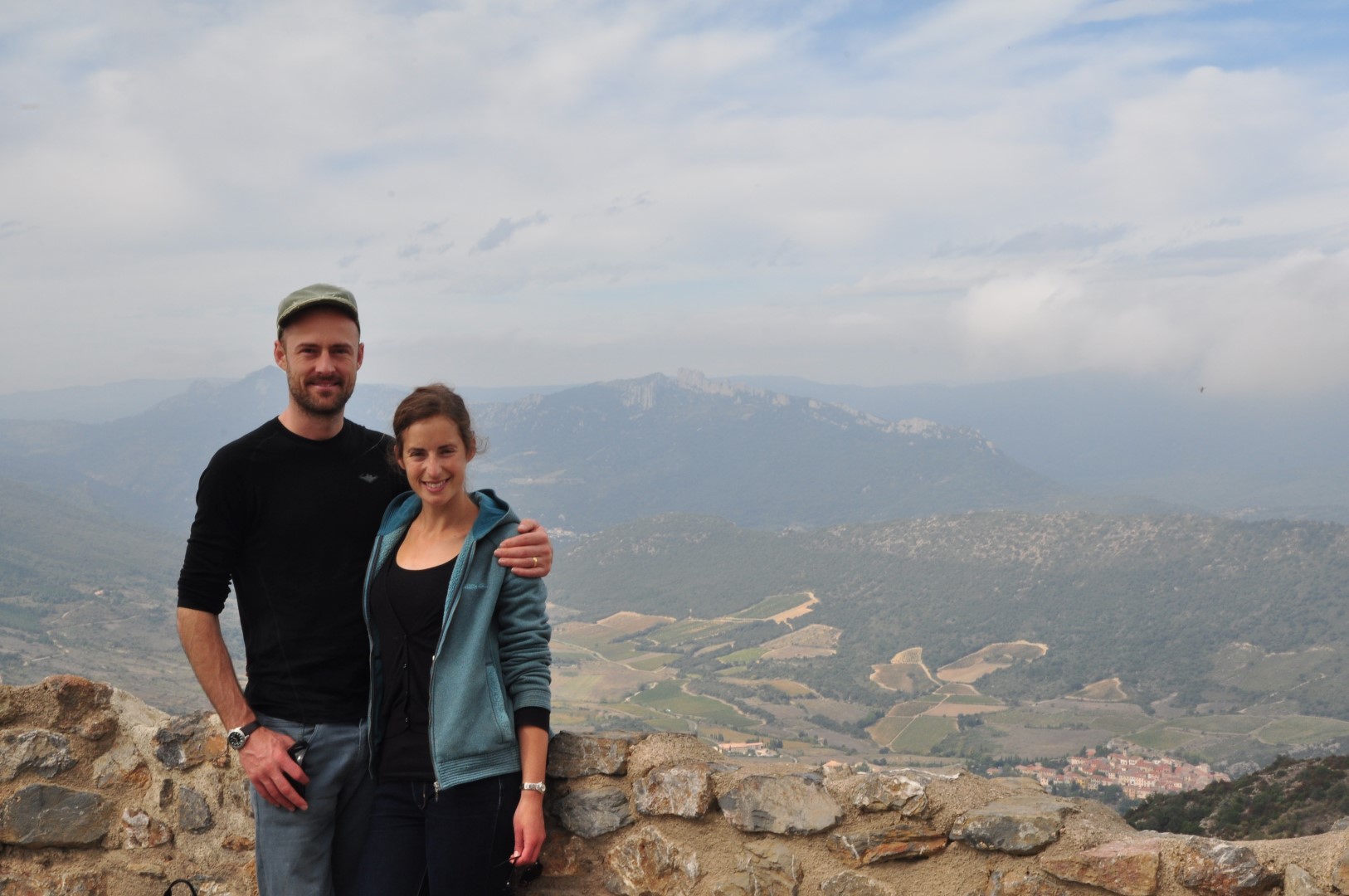
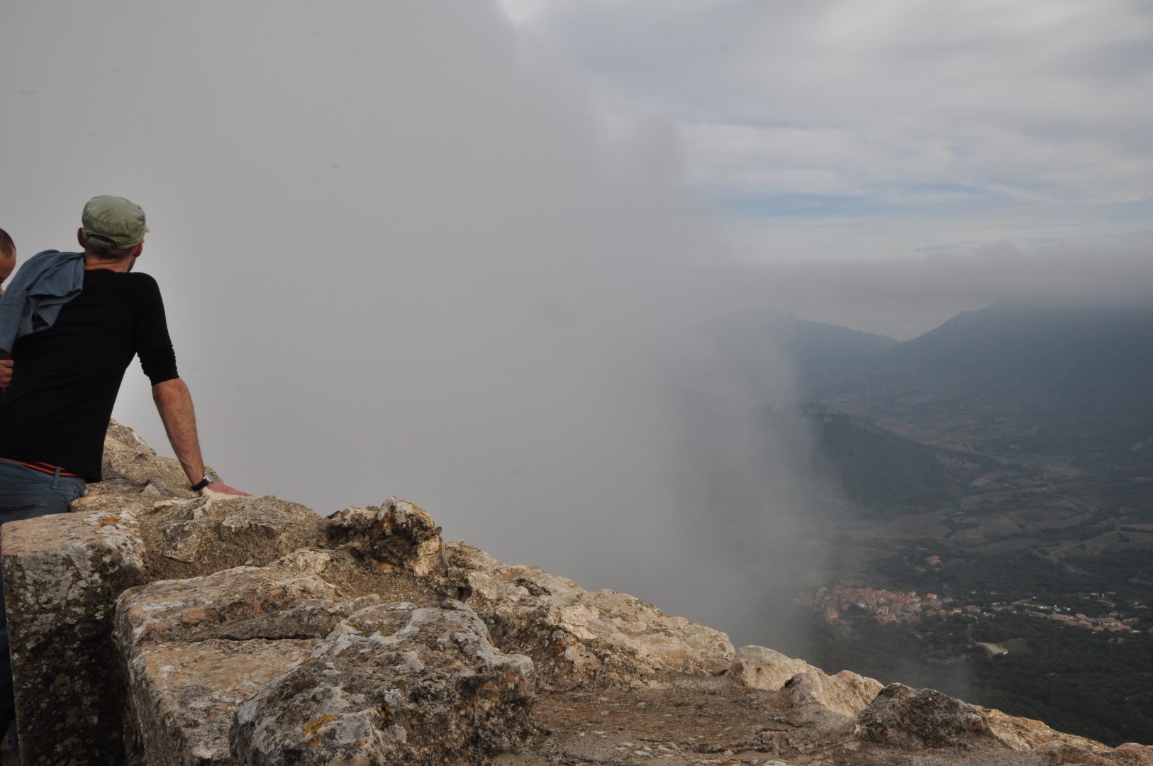
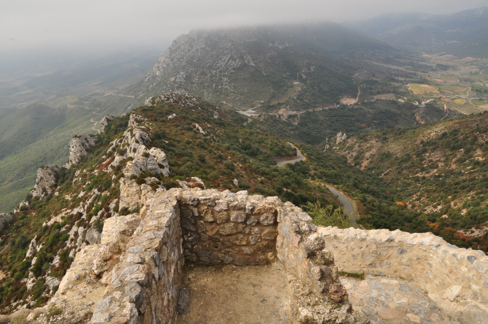
We’ve spent the past three days riding along the southern coast of Iceland, where Vatnajokull – the country’s biggest glacier – reaches down to the sea.

1 Gemma on the road from Hofn

Day 29-32
Hofn > Kalfafellsstadir > Hofskirkja > Kirkjubaejarklaustur > Vik
Distance 230km (including 20km backtracking, and excluding 70km on the bus to Vik)

There is an old Icelandic proverb: “Kemst þó hægt fari”. It translates, roughly, to “you will reach your destination, even though you travel slowly”. The saying – shared with us by one of Paul’s former colleagues – has provided mental comfort on many occasions as we’ve pushed through headwinds, our destination still seeming impossibly far away. We will get their eventually, I tell myself. And we always have.

Not only is the proverb apt for our own experience over the past month travelling through Iceland (at an overall average speed of about 15km/h), it also speaks to Iceland’s rich tradition and culture of long, arduous journeys through this sparse and often unforgiving landscape. At one museum we learned that Icelandic people once measured distances in ‘boots’ – as in the number of pairs worn out on a journey. Along a similar vein, we’ve heard of an ongoing debate here around farmers allowing access to their roads for travellers. Apparently, traditional Icelandic law prioritises the right of the traveller to pass through farmland over the right of the landowner to restrict access. However, increasingly (we heard) wealthy landowners are building impassable fences with stern signs barring entry – not in  keeping with that old tradition aimed at protecting weary travellers.

I’ve thought a lot on this bike tour about just why we, across cultures, romanticise the challenge and struggle of long journeys. Why do I feel a warm glowing empathy, say, for someone travelling for days on a bike or on foot through difficult conditions, but struggle not to be a bit cynical about the air-conditioned buses that eject hordes of dry, over-fed tourists at guide-book points of interests, before whisking them away again before the weather turns?

Both methods of travel are perfectly legitimate, and rationally speaking there is nothing inherently better or worse about either option. We on our bikes are busy-body tourists contributing to the crowds as much as anyone else, and while one method of travel is safer and more comfortable, we’re not exactly pioneers or soldiers either. Far from it. It’s more like we’re simply dipping into the struggle and endurance that is such an integral part of human history, and which we romanticise so much.

But again, why do we? The conclusion I think I’ve come to is that discomfort and challenge bring out positive qualities in us – tolerance, courage, empathy, gratitude; whereas too much comfort and convenience can sometimes bring out the worst in us – laziness, pettiness, intolerance, greed.

Of course, I write this having penned the last post on a long, sleepy 7.5-hour bus ride down the country’s east coast. In fact, the contrast of that experience with our previous days on the bike probably helped set off this particular train of thought (pardon the pun).

Anyway, enough philosophising: here’s some context.

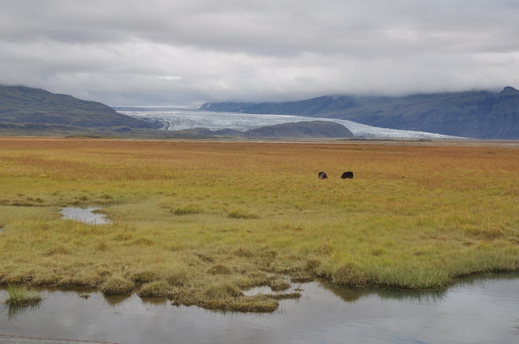
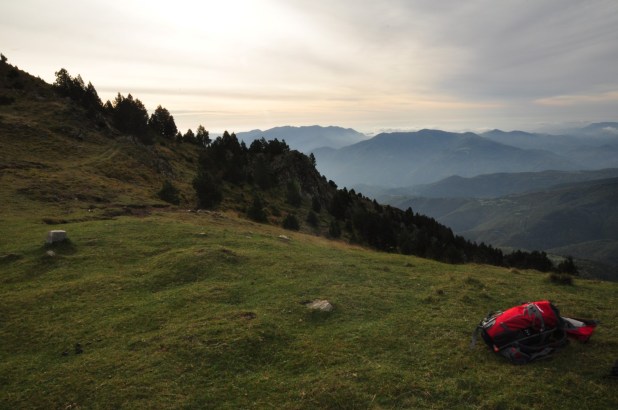
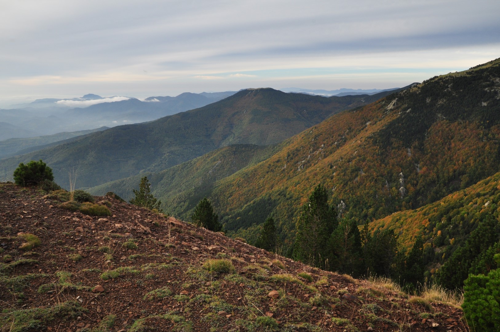
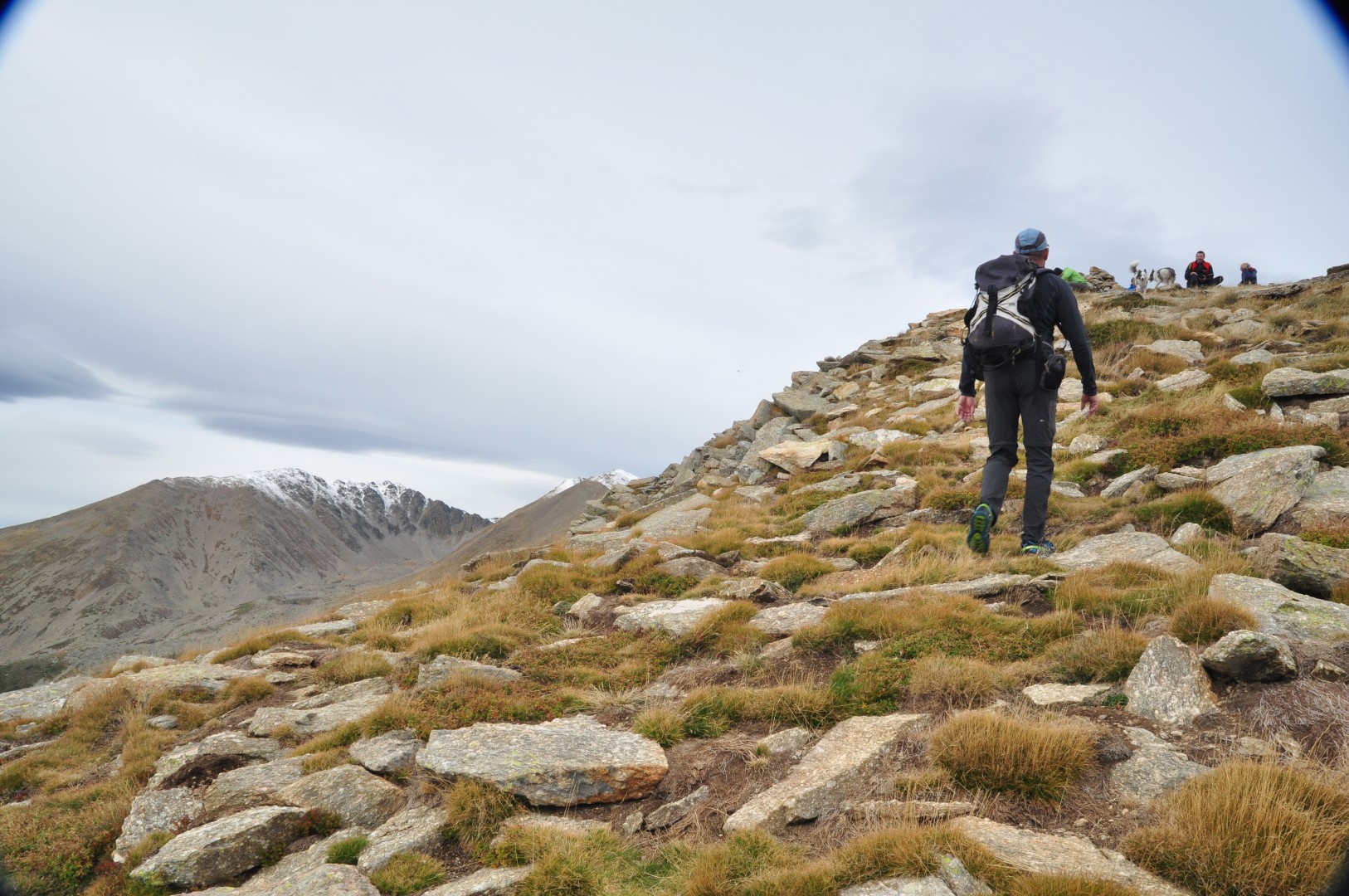
We’ve spent the past three days riding a little over 200km along southern edge of Iceland’s (and one of Europe’s) biggest glacier, the magnificent Vatnajokull. At 8100 square kilometres, she makes up eight percent of the entire country’s land area.

3 Vatnajokull glacier outlet

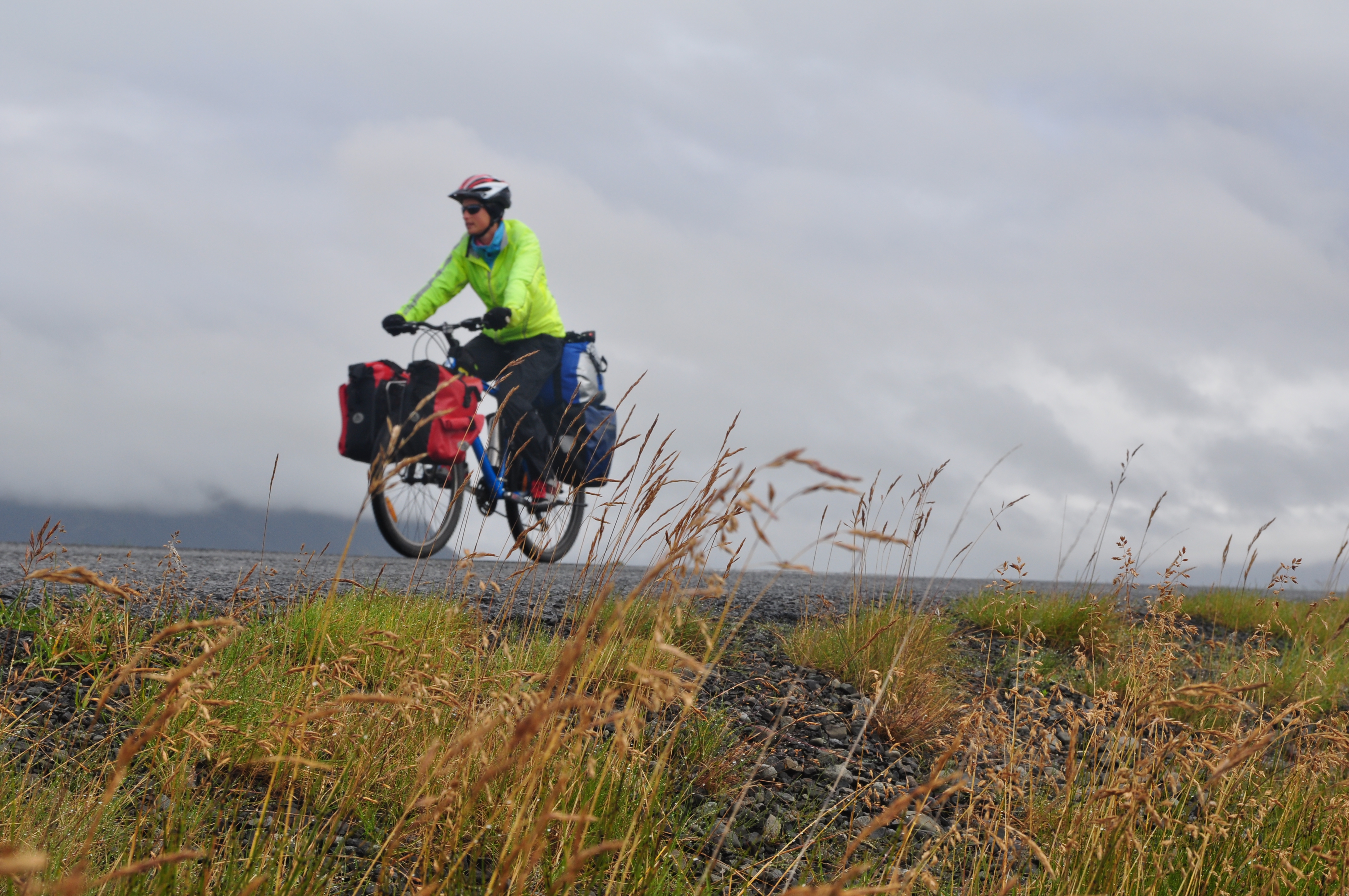
We set off from Hofn after our day on the bus at around 9am. It was raining, so we donned our full set of wet weather gear – waterproof pants (over padded bike shorts), rain jacket and warm (water resistant-ish) gloves, then hit the Ring Road. We had a comfortable tail wind, and the terrain down here is mostly flat, so we were managing, comfortably, average speeds of about 20-25km/h.

Very soon, Vatnajokull came into sight – her outlets reaching down to sea level in ‘tongues’, looking a bit like torrents of rushing whitewater frozen in suspended animation, which I suppose in some ways they are. I kept expecting someone to press ‘play’ and the scenery to turn from peaceful countryside to Hollywood disaster movie. The rain eased off after a couple of hours, leaving clean, clear fresh air, and the tail wind was marvellous – we were making great time. We found a road sign showing local villages and picked a place called Gerdi, which featured a tent symbol and was about 70km from where we’d started that morning – and another 80km from our next night’s destination. With this tail wind expected to remain, that would be easy, we thought.

It was about 1pm by the time we turned off the Ring Road, both our stomachs grumbling for lunch, ready to set up camp for the afternoon. We rode through the little ‘village’ (two farms, a couple of associated guesthouses and a restaurant/museum) to the place called ‘Gerdi’ which was in fact a guesthouse on a farm. There was a caravan on the grass, which looked promising. We dismounted, removed our gloves, helmets and sunglasses, and went inside to be greeted by a small crowd milling in the middle of a big dining room, with seats upside down on the tables. In what is becoming a common occurance, we all stared at each other for a beat of uncomfortable silence, until someone emerged from an adjacent room wearing an official-looking polo shirt.

“Hello, we’ve just arrived and we’d like to camp here, please.”

“Sorry, we don’t have any facilities for camping.” (I refrained from gesturing outside to the fields of grass.)

“Nothing?”

“No.”

“Is there anywhere to camp in this area?”

“Sure, there is a campsite 10km east of here.” In other words, back in the direction we’d come, but this time facing straight into the strong wind that had carried us here so helpfully. We’d ridden 70km that day and had another 70km ahead of us the next day, so going back 10km on ourselves into a headwind felt too unfair, surely.

Having ascertained that all of the silent-starers crowding the dining room were in fact staff with terrible customer service skills, we managed to gain permission to have our home-packed lunch in the empty dining room while we looked over the map and worked out our options.

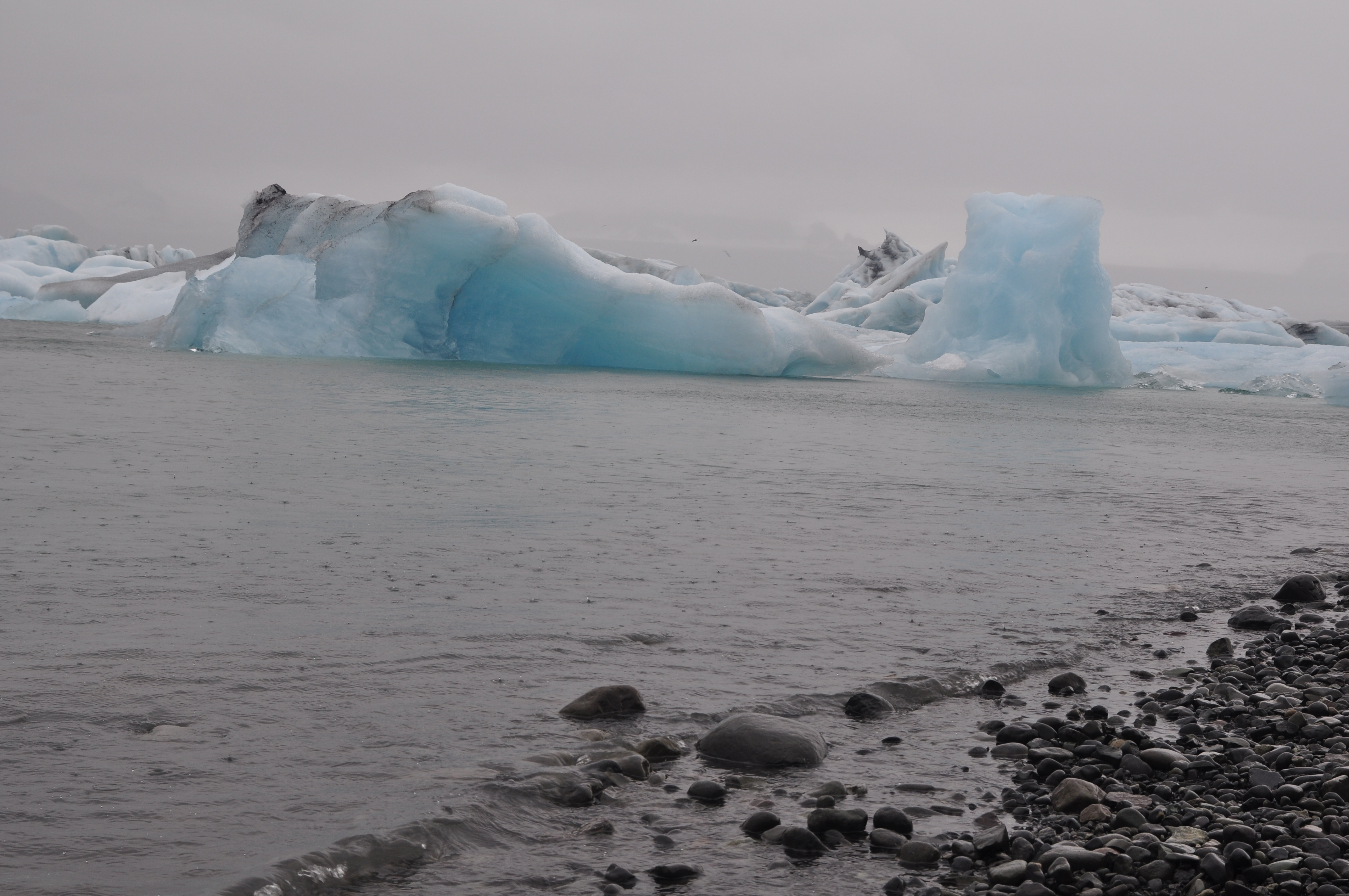
Just 13km further west, the direction in which we would rather use up our energy heading, was the famous glacial lagoon Jokulsarlon, where icebergs drift out to sea. It’s a must-do, apparently, and we’d looked forward to getting their early the following morning en-route to our next stop. Continuing in that direction also meant we would be passing through the kind of terrain least suited to ‘free’ camping (if we resorted to that) – desert lava fields, icebergs, not to mention zero protection from the growing winds and incoming rain.

We finished our lunch and rode back up to the restaurant/museum to see if they could help. No camping, the girl at the counter told us, and all of the accommodation was booked out anyway (not that we could quite justify forking out on a room rate in place of a 10km ride – we knew that much). We even asked if she thought we’d have luck knocking on the farmers’ doors and asking to camp on their property, but as they own the adjacent guesthouses she said certainly not (and she had good insight, as she lived on one of the farms with her grandmother, she told us).

And so, to soften the blow a little, we had coffee in the restaurant then got back on our bikes to retrace our steps back 10km, which would ‘only’ take about 45 minutes in this wind. (It took about 15 minutes in the other direction). Not much, in the scheme of things. Just a little learning curve.

The campsite, on another farm, was indeed worth it. There was an enormous, rambling building which provided communal facilities and dorm accommodation, with camping on the grounds. The showers were buried in a basement, but were more than adequate. The dorm room layout, which I snooped around and explored as we sheltered from the rain, was like a rabbit warren – leading down hallways, through a storage room with boxes and an old piano, into the bunk rooms with double-height rain-slashed windows.

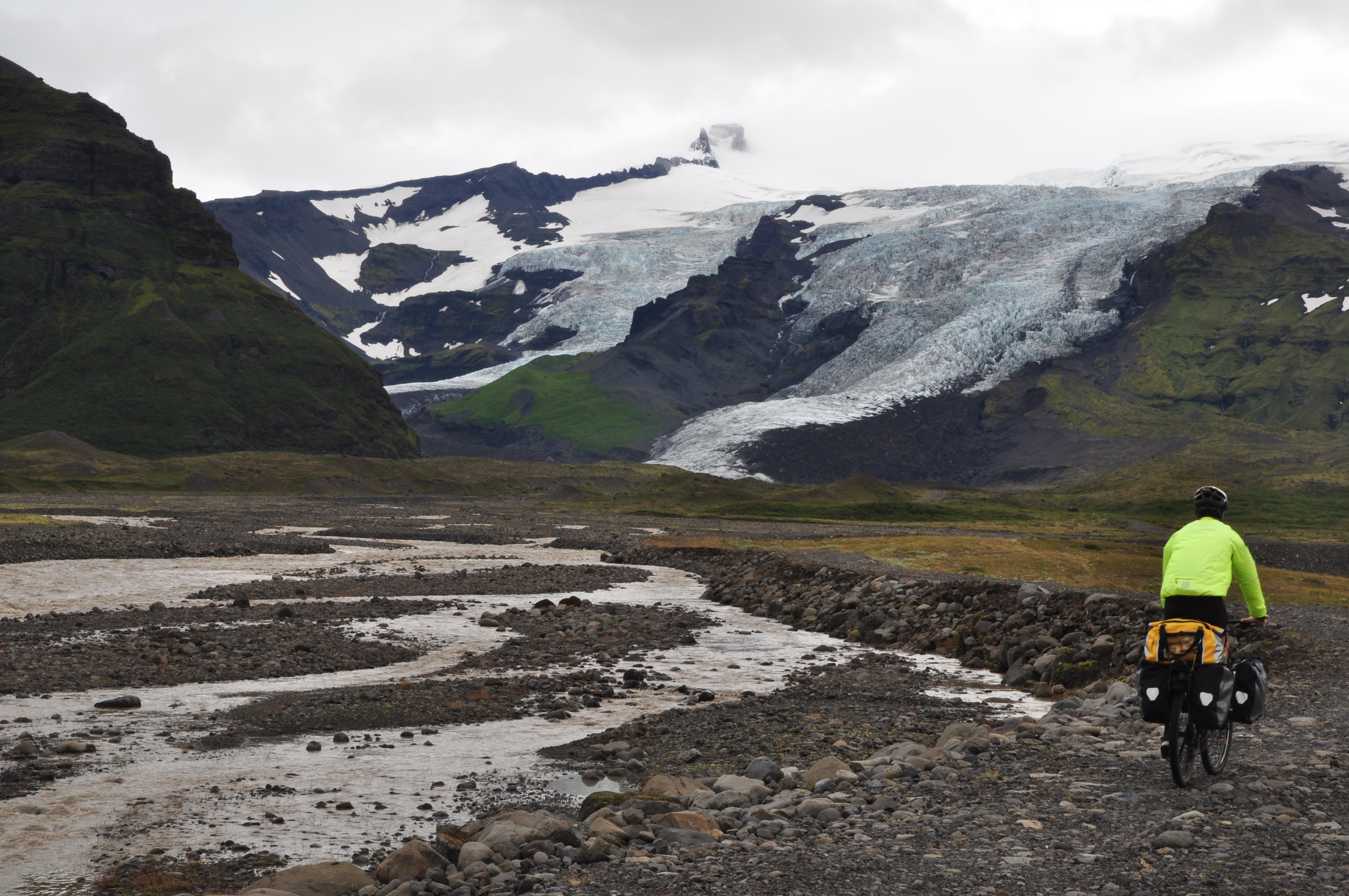
The next morning we were heading for Skaftafell, a kind of national park at another one of Vatnajokull’s outlets. The tail wind had reached unprecedented speeds, so we covered the 23km to the glacier lagoon in about 45 minutes. We could tell the direction of the wind by the rainwater lifting off the road in sheets, then writhing and twisting ahead of us as we sped along at up to 35km/h, often freewheeling in top gear.

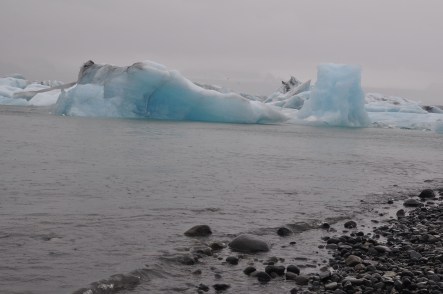
The glacier lagoon was as impressive as we’d predicted and as its popularity would suggest (there was at least a dozen tour buses parked at the entrance). We were soaked through from the rain so first gravitated towards the cafe, which, as it turned out, lacked even standing room. We pulled out the camera whilst sheltering under a narrow eave then wandered down to the lagoon’s edge.

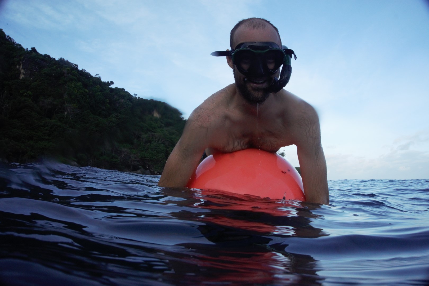
This was the first time either of us have seen anything like this – jagged, transparent blue icebergs, some flowing down the lagoon towards the Ring Road bridge, at which point they pick up speed and rush towards the beach and out to sea. We also saw our first seals here – about three or four of them ducking in and out of the water playfully.

We had to keep warm, so after about half an hour checking out the lagoon (the cafe entrance still impenetrable), we got back on our bikes to continue on our way. There was a gas station 30km from there, where we thought we might shelter and have lunch before the final 23km to our destination.

The wind was so strong by now that it was difficult to ride out of the lagoon driveway with it blowing at our side (perhaps this should have been a warning of things to come?). It pushed us diagonally across the gravel until we could finally face our bikes west at the main road and then fly off at astounding speeds. One strong gust had us speed-peddling in top gear up to 55km/h (according to Paul’s bike computer – and I was right behind him).

We reached the gas station, which was actually just a fuel pump on the side of the road and an empty building. Still, we pulled in to check it out and met another couple of French bike tourers also sheltering under the empty building’s inadequate eaves. When they told us they were heading in the opposite direction, against this wind rather than with it, I think Paul and I both simply cried, simultaneously, “No!”

They were only three days into their tour, they explained with sad, resigned faces. (Hadn’t they read the same blog we had that suggested travelling clockwise?) That morning they’d ridden the 23km from Skaftafell (our planned destination), but they couldn’t face much more – they’d been blown all over the road, they said. We guiltily told them we’d travelled 60km in less than two hours already. We could barely believe it ourselves.

Having found no shelter or respite at the gas station, we wished them heartfelt good luck, then skidded sideways across the gas station lay-by until we faced our bikes west again and let the wind carry us up a slight incline at our average speed of about 35km/h. I can only imagine how they must have felt watching our frames shrink into the distance in minutes.

8 Glacier

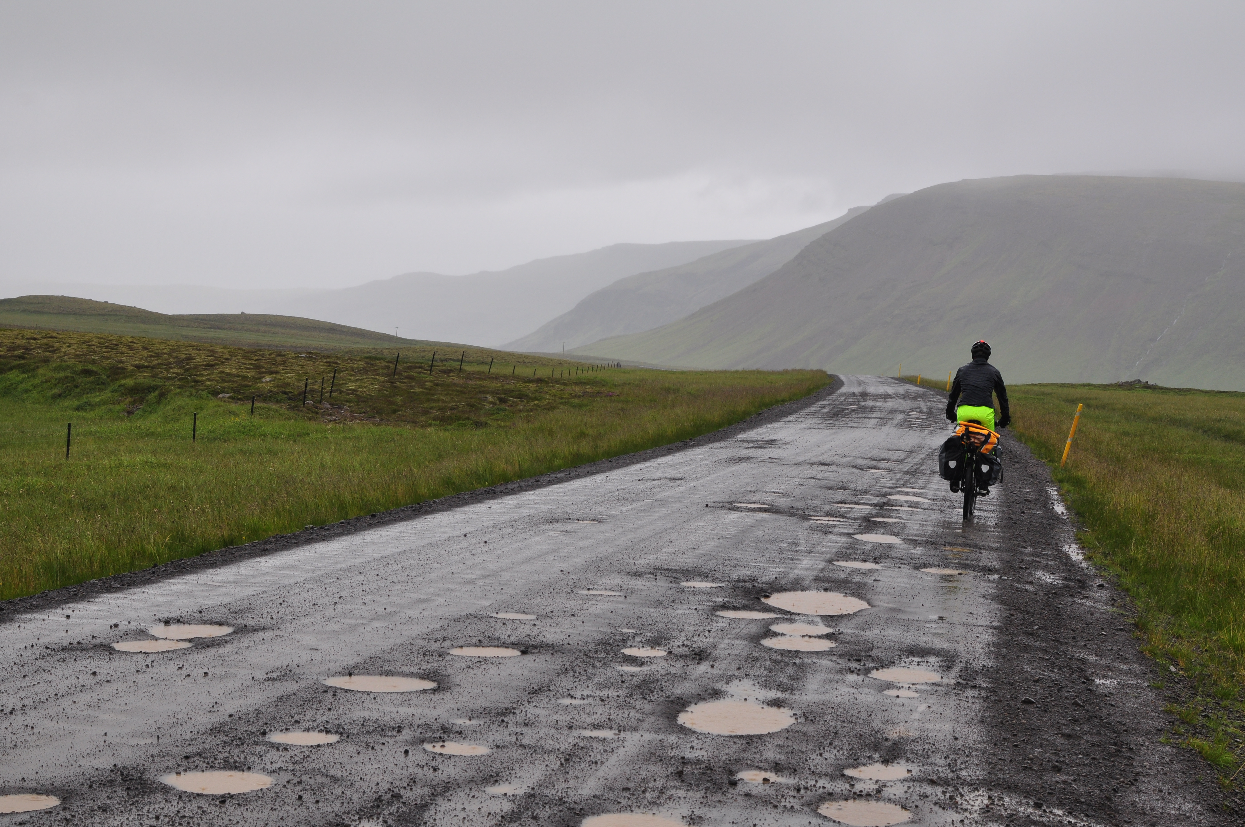
With this wind, we imagined we’d be in Skaftafell in less than an hour. However, the road after the gas station changed direction slightly as we rounded the base of Iceland’s tallest mountain, Hvannadalshnúkur (2110m). This was a terrible combination. Looking at the radar later, we realised that we’d turned into flukey windstorm with minimum 70km/h gusts crashing down from the mountain and hitting us in unpredictable savage bursts. We didn’t know the exact windspeed then, but we knew it was scary. I had to keep slamming my brakes as the bike veered wildly of its own accord across the road, towards the other side and potentially on-coming traffic. All I could do was shout over the roaring wind to Paul “I don’t like this!” He didn’t like it either, as he was trying to ride double abreast with me in a gallant attempt to act as a block between my possessed bike and the centre road marking.

Thankfully, after about three kilometres of this, we spotted a turn-off to a hotel and restaurant. We turned off initially with the aim to have lunch and decide on a plan of action, but that plan almost immediately turned into staying at the hotel itself – the wind by now rushing down the mountain with such force we could hear it barrelling towards us before it hit. We could barely walk through it, let alone ride, and the rain was still ‘falling’ in solid, sideways sheets. We’d discussed the kind of conditions in which we might spend a night in four-wall accommodation. Yesterday’s experience in Gerdi didn’t cut it, but this did.

We had to adjust our demeanour as we entered the muted, sophisticated interior of the hotel lobby. We must have looked a sight in our dripping-wet, hi-vis bike gear and pink wind-burned faces. Also, having spent the past couple of hours shouting at each other over the elements, it  was difficult to find an appropriate indoor volume.

“HI CAN WE PLEASE HAVE A ROOM HERE!”

Apparently, they were completely booked out and suggested another guesthouse a couple of hundred metres down the road. We warned/informed her we’d be back for lunch, and wrestled our bikes through the weather to the other guesthouse. We entered to find an old lady knitting on an armchair in a homely olive-green living room. She said something in Icelandic and another woman emerged. All booked out, she told us. “Nothing at all?” I asked, trying to sound as desperate as possible, and to make clear that we would not be getting back on that road, almost adding – “a laundry floor, basement, anything?” She told us there was another guesthouse, the last one in the same village, another couple of hundred metres away – “a little white house with blue windows”.

Paul got there before I did and emerged shaking his head. Booked out. No, that wouldn’t do. I barged in after him and (surely in vain) asked again. “Are you sure? Nothing at all?”

Finally, my brain switched into gear and I asked if we could please at least pitch our tent in their yard, and make use of the communal facilities (this place looked less hotel, more hostel). Fully expecting a ‘no’, as we’d experienced in Gerdi, the lady (who happened, like some cruel joke, to be baking cookies at the time) looked at me as if she’d only just then noticed what a drowned, windswept mess I was. She then smiled with pity, and nodded. I could have hugged her. Instead, inexplicably, I put my hands together and bowed like we’d once learned on a holiday in Thailand. “Thank you! Thank you!” I said, bowing low as I reversed out of the kitchen like a crazy person to inform Paul of the good news – which included the fact that she had also refused to charge us anything for the night’s stay, camped among her children’s toys in the tiny front garden. Perfect!

We left our bikes in the rain leaning up against the white wall and below the blue windows, and walked to the hotel – re-adjusting to “posh hotel lobby” mode as best we could, whilst forming a small pool of rainwater on the tiles around our table. One of the first things I noticed was that the other groups of patrons in the restaurant – in their dry, warm, clean clothes – looked positively miserable. All dead silent, every last individual staring at his or her smartphone with slightly slack jaw and lifeless eyes. And there we were, trying not to burst into bouts of hysterical laughter.

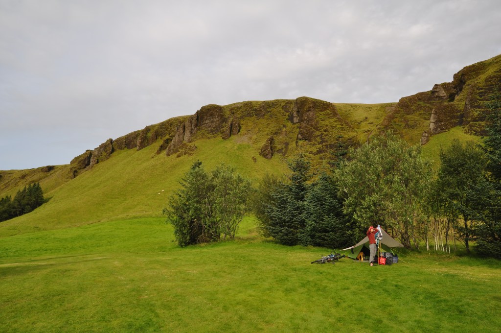
After lunch, we set up our tent in the wind and rain with renewed vigour, toweling down the tent interior before ejecting into it the contents of our dry duffel bag – sleeping bag, wool thermals, down-stuffed pillows, bed socks, beanies and scarves and sleeping mats.

12 Kirk campsite
Before we set off to Iceland, we had a few people cringe at the idea of sleeping in a tent every night for 38 days, predicting that we’d soon become utterly tired of it. Yet, in this moment, that attitude – or the notion that this was the hard part – seemed ridiculous. We had shelter! And a warm, comfortable place to sleep! What a luxury and a joy!

Paul used some extra rope we’d packed to help secure the tent in the strong winds. Even in the lee of the little white house, the tent poles warped and buckled disconcertingly. That night, the wind sounded as if we’d pitched our tent on a shoreline next to crashing waves.

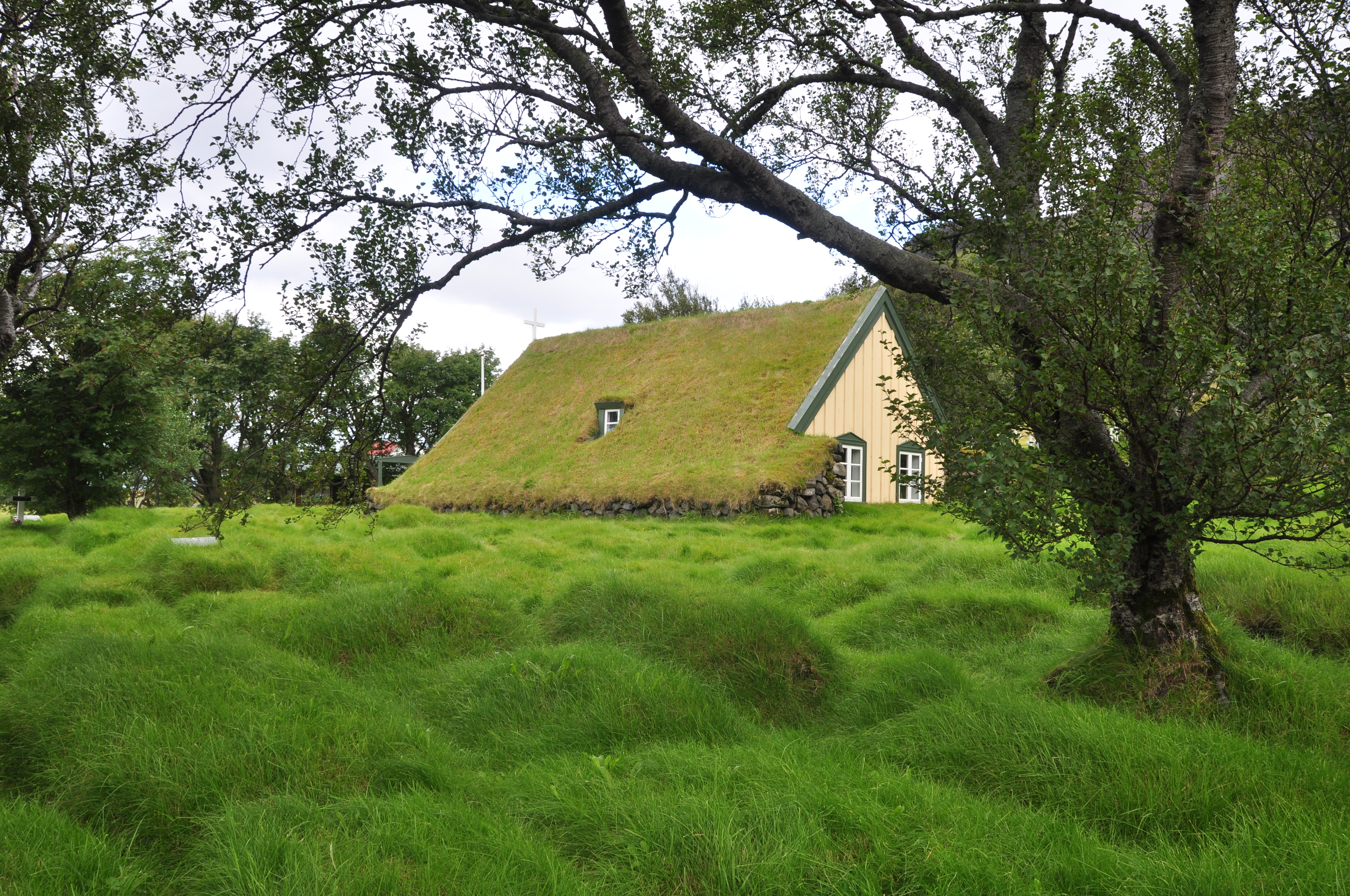
After a slightly fitful sleep, we woke up to calm conditions and blue-sky gaps in the cloud cover. We wandered through the calm village (toward the hotel buffet breakfast – our grocery supplies by now dwindled), startled at the effect of the changed weather on our perception of the place. Well wasn’t this a lovely little quaint place! And the road down there, long and winding and flat through green fields. Not intimidating at all! Just near us was a refurbished 18th-century turf chapel surrounded by a lumpy, ancient graveyard, which we wandered through in fascination, before packing up camp and getting back on our bikes by about 10am.

We later learned that the weather in this particular region at the edge of the glacier can be so localised that a storm can tear off roofs and smash windows at one farm, while mild conditions reign at the neighbouring property. We’d ridden straight into a windstorm, but at Skaftafell, in a more protected position, was likely calm and pleasant (if we could have just made it there).

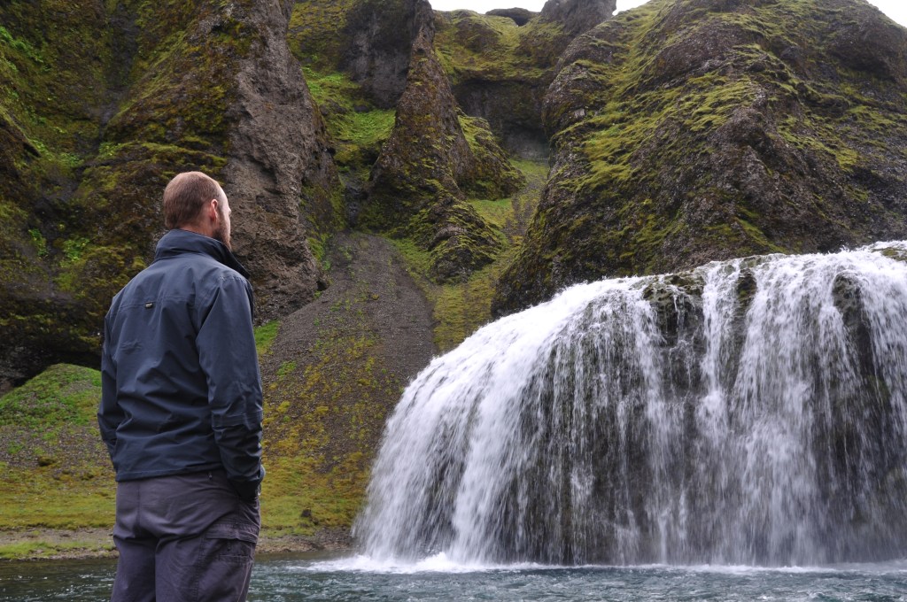
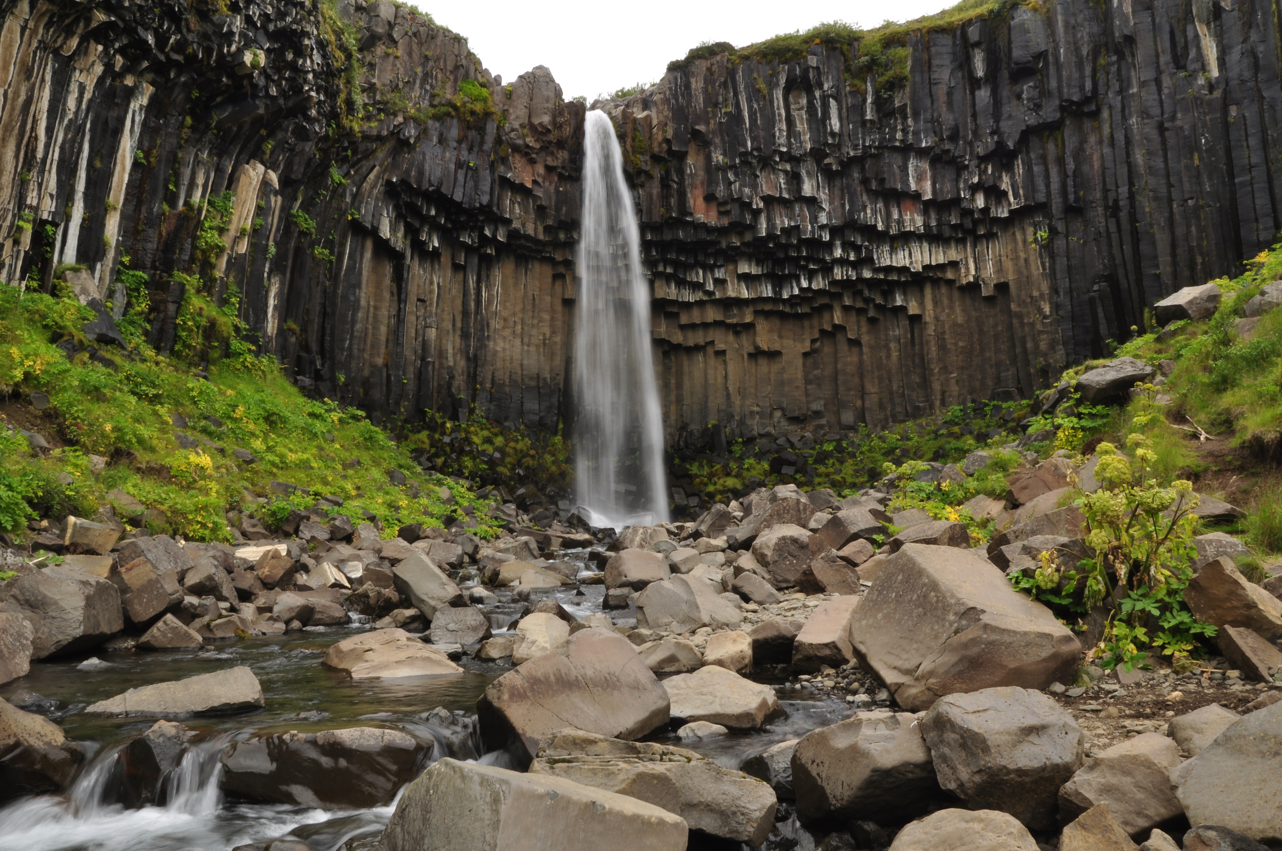
We did make it there eventually, by midday that day. There was a slight headwind, which was a bit of an effort, but at least we retained control of our bikes! We spent two hours at Skaftafell, firstly hiking to the base of the glacier outlet there, and then up to the waterfall. We ate a packed lunch and were back on our bikes at 2pm – with 70km still ahead of us.

10 Skaftafell svinafoss

The road was long and straight through lava fields and vast gravel glacial floodplain. The headwind was relatively gentle, but enough to gnaw away at you over time. Eventually I made Paul inform me every time we covered another 10km, but in return I was forbidden from asking “are you sure we haven’t done another 10km yet?” “Are we at 30km yet?” “How many kilometres?”

Our destination was our first fully-fledged town in a couple of days, called (wait for it): Kirkjubaejarklaustur. We made it there (as we always do – the proverb rings true!). We showered and used the hot tubs at the local pool, then went straight to the restaurant/pub for a feast before setting up camp. We’d ridden over 90km and spent two hours walking around Skaftafell – all personal records smashed. Next day was to be a rest day, obviously.

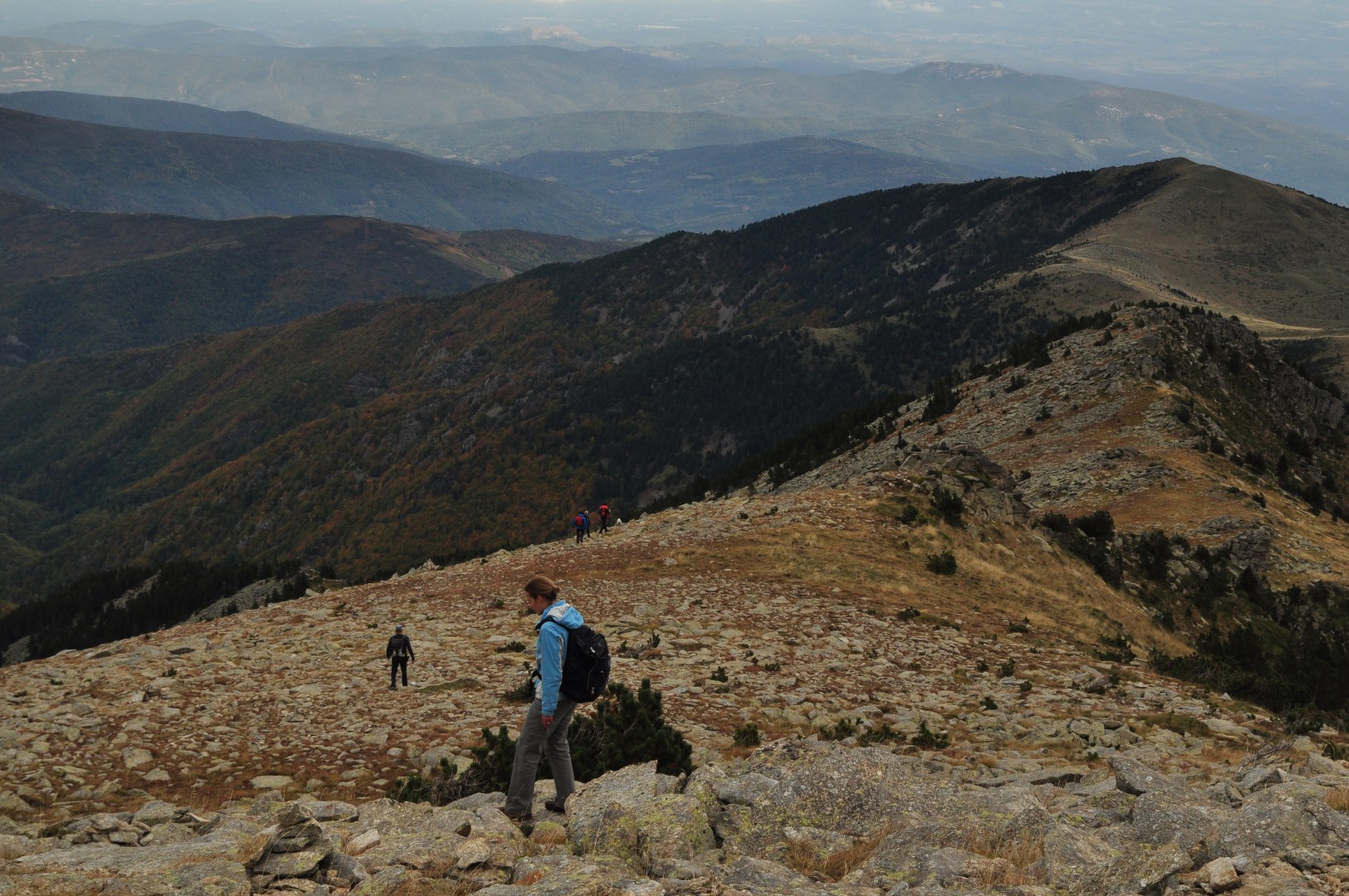
I am now writing this from a town called Vik, 70km west of Supercalifragilisticexpialidocious. We woke up this morning, after our pleasant rest day (which included another trip to the pool, and a stroll up a sheep trail to a plateau that overlooked the area and the glacier in the distance), to the sound of more wind and rain. We’d expected this from the radar forecast, and it hadn’t looked quite as bad as what we’d faced previously – in numerical terms, at least. However, then and there, in our sleeping bags listening to the familiar rhythm of rain on tent fabric, we were having second thoughts.

13 Paul flat bum waterfall
Tomorrow is supposed to be sunny and calm, so usually we’d have simply waited until then to ride the 70km to Vik. However, we are running out of days and our generous cookie-baking hostess who let us camp in her garden (in true old-Icelandic style) suggested we ride to a place called Thakgill. It’s a 20km ride (mostly up hill, on loose gravel with a couple of water crossings) out of Vik – but it’s the style of touring we prefer to long days on the Ring Road, and it’s supposed to be beautiful. So we’ve prioritised it. We spent an hour on a public bus to get here, feeling fully vindicated as we watched the angry weather pass by outside.

Perhaps we had had enough of the romance of challenging journeys for that one day? Either way, its back on the bikes tomorrow, and we’re looking forward to it.

Until then, from another old proverb – may the road rise up to meet you and the wind be at your back!

This slideshow requires JavaScript.

Mental Everest

This slideshow requires JavaScript.

Day 1-4: 8 to 12 July 2014
Reykjavik > Ulfljotsvatn > Thingvellir National Park > Hvalfjardarvegur
Distance covered: 175km
“It’s not the mountain we conquer, but ourselves.”

At least, so said the inspirational poster plastered among several on the walls of the heated campsite kitchen to which we retreated for a luxurious half a day’s rest after our first day on the bikes.

The quote was from Sir Edmund Hillary, and while he obviously didn’t have access to sealed roads, a laptop or hot showers when he summited Everest, his words still resonate.

Our ‘Everests’ that first day included every 15-degree incline we approached with foreboding, gearing our weighty mountain bikes – as well as ourselves mentally – for the thigh-burning climb ahead. On several occasions I was forced to stop midway (and even Paul had to a couple of times) to push the bike to the top, groaning and feeling sorry for myself.

However, cycle touring, I have come to realise, is a somewhat bipolar (or perhaps amnesiac?) pursuit. Mere minutes after questioning our grasp on reason for taking on this trip, we are flying down the other side, grins spread across our faces, whooping into the vast, volcanic landscape around us. Yes!

We picked up our two, hire Trek mountain bikes from The Bike Company in Reykjavik the day before we set off, entering the office tentatively to find two employees drinking their morning coffee. There was a moment of awkward silence as we stared at each other across the room – them clearly fitting into the cool mountain biker subculture that seems to transcend international borders, us very much the gawky tourists.

“We’re here, um, to pick up some bikes?”
Silence.
“…It’s Chilton. We’re going touring around Iceland!”
Another beat of silence, then, seriously: “Have you done any bike touring before?”
Both Paul and me at once, over the top of each other: “Oh yeah, a bit, kind of, you know. Not really.”

Shit, this guy was on to us. He saw straight through us and brought all of our insecurities and doubts bubbling to the surface like an Icelandic geyser. Except, we soon realised, he really was actually rather pleasant and excited on our behalf. Our penchant for over-the-top pleasantries, we’re learning, doesn’t always cross cultural (or linguistic) borders. What did we want, a pat on the back or a high-five? We collected the bikes and our gear, sat together in his office and looked over some maps and garnered all the advice and tips we could, and left feeling confident and giddy with excitement once again.

We celebrated our last evening in Reykjavik with soup and beer, followed by a second dinner of smoked lamb served up by our generous airbnb hosts, who’d just finished up a family meal when we returned home for our usual jetlag-induced 8:30pm bedtime.

Another small Everest: I had a tiny razor cut on my ankle, and it had turned nasty after our trip the previous day to the tourist mecca of the Blue Lagoon – those sophorific pale-blue, steam-shrouded hot springs where you cake your face with silica mud and drift sleepily among hordes of other tourists (as well as, I now see, their germs thriving in the warm, moist environment…)

My foot was swollen and my ankle felt achy as if it was sprained; all this the night before we were supposed to head off on a 38-day cycle trip around remote, wild Iceland. So I started on a course of general antibiotics we’d packed for an emergency, smeared on antiseptic cream and a clean dressing, and went to bed trying to think healing thoughts.

We woke up at 4:30am, and looked at each other across the bedsheets in our ever-sunlit room. The weather outside was perfect. This was it. How was I feeling? Somewhat better. The antibiotics must have started working fast – the swelling was going down and my ankle bone re-appearing. We’d start our trip, keep an eye on it, and see how we went. (It’s almost completely better now.)

By 6am we were up the hill with my mobile phone in my top-tube bag directing us out of the city. We very soon became accustomed to the weight of the four panniers and satchel on each of our bikes (totally 60kg between us). The traffic was sparse, the air crisp (about 8-10 degrees Celcius), the sun shining and there was almost no wind.

01_Leaving Reykjavik

It was about 25km to the turn off onto Highway 431/5 (an alternative to the busy Ring Road), which would take us straight to the bottom of a big lake called Thingvallavatn. The map showed one long straight line cutting through the country side, followed by a squiggly bit – also known as a million little Everests. An experienced Swiss bike tourer (with thighs like tree trunks) who we met at our campsite that evening and who had ridden that way once before said he imagined that that part of the road must look like honeycomb from above (or Swiss cheese, I thought) – up and down, up and down.

After riding along a mostly straight two-lane road surrounded by vast, green country side and the odd sheep (to which I always say hello out loud – there’s no one around to hear), this steep winding road was bordered by towering bright-green mountains smattered with dark rocky formations. It would make a great place to photograph/film a new car launch – and Land Rover agreed. We were shooed away from one park we tried to stop at by a bunch of English-accented people with two identical red Range Rovers and the enormous truck that had transported them there. It was only once we’d summited (partly on foot) the final incline and came upon, for the second time, a burly man with a walkie-talkie that we realised they’d been waiting for us to clear the road so they could start filming. It must have been frustrating for them to watch on, tapping their feet impatiently no doubt, as I stopped intermittently for breathers or pushed my bike up the hill at about a kilometre an hour. Saying that, they can’t have been in that much of a hurry – they could always have offered us a lift!

There’s was a serious business – we watched from the top of the hill (in sight of the burly man) as they quickly shrouded the vehicle with a black sheet to hide it as another car drove past. To be honest, the Range Rover didn’t look that different on the outside from the current model, but I guess they need to be careful. And two cyclists on the same roads that were meant to look gnarly for a powerful 4WD probably would have ruined their footage, so we mounted our two-wheeled, human-powered steeds and continued on our way.

06_Gemma_Pingvallavatn

By the time we had reached the lake (having to alternate brakes on descent to keep them cool), the road flattened out and turned to gravel, and the weather had also started to turn. We watched the cloud formations over the lake as we lunched at its pumice-gravel banks, which helpfully massaged our saddle-sore behinds. We ate Icelandic flatbread with smoked lamb and cheese, and rinsed our apples in the icy, fresh lake water.

It was only midday and we’d covered about 50km, and a side-wind had just set in. Thankfully, though, the rain remained in the distance and never quite hit us. We trudged through the last 20km at a much lower average speed and with much less conversation between us.

We both felt a rush of relief when we spotted the campsite in the distance as we came to our last descent, stopping at a hill looking over a small, red-roofed church perched beside the lake. That relief turned to joy when we spotted the sign for hot showers.

Feeling clean and warm and exhausted (it was only about 3pm), with a cosy tent and a down-stuffed sleeping bag waiting for us, those hills we’d come from suddenly diminished in size in our memory.

08_Paul_Lunch on the pumice gravel banks of Pingvallavatn

…So much so, that what we’d planned to be a rest day on Day Two turned into a quick (and spectacular) 30km ride up the road to Thingvellir National Park in the late afternoon (it never gets dark, which is handy).

Thingvellir is where the European and North American continents meet (and where we plan on snorkelling in some of the world’s clearest waters once we’re back in Reykjavik at the tail end of our trip). It is also the site of the world’s oldest parliament (as we learned on a friendly, and free, guided tour the next day – our real rest day).

The decision to stay put was helped by the dreadful weather that had set in, particularly bad even for Iceland at this time of year, we were told (rather unhelpfully, really). I slept a little nervously that night as our tent flapped and warped (but otherwise coped well) in the strong winds

Having tentatively planned to miss riding in the rain by hanging around in the rain until a 6pm bus would take us to our next destination in the north-west (a little depressingly, via Reykjavik), we instead bit the bullet at about 11am, downed a hotdog at the tourist centre there, donned our rain gear and toughed it out – and how glad I am that we did.

DSC_0154

After a busy section on the main road for about 15km, we turned off onto a potholed gravel road surrounded by some of the most dramatic scenery we’ve seen so far – rushing waterfalls, snow-capped mountains, steaming geothermal springs and streams, all eventually opening up onto a wide bay just as the sun emerged for a brief show. The rain was no problem – in many ways it’s easier to deal with when you are well and truly out in it rather than trying desperately (and usually failing) to keep dry.

Six hours and 71km later, we are now sitting in an old barn converted to a tourist hangout at a sheep farm. We’ve already booked two nights here.

Tomorrow we will sleep, eat lamb raised on the farm, take photos and maybe even go for a trail ride on a horse.

This really is no Mount Everest after all. And we’re loving it.


South of the border

Throwback Thursday flashback to a guided tour of the North/South Korean Demilitarised Zone, back in January 2011.

DMZ 2011 messages of peace and reconciliation

Messages of hope left by South Koreans for their kin beyond the border.

The bus windows were speckled with a flaky substance our bubbly tour guide explained was disinfectant spray to prevent the spread of foot and mouth disease. It hampered our view and sounded alarmingly carcinogenic, but we could still make out the white fields and surrounding hills she was in the process of telling us about.

“You can tell which hills are ours and which are theirs by the number of trees,” she said. “Theirs are bare, because they’ve chopped down all the trees for heating. They don’t have coal, like us.”

I hated to think of the North Koreans living through this winter in particular – the coldest South Korea had seen in 40 years, with temperatures as low as -17°C and only dropping as we trundled north in our tour bus. I wasn’t unique in this musing – whenever the weather turns bad in the south, the uncomfortable thought lingers in many South Koreans’ minds as their eyes flicker guiltily northward: How much worse must this be for them?

Enigmatic Seoul

Enigmatic Seoul, the capital of South Korea.

Forty kilometres south of the North/South Korea border, Seoul is a vibrant, enigmatic city. Vats of silk worm larvae from street food stalls waft pungent steam in the direction of westernised nightclubs and coffee houses.

Planning a stopover trip to Seoul from the safety of our home in Sydney, Australia, the idea of visiting its border with North Korea, also known as the Demilitarised Zone (DMZ), sounded a bit too risky, so we hadn’t included it on our itinerary. However, reality has a tendency to tilt on its axis when you arrive in a foreign country, and soon the idea of being within reach of the most secretive totalitarian regime in the world seemed too alluring to pass up.

In the rare event that a journalist sneaks footage from across the North Korean border (usually via its communist cousin, China), the product is stories and images of desperate and dirty-faced citizens, and the occasional appearance of Kim Jong-il’s (or nowadays, Kim Jong-un’s) smugly plump jowls. And when North Koreans do occasionally make it to the south (also usually via China), they take a long time to assimilate. This is generally because they speak and act as if they’ve come from a different era. They have never heard of concepts considered Western, such as jeans, or ‘diet’, our tour guide tells us. The direct translation of their old-world terminology for the latter, for example, is to ‘cut the flesh’.

DMZ 2011 tour bus passport check

Passport check on the way to the border.

So I expect this day-trip to the DMZ to be tense, fraught with sadness and poignant, and when an armed soldier boards our bus to check passports (I managed to steal a photo before our guide nervously translated his clipped order that this was not allowed), it was exactly as expected.

Having successfully navigated our way through tank traps scattered across the road like a kid’s game of jacks, we arrived at the DMZ theme park (closed for the winter) complete with a frozen-over swimming pool and inoperative amusement rides.

Bracing ourselves against the northern chill, we left the bus and followed our guide to the first tourist stop, the so-called Bridge of Freedom (also known, paradoxically, as the Bridge of No Return). This is the only bridge crossing the Imjin River and therefore connecting the north and south. It was here the two sides exchanged prisoners at the end of the Korean War, with the signing of an armistice in 1953.

The tourists milled gingerly around the ice-crystal-swathed bridge, shivering and eyeing each other sideways. Whitney Houston was belting “I-eee-I will always love you-ooo-uuu” over the PA speakers lining the bridge. The razor-wire fence at the end of the bridge was covered with colourful ribbons bearing Korean messages of peace and reconciliation to their long lost ancestors and family members on the other side.

DMZ 2011 theme park

‘DMZ Disney Land’ closed for winter.

The idea, I gathered, behind this bizarre dichotomy of quiet poignancy and, well, cheese at the tourist site was that, post-unification, the DMZ would be rendered little more than an historic monument to the bad-old-days. North and South Koreans alike could become teary-eyed to the vocal refrains of Céline Dion, and then enjoy a ride together on a merry-go-round. Instead this DMZ Disney Land gives a surreal, tawdry effect to a place that is otherwise one of the saddest I’ve ever visited.

Herded like school children into what I want to call the DMZ Discovery Centre, we shuffled through a museum of Korean War photos and educational displays, before entering a cramped cinema where we were shown a propaganda film. As the lights switched back on and curtains drew back over the screen, I had an uncanny sense of experiencing a Cold War I thought I’d been born too late for, but which never ended at this 250km-long by 4km-wide slash at the 38th parallel, separating two peninsulas populated by otherwise racially, culturally and linguistically identical people.

DMZ 2011 the bridge of freedom or no return

Sadly, the Bridge of No Return remains a more fitting name that the ‘Bridge of Freedom’.

Our final destination before being shipped back to the relative normalcy of Seoul was Dorasan Station, a modern train station in all its digitally timetabled, air-conditioned grandeur, bar one glaring absence: passengers. A couple of giggly tourists made snow angels near the unused tracks pointing north – tracks ready in every way, except politically, to transport imaginary commuters to Pyongyang. If it ever gets up and running, it will connect Korea to the rest of Asia and Europe – a backpackers’ rite of passage waiting to happen.

Adjacent to the train station was a small shop marketing the DMZ in a very unusual way – for its organic produce. Think about it: around 1000 square kilometres of fertile land relatively untouched (bar the odd land mine) for almost 50 years.

Albeit, after a breakfast of steamed silk worm pupae, the fruity biscuits we purchased were indeed tasty. The bottle of made-in-North-Korea soju (Korean vodka) was less so, but I’ve kept it as a memento of my weird trip into no-mans land. It serves as a reminder that, until things change, on the other side of that tacky border theme park exists an almost invisible population of suppressed, desperate people who are, among other things, fast running out of trees to burn for warmth.

Note: My husband, Paul, and I travelled to Seoul, South Korea, and visited the North Korean border back in 2011, which was when I originally wrote this piece.


DMZ 2011 unification

Dreaming of unification.